
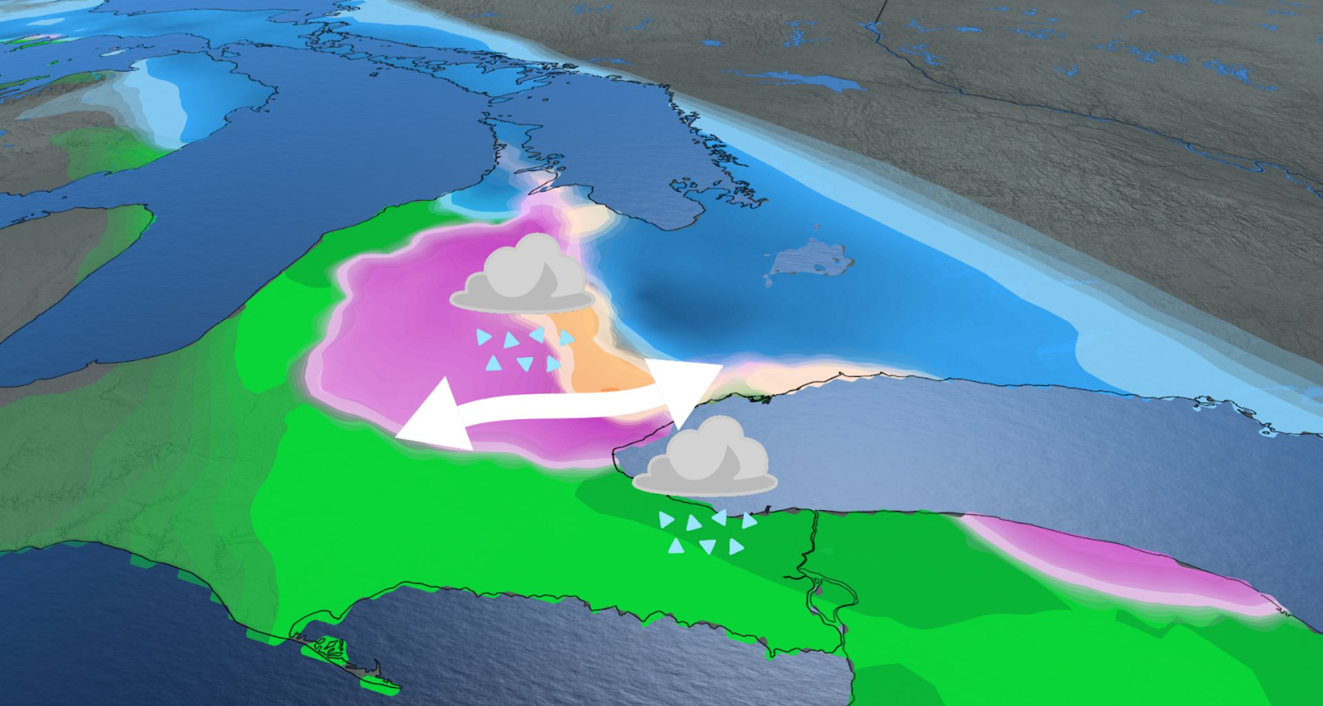

A swath of messy precipitation, freezing rain and ice pellets, sets up north of the warm front, but the timing and exact placement is still uncertain.
SEE ALSO: Toronto’s record winter highlights snow removal challenges in North America
Currently, forecasts indicate the highest risk for freezing rain will be northwest of the Greater Toronto Area (GTA), including Orangeville, Guelph, Fergus, Cambridge, and Brampton.
Forecasters are confident that the transition zone between precipitation types, including freezing rain and ice pellets, will be over the GTA throughout the event. Areas that are impacted by the freezing rain will have an increased risk for power outages, tree damage, and dangerous roads through Wednesday.
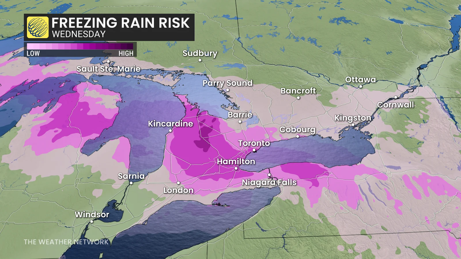
Small changes in temperature can have drastic impacts on your precipitation. On the colder side, a swath of heavier snow is more likely north of the GTA, extending from Georgian Bay-Barrie to regions north of Lake Ontario, such as Kingston, where temperatures aloft stay below freezing.
Precipitation will spread across southwestern Ontario through the pre-dawn hours on Wednesday. The morning commute will be tricky with locally heavy rain and a wintry mix near and west of the GTA.

The Wednesday afternoon and evening commute will most likely be slow across southern Ontario, while precipitation begins to ease across the southwest as we progress through the evening.
WATCH: Four snowmobile fatalities this season have OPP urging safety