
Starting this month, the city is going to begin removing 847 trees in a flood mitigation effort it says will finally help the flood-prone Rockcliffe-Smythe neighbourhood.
But residents and community advocates desperate for help are urging the city to reconsider, saying the plan — which starts with widening and replacing Jane Street and Scarlett Road bridges — isn’t scientifically sound and may actually make the situation worse.
“Fixing the bridges over here without knowing how to fix the problem upstream is like putting the cart ahead of the horses,” said Antia Gonzalez Ben, a member of the Black Creek Flood Coalition (BCFC).
Gonzalez Ben, Sarah McVie and other members of the BCFC say nearly 2,500 residents have been impacted by constant floods and sewage backup in their homes for years, costing them thousands of dollars in damages and repair every time.
It’s a problem that’s been recognized by the city and the Toronto and Region Conservation Authority (TRCA), which launched an environmental assessment in 2013 and recommended the current mitigation plan.
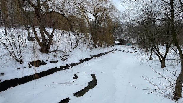
The plan, however, does not include any changes to the main area of concern — an upstream 12-metre channel in Black Creek running from Weston Road to Hilldale Road — where the majority of impacted residents live, said McVie.
She said the plan is based on a computer model with inaccurate scientific calculations that were flagged to the coalition by independent water resources engineer Tim Mereu.
McVie said the TRCA confirmed there were issues with its modelling software in a meeting last month with herself, Mereu and others, but said the project was now in the city’s hands.
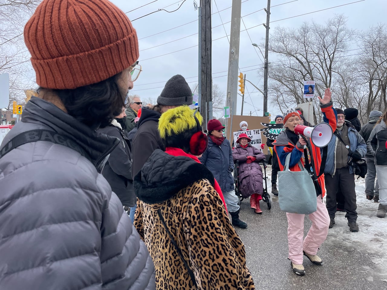 Residents of the Rockcliffe-Smythe area came together Saturday to protest a flood mitigation plan they say will cause more harm than good to the community. ( Spencer Gallichan-Lowe/CBC)
The city is standing by the environmental assessment and continuing forward with the project, said a city spokesperson Krystal Carter in an emailed statement on Tuesday.
She said modelling found that widening Black Creek and replacing the Jane and Scarlett bridges would “significantly lower flood risk.”
“Modelling results are consistent with the environmental assessment,” she said. “Work to increase the span of the Jane Street bridge will begin first, as it provides flood risk relief to the greatest number of properties, as identified in the Environmental Assessment.”
Residents are calling for a redesigned project, said McVie, as well as a city-appointed coordinator to oversee their concerns.
“Every house needs an emergency preparedness kit and we need a coordinator … someone managing the situation,” said McVie.
Residents and environmental advocates rallied last weekend at Smythe Park, where some trees are slated for removal, urging the city to check its plans again before tree removal takes place.
Tree removal is part of preparation for the first phase of the three-phased project, per the city’s website, which labels the neighbourhood “one of the most flood-prone areas in Toronto.”
Construction for the first phase is expected to begin in late summer or early fall. Carter said the city “remains committed” to receiving feedback and engaging with residents.
WATCH | Last year, residents expressed concern about flooding from snowmelt:
Toronto residents worry melting snow will lead to flooding
Toronto residents are bracing themselves for potential flooding as warmer temperatures cause snow to melt. Some worry about the impact on their homes. CBC’s Britnei Bilhete has the story. Friction, water speed not accounted for in model: engineer
Tim Mereu’s interest in the project started four years ago after his son, who used to live by Lavender Creek, which flows into Black Creek and will be partially widened as part of the third phase, mentioned an assessment for flooding issues in the area.
He said the TRCA claimed the area by Lavender Creek floods on average every two years and needed to be replaced with a 20-metre concrete channel. But once Mereu dug into the existing materials, he said he discovered — and heard from residents — that there hadn’t been any floods around there in decades.
Mereu said he later heard from Black Creek residents about their flooding concerns. The project’s solution for that area looked “very odd” and only widened the downstream channel, instead of the upstream channel near the most-impacted homes, he said.
Mereu said he later realized the environmental assessment’s computer model — the one the project is based on — didn’t account for friction or the change of water speed, therefore making the flow of water appear much faster than what it actually is.
“Both the physical model I created and reflecting on the error of friction … it is very clear that this little section of channel will continue to flood and therefore the 200 homes will continue to be at risk of flooding,” he said.
CBC News reached out to the city to see if plans to widen the upstream channel will be included in the project. It did not receive an answer prior to publication, but this story will be updated if a response is sent.
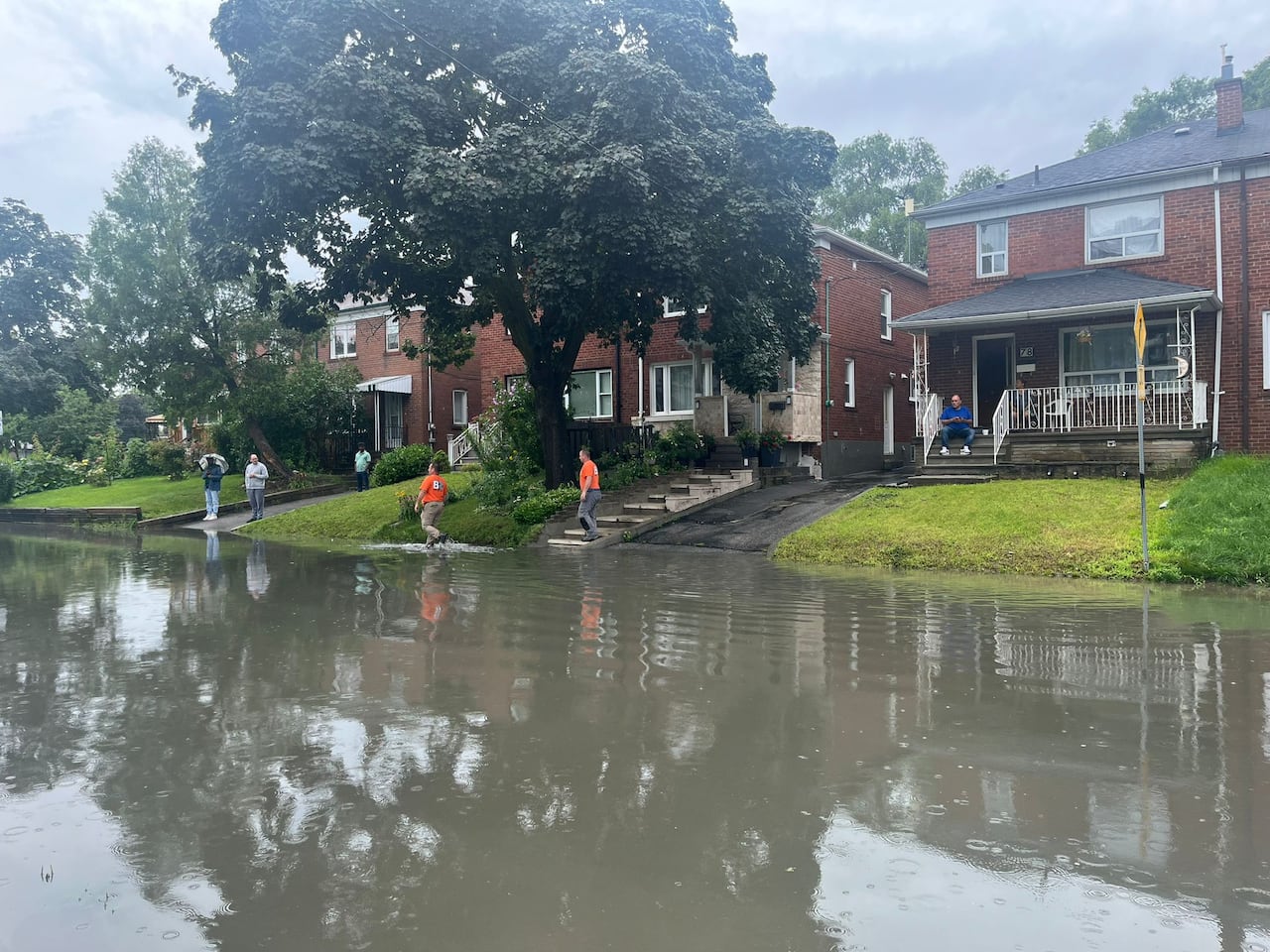 Residents have spoken out about flooding in the area for years. Pictured is flooding on Cordella Avenue after a major storm in July 2024. (Submitted by Brandon Price)
While the city has yet to address the issues with the model, Mereu said it released terms of reference in December as part of a posting to hire an engineering consultant to design the proposed project.
In the fine print, said Mereu, the city had a clause encouraging consultants to recheck calculations.
At a meeting in January with the TRCA, Mereu said the conservation agency admitted there was “an anomaly” in the model that “wasn’t generating information that seemed correct.”
He says the city and TRCA should pause all work and come up with a new solution.
The TRCA acknowledged “technical concerns” have been raised and will “seek to resolve them” during the next design phase, according to an emailed statement from Sameer Dhalla, director of the TRCA’s engineering services.
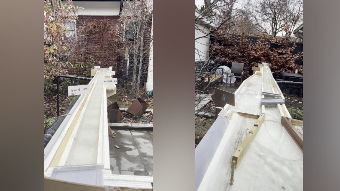 Tim Mereu said he created a physical model to recreate the flood mitigation project and test out if it would work. (Submitted by Tim Mereu)
Dhalla said there will be additional meetings with residents after an engineering consulting company completes its review.
In the meantime, the project has moved on to the design and construction stage, with substantial work already done for the bridge changes the city says it “is moving forward with.”
The cause for the error is likely from engineers relying on models and not going back to the basics of physics, said Mereu.
“A model is just a tool to come up with an answer. There’s physics involved, and the solution has to adhere to the laws of physics,” he said.