
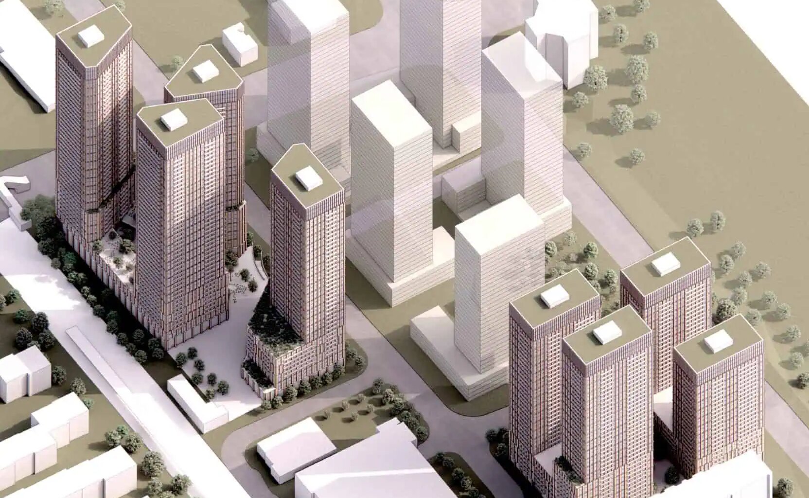
A proposed eight-tower development next to a Mississauga GO station has building heights that “far exceed” other community buildings.
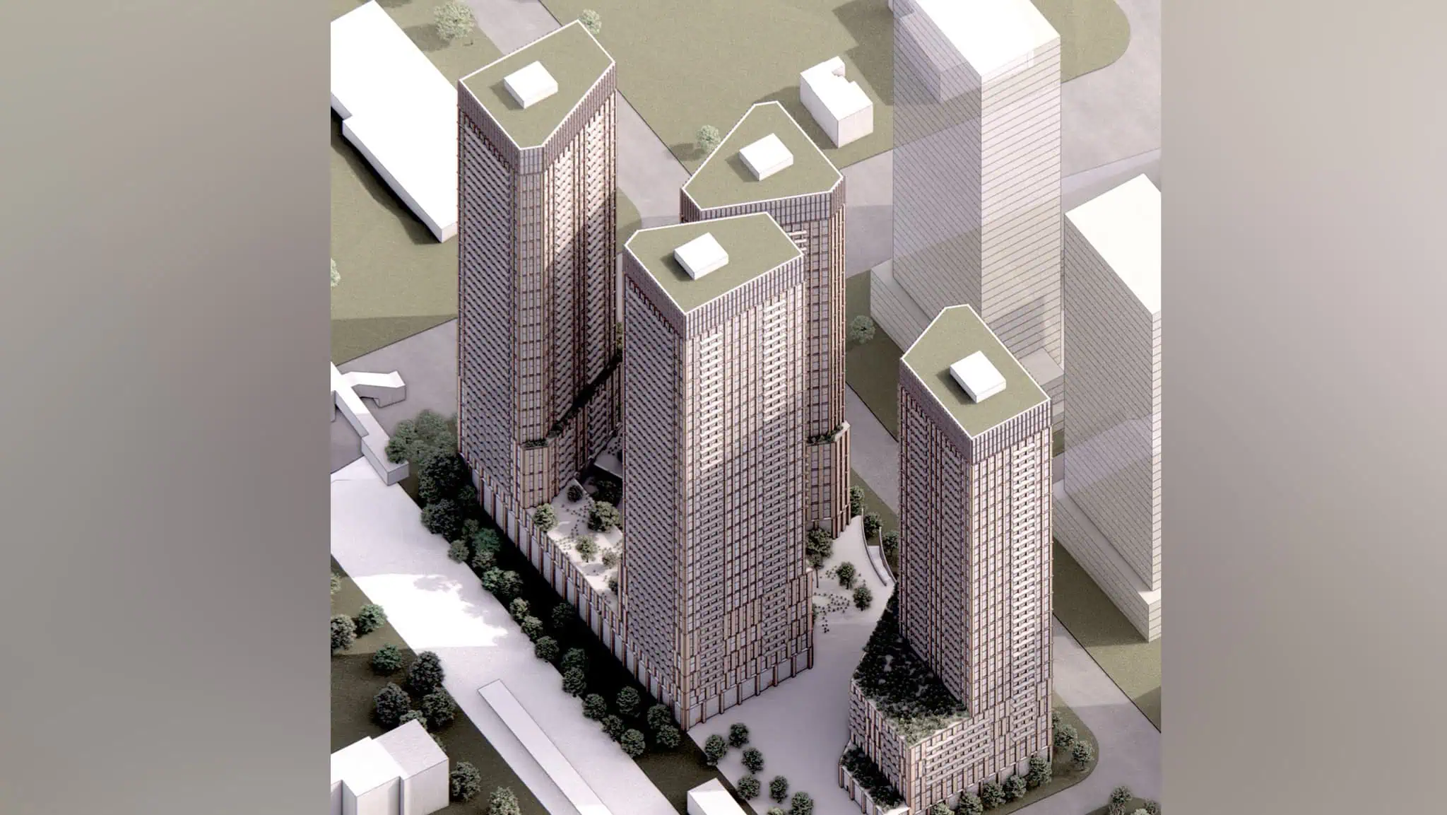
Last fall, Infrastructure Ontario presented the development proposal for approximately 3,000 residential units in eight towers next to the Cooksville GO Station. Designed by Arup, the towers range in height from 28 to 49 storeys.
The development is part the provincial “Transit-Oriented Community” program that started in 2019 and builds mixed-use developments next to transit, according to Infrastructure Ontario’s planning justification report obtained by INsauga.com.
The proposed Cooksville GO Station development will occupy two properties totalling approximately 21,000 square metres. The properties are currently Metrolinx-owned surface parking lots.
As an Infrastructure Ontario project, the development doesn’t need Mississauga City Council approval. Approvals for the project will be achieved via a Ministerial Zoning Order issued by the Ministry of Municipal Affairs and Housing.
But the development proposal has been submitted to the city for comments, according to a report to the Feb. 23 Planning and Development Committee meeting.


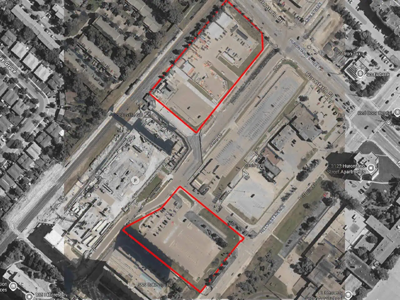
The locations for a proposed development at the Cooksville GO Station are marked on an aerial map. Map: City of Mississauga submission
Issues such as building height, interface with Hurontario Street, pedestrian wind and sun shadow impacts, MiWay and traffic concerns would need to be resolved before planning staff could support the project, the report states.
The height of the towers is much taller than the surrounding area buildings.
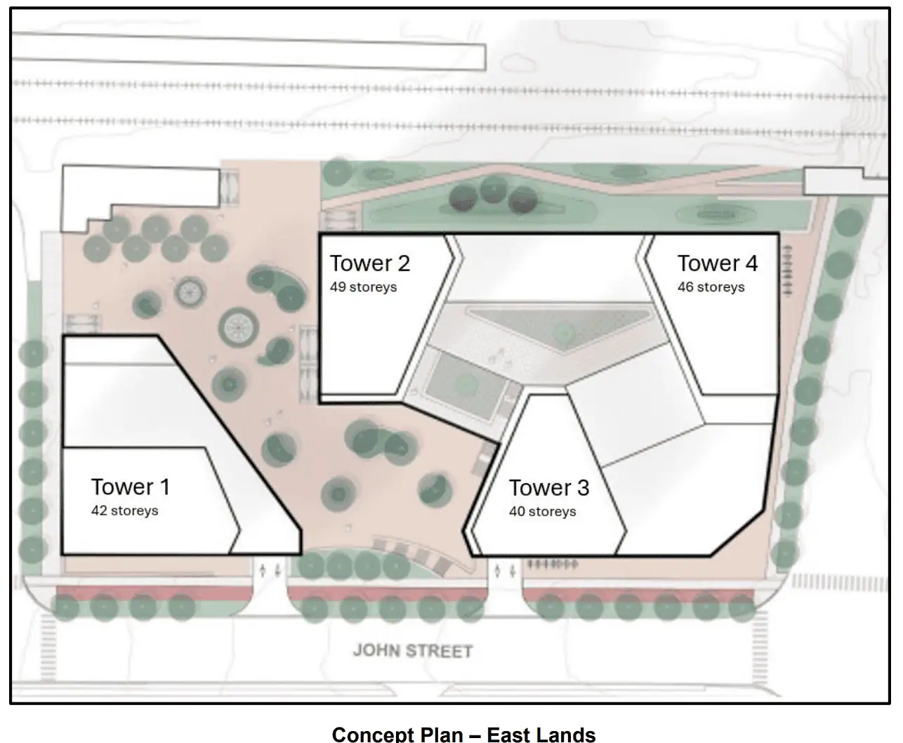
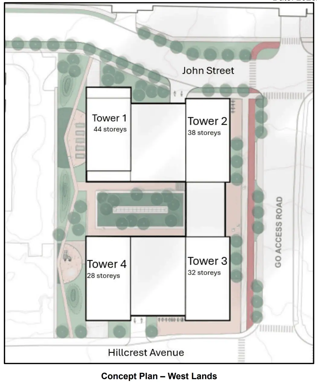
The project’s two sites are described as the East Site on John Street and Hurontario Avenue and West Site on Hillcrest Avenue.
On the east side, the towers are 42, 49, 40 and 46 storeys.
On the west, the towers are 44, 38, 32 and 28 storeys.
The current Mississauga Official Plan permits a maximum building height of 30 storeys on the east lands and 25 storeys on the west lands. However, there are recent approvals to increase the maximum height on the east lands to 35 storeys, and changes to the Official Plan allow development to exceed the maximum height by a maximum of three storeys to accommodate non-residential uses above the ground floor.
But the heights proposed by Infrastructure Ontario “far exceed the City’s built form vision for the area and recent neighbouring approvals,” the report states.
“Staff are concerned with the precedent setting nature of such deviations in height from the MOP (Mississauga Official Plan) permissions and the intrinsic implications on land speculation in the surrounding area. Further discussion with IO (Infrastructure Ontario) is required in this regard,” the report states.
Other issues include a wind study that identifies “unsafe” and “uncomfortable” wind conditions in the public realm and open space areas of the development, the report noted.
There is also “missing/requested” information on traffic and public transit.
For more information, see the report and the Feb. 23 meeting agenda here.
INsauga’s Editorial Standards and Policies
Last 30 Days: 60,250 Votes
All Time: 1,231,045 Votes
3415 VOTES
Should bike lanes stay or be removed?
WIN A $100 GIFT CARD
Subscribe to INsauga’s daily email newsletter for a chance to win a $100 Amazon gift card.