

Published on Mar. 16, 2026, 12:46 PM
Central and northeastern Ontario are facing heavy snow and icy precipitation through Monday, with strong winds creating hazardous or near-impossible travel conditions. Hardest-hit areas, including Timmins, Sault Ste. Marie, and Sudbury, could see 40-50+ cm of snow, with lingering snowfall continuing into Tuesday morning
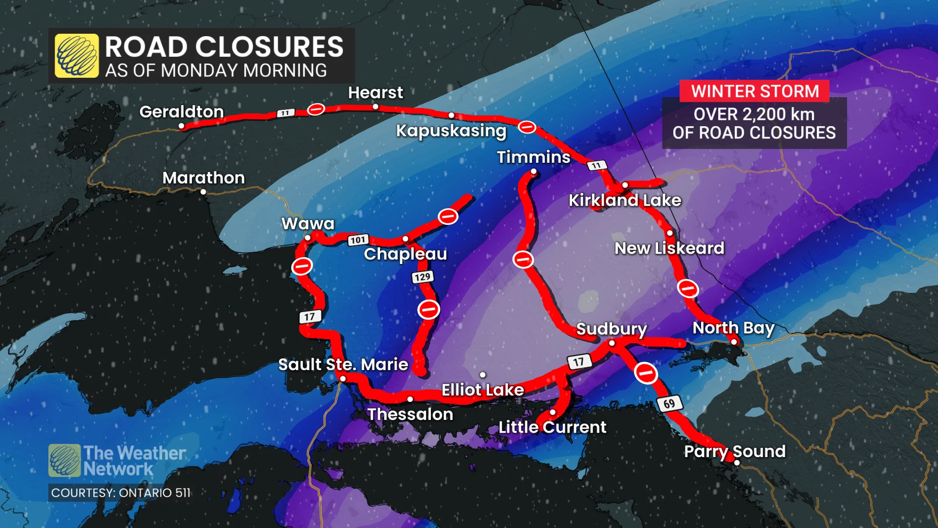
A major winter storm is delivering heavy snow and blizzard conditions to northern Ontario, particularly along the Trans-Canada Highway. By Monday morning, more than 2,200 km of highways were closed in the northeast, including a nearly 800-km section of Highway 11 from Longlac to North Bay.
With a potential of 30-50+ cm of snow, coupled with wind gusts between 50–90+ km/h, travel will likely be treacherous, if not impossible, through Monday.
DON’T MISS: A potentially strong El Niño will develop by this summer
“All travel and outdoor activities should be avoided,” says Environment and Climate Change Canada (ECCC) in an Orange winter storm warning. “Prepare for prolonged, widespread disruptions to transportation, services, and utilities.”
Be sure to check back for the latest forecast updates, and keep an eye on the road conditions before heading out.
Heavy snow, high winds create dangerous travel in northeastern Ontario
Heavy snow and icy precipitation will continue impacting central and northeastern Ontario through Monday, bringing hazardous travel conditions. Northeastern areas will face near-impossible travel, with wind gusts reaching 50-80+ km/h causing widespread blowing and drifting snow.
Conditions near Timmins will deteriorate further as the heaviest snow moves through the region. Blizzard conditions are expected near Lake Superior from Wawa to Sault Ste. Marie, with sustained northerly winds of 40-60 km/h and gusts nearing 100 km/h.