
By Staff
The Canadian Press
Posted March 16, 2026 9:05 am
Updated March 16, 2026 11:21 am
1 min read
Descrease article font size
Increase article font size
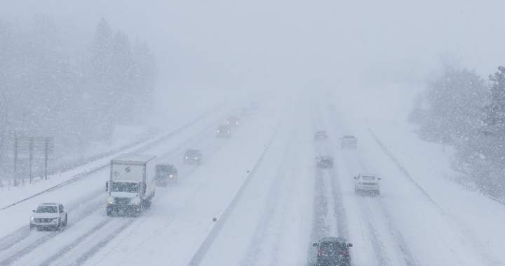
A major winter storm is bearing down on a large swath of northern Ontario extending into Quebec.

Environment Canada says weather warnings are in place from east of Thunder Bay and Lake Superior, all the way to the city of Sept-Iles in eastern Quebec.
The weather agency says up to 60 centimetres of snow could fall in areas around Sault Ste. Marie and Timmins, with a risk of freezing rain and ice pellets that could bring visibility on the roads to near zero.

Get daily National news
Get daily Canada news delivered to your inbox so you’ll never miss the day’s top stories.
Environment Canada says the storm is expected to continue through the day, with winds as strong as 80 kilometres an hour in some areas.
In Toronto and parts of southwestern Ontario, Environment Canada has issued a special weather statement forecasting high winds, and perhaps a patchy mix of rain, freezing rain and snow that may extend into Tuesday.
More on Canada
More videos
Story continues below advertisement
In Sudbury, police say the northern city has already declared a significant weather event and is deploying all available resources to respond to the storm.
“We are asking all residents to remain at home and stay off the roadways until further notice. Municipal crews continue to work diligently to reduce the impact of this weather event on our community,” police said in a news release.
© 2026 The Canadian Press