
Published on Apr. 5, 2026, 8:50 PM
This will have implications for building drought conditions, the wildfire season, streamflows and water reservoirs
While a large chunk of mountains across the western half of North America are dealing with near-record-low snowpack, a success story is quietly building west of Calgary, Alta.
A snow station (Little Elbow Summit) about 1,600 metres in elevation and 100 kilometres southwest of Calgary, in the headwaters of the Elbow River, is stacking up an exceptional amount of snowpack this season.
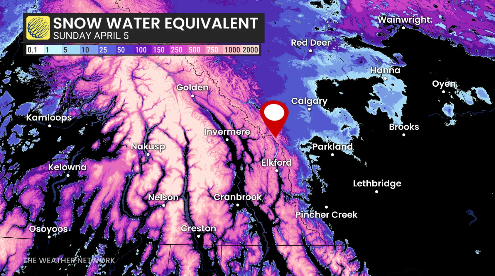
Snow-water equivalent comparison (April 4)
2025: 250 mm
2026: 531 mm
Normal: 300-400 mm
That’s more than double the snowpack from the previous year, and is the second-deepest snowpack since record-keeping began in the 1980s.
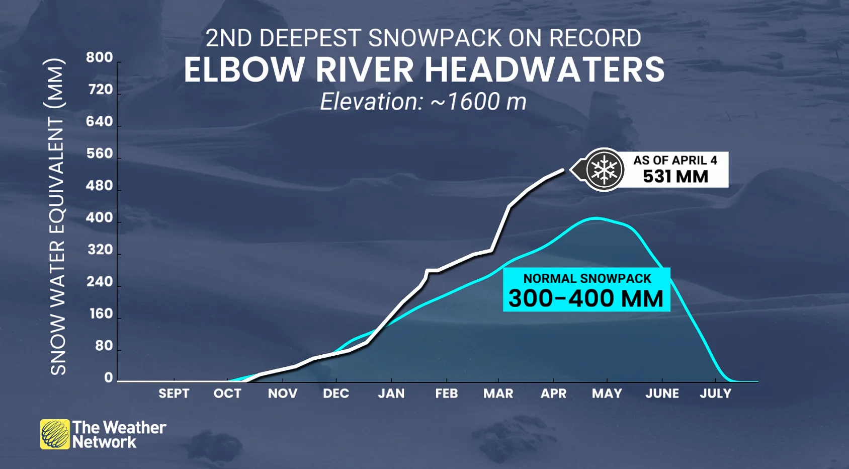
For comparison, 1991 had 587 mm of snow-water equivalency. The record-low snowpack on April 4 is 203 mm, recorded in 1992.
Storm track: The snow key
The upper-level pattern over the past few months has carved an ideal storm track across central British Columbia, ushering in moisture from the Gulf of Alaska. The prevailing westerly winds allowed moisture to reach the Rockies, falling as heavy snowfall.
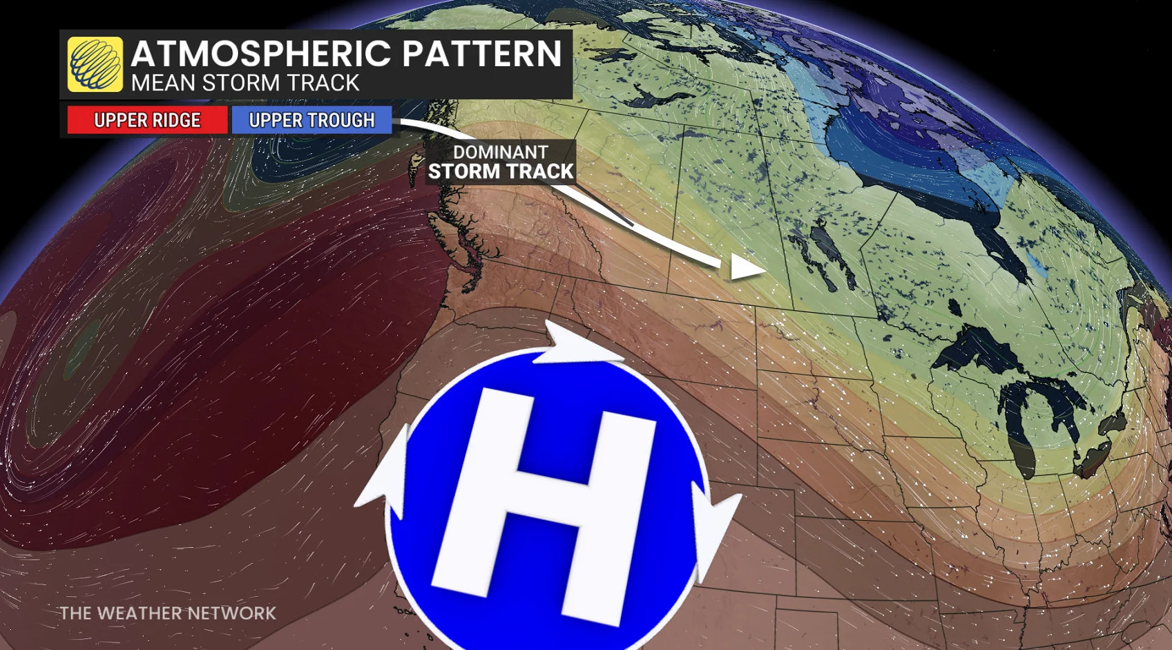
Freezing levels have been more stable across the South Coast of B.C., where milder southwest flow has often taken over, creating a much more inconsistent snowpack.