
A 3.9 magnitude earthquake rumbled the nation’s capital on Tuesday afternoon, according to Earthquakes Canada.
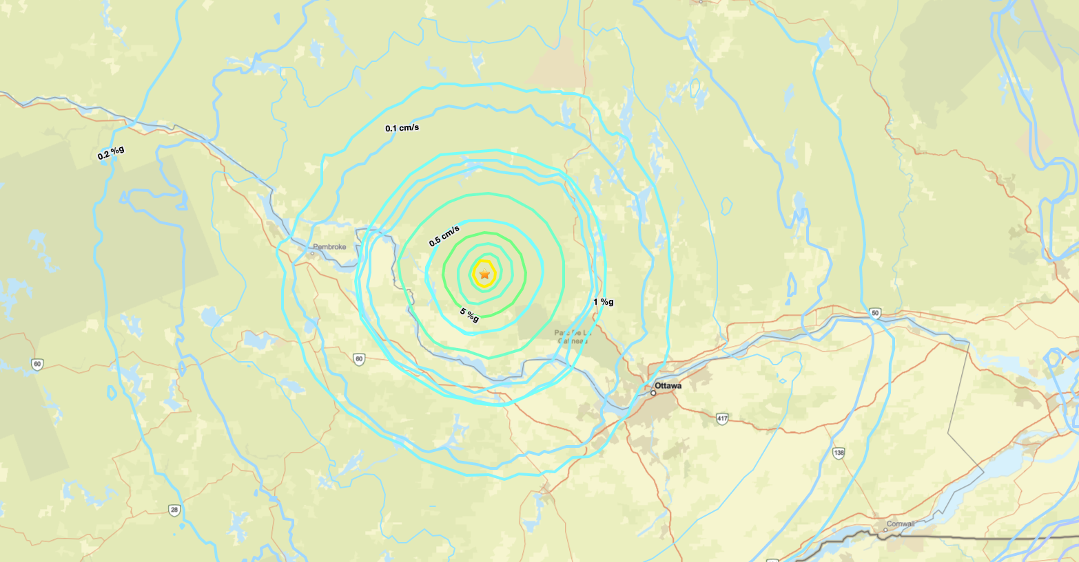
According to reports, the quake hit near Shawville, Que. about 77 kilometres northwest of Ottawa. It happened about 12:36 p.m. on April 14, the site notes.
It was at a depth of 13 kilometres.
Thousands of reports were sent to Earthquakes Canada, according to the government organization. A map from the site shows that people as far as Toronto felt the quake.
Over two dozen people are reporting that they felt the earthquake as a level 1 intensity, and hundreds more felt it as level 2 or 3.
The last large earthquake that was felt in Ottawa happened in 2010 when a quake hit the Val-des-Bois area north of the capital. It lasted about 30 seconds and was measured at 5.0 on the Richter scale.
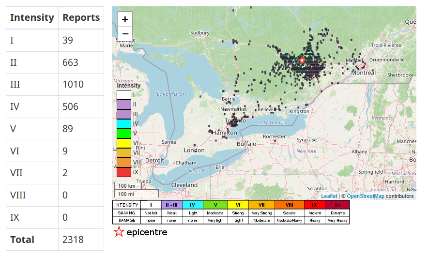 Reports to Earthquakes Canada shows thousands of people say they felt the rumble from Shawville, Que.
Carleton University studying infrastructure risks during quakes
In the Carleton University Canada Foundation for Innovation-funded structures lab, civil and environmental engineering researchers are conducting tests to understand how buildings respond to intense shaking, and how they can be designed differently to minimize injuries and damage.
Professor Jeffrey Erochko said there are seismic hazards in eastern Ontario — as seen by Tuesday’s example.
The Ottawa Valley, up to Montreal along the St. Lawrence River are in a moderate seismic zone, Erochko explained.
“The difference between the west and the east is that in the east, although the earthquakes we could get can be just as big as the west, but they happen less often,” he said. “But it’s been a while since we’ve had a big one.”
Suspended ceilings traditionally look like a grid system with tiles in place. They are often found in office buildings and in schools, researchers explained. The data collected by the lab shows that they are one of the most commonly damaged components of buildings during a quake.
“When they fall, they are both a falling hazard, and they can prevent barriers to people evacuating the building,” PhD student Cameron Flude said in an interview.

The star on the map indicates the approximate location where the earthquake hit. (USGS)