

THE LATEST:
Water levels appear to have dropped by a few centimetres on the Ottawa River between Ottawa-Gatineau and Thurso, Que., according to authorities.
Levels and flows have stabilized or slightly increased elsewhere.
A second peak still remains possible, depending on the snowmelt and rain.
The mayor of Fort-Coulonge, Que., told CBC the community’s state of emergency ended at 6 p.m. on April 23.
Water levels and flows on the Ottawa River have begun to slightly decline in places between Pembroke, Ont., and Carillon, Que., according to the river’s planning board.
Levels appear to have dropped by a few centimetres from Ottawa’s Britannia neighbourhood downstream to Thurso, Que., according to Thursday afternoon’s forecast from the Ottawa River Regulation Planning Board.
The board was still reporting a rise of roughly five centimetres closer to Pembroke, Ont., on Thursday.
“With accelerated snowmelt expected in the northern part of the watershed, northern reservoirs are now passing increased flows downstream,” the board said.
“This may lead to increasing water levels in Pembroke and stable or slowly decreasing levels between Lake Coulonge and Carillon.”
A second peak still remains possible, the board added, since both the rate of snowmelt on the river’s northern reaches and the amount of rain in the imminent forecast are uncertain.
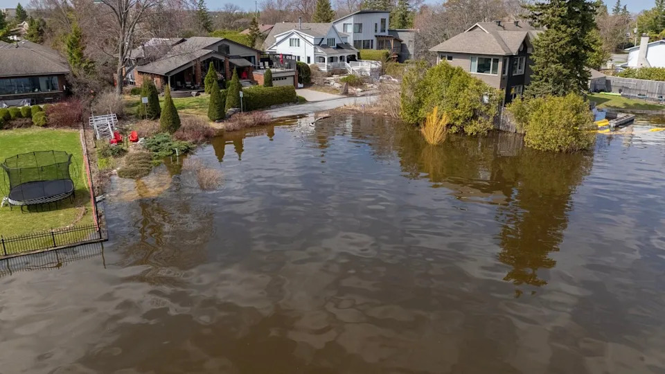
Water reaches into the backyard of a home in Ottawa’s Crystal Bay community on Wednesday. (Félix Desroches/CBC)
What you need to know
In Ottawa, there were 15 locations as of Thursday afternoon where residents could pick up sand and sandbags.
The City of Ottawa keeps an updated list of road and pathway closures that can be found here, as well as an interactive map.
The City of Gatineau also has an interactive road closure map. Several dozen roads have been affected by flooding, some of which are only accessible by boat.
Any residents who need help escaping their flooded properties should call 311 and emergency crews will be dispatched, the city says
A flood relief centre also opened Tuesday at the Centre sportif de Gatineau at 850 boul. de la Gappe. It’s open from noon until 8 p.m. daily.
Traversiers Bourbonnais, which operates the ferry between Gatineau’s Masson-Angers area and Cumberland in east Ottawa, suspended operations on April 21 and remains closed.
The Ecolos ferry between Clarence-Rockland, Ont., and Thurso, Que., is also out of service.
People living in communities outside Ottawa-Gatineau are encouraged to check their municipality’s website for the latest on flooding in their area.
Aside from the Ottawa River, the Mississippi Valley Conservation Authority has a flood warning in place for Dalhousie Lake and flood-prone areas of the Mississippi River.
People should take precautions like checking sump pumps and moving valuables from basements, the authority said.