
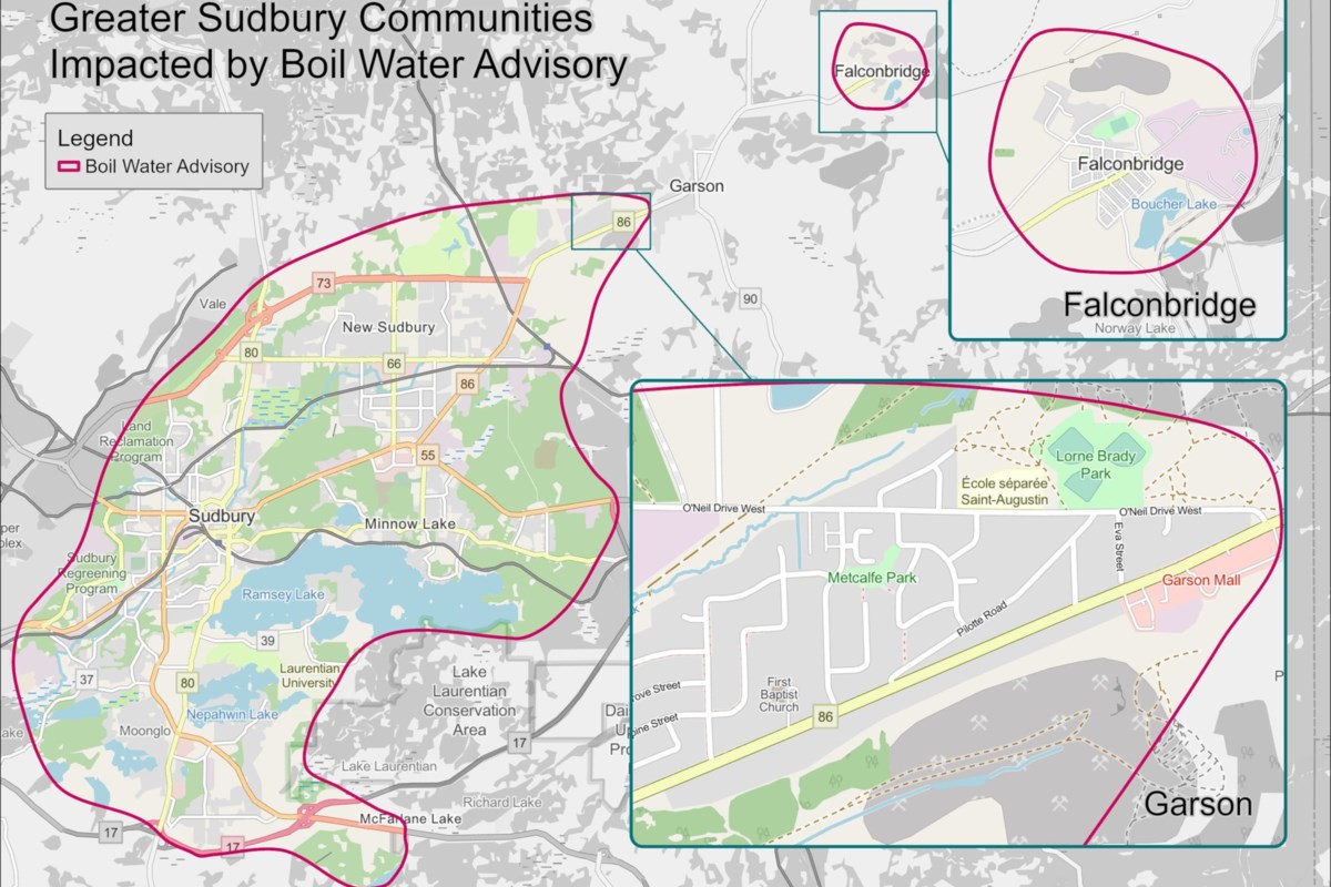
Public Health Sudbury and Districts released a map at 2:05 p.m. on May 8 to indicate which areas of Greater Sudbury are affected by an ongoing boil water advisory
Public Health Sudbury and Districts has released a map to show which areas of Greater Sudbury are affected by an ongoing boil water advisory.
It affects residents in Sudbury, New Sudbury and Falconbridge as well as both sides of O’Neil Drive West and the area between Maley Drive and O’Neil Drive West.
The boil water advisory has been in place since 6:22 p.m. on May 6, after which many residents have taken to social media to express confusion regarding whether their property is affected.
PHSD refined their descriptions of affected areas in the hours that followed.
Ward 7 Coun. Natalie Labbée told residents on the Garson Falconbridge Community Action Network Facebook page on May 7 that she had requested a detailed map to share with residents.
“I’m hoping it’s circulated soon,” she wrote at 12:32 p.m. on May 7. “It will be posted on the city website and social media pages.”
This finally happened at 2:05 p.m. on May 8, when the map was posted to Facebook.
Meanwhile, PHSD announced at 9:41 a.m. on May 8 that their website was down. By the time of publication, the website, phsd.ca, still appeared to be down. For now, they’re asking people to follow them on social media.
Update: At 4:15 p.m. on May 8, PHSD noted that their website was back up.