
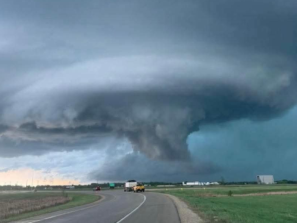
Updated 11:28 p.m. Environment Canada has updated a tornado warning for South Central Manitoba.
Red level warning – tornado – issued for:
R.M. of St. Clements incl. Grand Beach Brokenhead and Libau, Man. (052410)
Red level warning – tornado – continued for:
R.M. of Rockwood incl. Teulon Stonewall and Stony Mountain, Man. (052240)
R.M. of St. Andrews incl. Selkirk Lockport and Ponemah, Man. (052270)
Impact Level: Extreme
Forecast Confidence: Very high
At 11:24 p.m. CDT, Environment Canada meteorologists are tracking an area of severe thunderstorms that is possibly producing a tornado. Damaging winds, large hail and locally intense rainfall are also possible.
Tornado Location: Near Clandeboye and Petersfeild
Motion: Moving northeast at 35 km/h
Locations in the Path:
Clandeboye
Petersfeild
Netley
This is a very dangerous and potentially life-threatening situation.
Take cover immediately in a basement, interior room, or a sturdy shelter when threatening weather approaches. If no shelter is available, lie in a low spot and protect your head from flying debris.
 As of 11:20 p.m., areas in red are under tornado warnings. Take shelter immediately if threatening weather approaches. (Environment Canada)
Environment Canada has issued a number of tornado warnings on Tuesday evening as hail-packed storms moved through the region.
An orange-level tornado watch remains in place for much of southern Manitoba Tuesday night, warning that conditions are favourable for severe thunderstorms capable of producing tornadoes, large hail, damaging winds, and heavy rainfall.
The watch carries a high impact level and high forecast confidence, with forecasters warning that strong tornadoes are possible as storms begin developing this afternoon.
Meteorologists say thunderstorms are expected to form over southwestern Manitoba and southeastern Saskatchewan between 4 p.m. and 5 p.m. before moving eastward across southern Manitoba through the evening. Additional storm development is also possible in the Red River Valley later this afternoon.
Strong tornadoes possible
Environment Canada says the initial storms are expected to develop as discrete thunderstorms, which pose the greatest risk of tornadoes. Strong tornadoes and large hail are considered the primary threats during this phase of the event.
As storms organize into a larger line later this evening, the threat is expected to shift toward widespread damaging winds. However, embedded tornadoes may still develop within the advancing storm complex.
Forecasters warn that significant damage to homes, infrastructure, vehicles, crops, and the natural environment is possible.
Related Stories:
Residents urged to prepare
The tornado watch covers much of southern Manitoba, including the Parkland, Westman, Central Plains, Interlake, Red River Valley, Pembina Valley, southeastern Manitoba, and the Winnipeg region.
Environment Canada is urging residents to closely monitor weather conditions throughout the day and be prepared to take shelter immediately if warnings are issued.
The safest place during a tornado is a room on the lowest floor of a sturdy building, away from windows and exterior walls, such as a basement, bathroom, stairwell, or interior closet.
People in mobile homes, vehicles, tents, trailers, and other temporary structures should move to a permanent building if possible.
Boaters are also being advised to head to shore immediately if threatening weather develops, as lightning, strong winds, and large waves can create dangerous conditions on the water.
Environment Canada says weather conditions could change rapidly, and additional watches or warnings may be issued as storms develop across the region this afternoon and evening.