
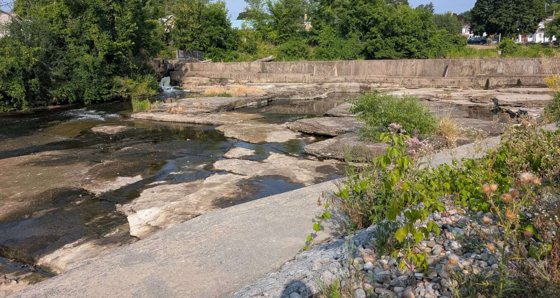
 The Napanee Falls look quite dry on Tuesday, Aug. 12, 2025. Photo by Michelle Dorey Forestell/Kingstonist.
The summer of 2025 has certainly been a hot one so far. And the lack of significant precipitation has caused grief for farmers and growers across the region, not to mention those who enjoy local waterways for recreation.
Merriam Webster defines a drought as “a period of dryness especially when prolonged; specifically: one that causes extensive damage to crops or prevents their successful growth.”
Although we experienced a brief rainstorm earlier this week, one downpour does not typically alleviate drought conditions, especially when local precipitation rates have been low for months. According to Environment Canada data, the Kingston area had not had rainfall since the week of July 21, 2025, and the rainfall amount for the entire month of July was 18 mm. In 2024, Kingston experienced 65 mm of rain in July, and 56 mm in August. The heavy rain on the morning of Wednesday, Aug. 13, 2025, brought about 13 mm of rain (based on my backyard rain catcher), with only a one significant “chance of showers” in the week-long forecast.
To better understand the drought conditions and how water levels are managed in the region, Kingstonist reached out to municipalities and local conservation authorities.
Cataraqui Conservation, whose watershed region is composed of 10 smaller watersheds that all drain toward the eastern end of Lake Ontario and the beginning of the St. Lawrence River, issued a Level 1 Low Water Condition on Thursday, Aug. 7, 2025, for the Cataraqui Region extending from Napanee in the west to Brockville in the east and north to Newboro.
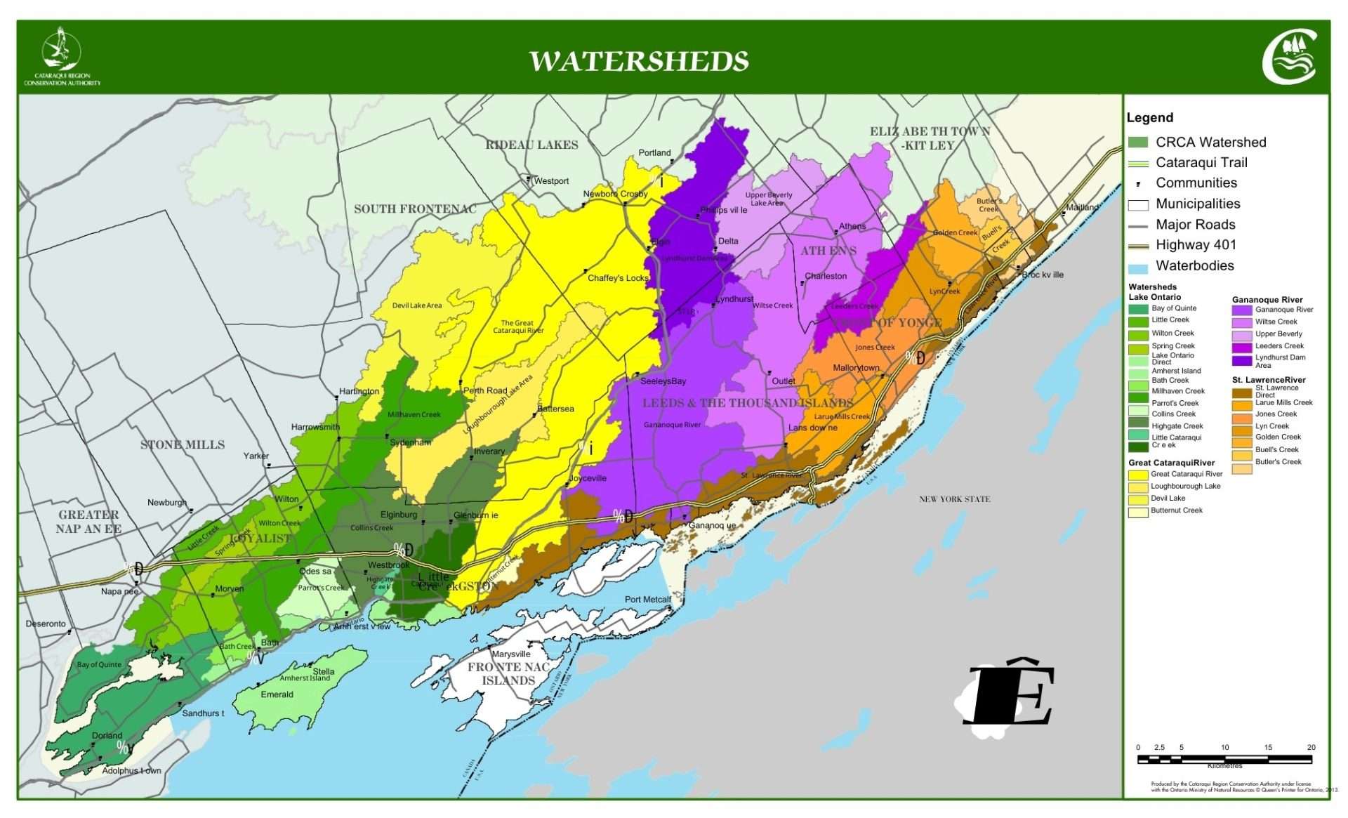 Watersheds in the Cataraqui Conservation’s region. Image via Cataraqui Conservation.
According to Krista Fazackerley, Supervisor of Communications & Education at Cataraqui Conservation, as part of Ontario’s Low Water Response Program, low water declarations are determined by the Cataraqui Region Low Water Response Team convened by Cataraqui Conservation. Membership includes water managers, major water users, Public Health, agriculture, school boards, marina operators, golf courses, government agencies, and others.
“For July, we only saw 23 per cent of the normal rainfall — every drop helps, though,” Fazackerly told Kingstonist in an email after the Wednesday morning rainfall.
“In these dry conditions, the ground does become very dry and hard, so when you get a heavy rainfall, it mostly will run off the hard surface into waterways instead of soaking into the ground.”
Low water conditions are monitored and reported based on thresholds of average precipitation and streamflow indicators, Fazackerley noted. Cataraqui Conservation staff use data gathered from stream gauges, weather stations, rain gauges, and meteorological forecasts to work with the Low Water Response Team to declare low water conditions.
She shared the three levels of low water conditions:
Level One: first indicator of a potential water supply problem, managed through water conservation.Level Two: a potentially serious problem, managed through water conservation and restrictions on non-essential water use.Level Three: water supply fails to meet demand, managed through water conservation, restrictions and regulation of water use.
“If current conditions persist with no significant rain in the forecast for the Cataraqui region, then a Level Two condition could persist or a Level Three low water condition could be declared in the coming months. Cataraqui Conservation staff and the Low Water Response Team will continue to assess the available data,” Fazackerly stated.
She also made it clear that only some of the lakes and streams in the catchment area are managed, and that water flow is not diverted in the Cataraqui Region. Dams, and water control structures (reservoirs, channels and detention basins) allow for some management of water levels, but when the water simply isn’t there, there is not much management to do.
Higher-than-average temperatures and generally very sunny conditions are contributing to faster evaporation, according to Fazackerly, which accelerates water level decline.
“Water levels on Cataraqui Conservation managed lakes have been falling about two to five centimetres per week for several weeks due to evaporation and no new inputs of precipitation. Without significant rain in the forecast, it is likely that the Low Water Response Team will declare a Level Two low water condition in September or earlier if no precipitation is received,” she detailed.
Water Managers in the Cataraqui Region are very limited in what they can do to alleviate effects without consistent or significant rainfall, Fazackerly stated.
“Under current conditions, there must be a balance between adverse impacts upstream and downstream and implications to recreational uses, the environment, and habitat.”
The Cataraqui Region has experienced very dry conditions in prior years, with the most recent being in 2016.
“That year, the region saw worse conditions than we are currently experiencing,” Fazackerly explained.
“In 2016, a Level One condition was declared in May, and the region was in a Level Three condition in early August through to November. Low water conditions persisted into early winter 2017, with levels coming back to normal status in February of 2017.”
Along the Rideau Canal, the ongoing hot and dry conditions have resulted in lower-than-normal local inflows and increased evaporation rates, according to Parks Canada.
“Consequently, the system has transitioned from summer-like conditions to a deficit state. Water management and operational activities are being conducted to appropriately respond to these changes and may result in fluctuations in water levels across the system,” Parks Canada said in its most recent update.
“The Rideau Water Management team will be actively monitoring the changing conditions.”
The Rideau Canal National Historic Site provides updates regarding water levels, fire bans, and other notices on its Facebook page.
In the City of Kingston, water management is a bit different. Within City limits, the municipality puts watering restrictions in place each summer, to ensure reliable water reserves and maintain fire protection capabilities.
Nancy Knight, Manager of Communications and Customer Care at Utilities Kingston, told Kingstonist that the usual restrictions (linked above) remain in effect until September 15, with no plans to change them at this time.
“We will continue to monitor conditions closely and, if dry weather continues, may consider additional steps to help manage demand and protect supply,” she noted.
“We encourage residents to do their part by following the watering restriction schedule and making every drop count — watering only on their permitted day, using rain barrels for gardens, and focusing on plants and trees that need it most.”
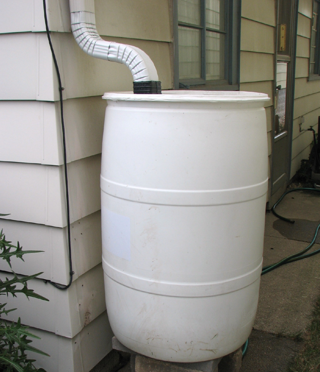 While many rain barrels were dry before this week’s rain, Utilities Kingston recommends harvesting the limited rainwater to water local gardens. Kingstonist file photo.
On designated watering days, the City of Kingston is also encouraging willing and able residents to help water municipal trees. Knight stated that this request does not apply to residents with private wells or residents served by the Cana municipal drinking water system (which is operated by Utilities Kingston, but draws water from the company’s Cana Well).
Kingstonist was assured that overall, there are no supply concerns for the municipal drinking water systems managed, operated, and maintained by Utilities Kingston.
“Our systems are operating well within capacity, and we continuously monitor supply and demand to ensure the needs of homes, businesses, and fire protection are met,” Knight stated.
Those in Napanee may have noticed that the Napanee Falls have slowed to a trickle. The Town of Napanee said that it does not monitor water levels itself, but that they are part of Quinte Conservation’s watershed management area.
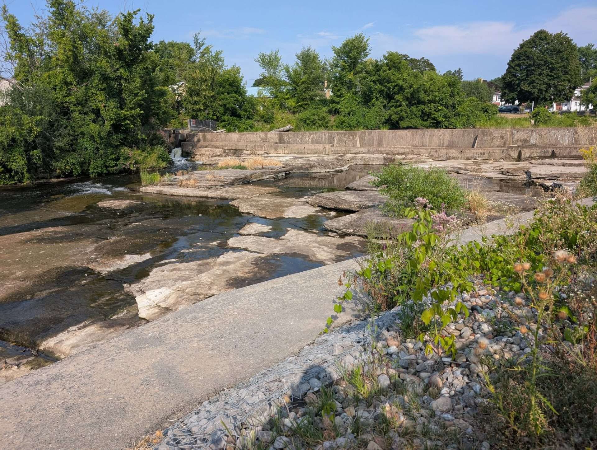
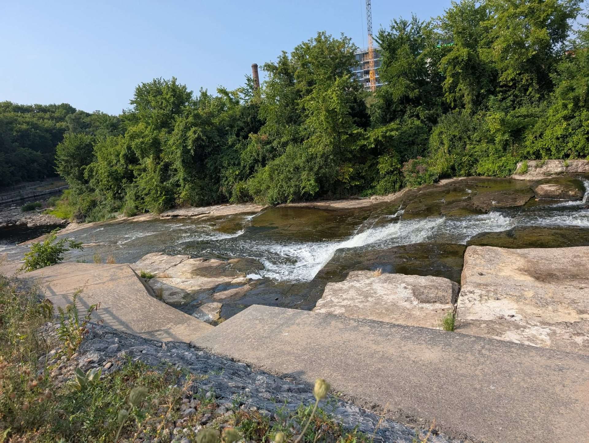 The Napanee Falls were almost completely dry on Tuesday, Aug. 12, 2025. Photos by Michelle Dorey Forestell/Kingstonist.
In response to Kingstonist inquiries, Kylie Huffman, Community Engagement & Communications Coordinator at the Town, stated that Greater Napanee does not have watering restrictions in place under the current Level 1 Low Water Condition.
“We are actively working with our local conservation authorities and Low Water Response Teams to monitor the situation,” Huffman detailed.
“Should conditions escalate to higher levels, water use restrictions may be recommended to help manage supply and protect local water resources.”
Similarly, Quinte Conservation, which covers the land that drains to the Moira River, Salmon River, and Napanee River, as well as Prince Edward County, has echoed that the Quinte Watershed is also in a Level 1 Low Water Condition.
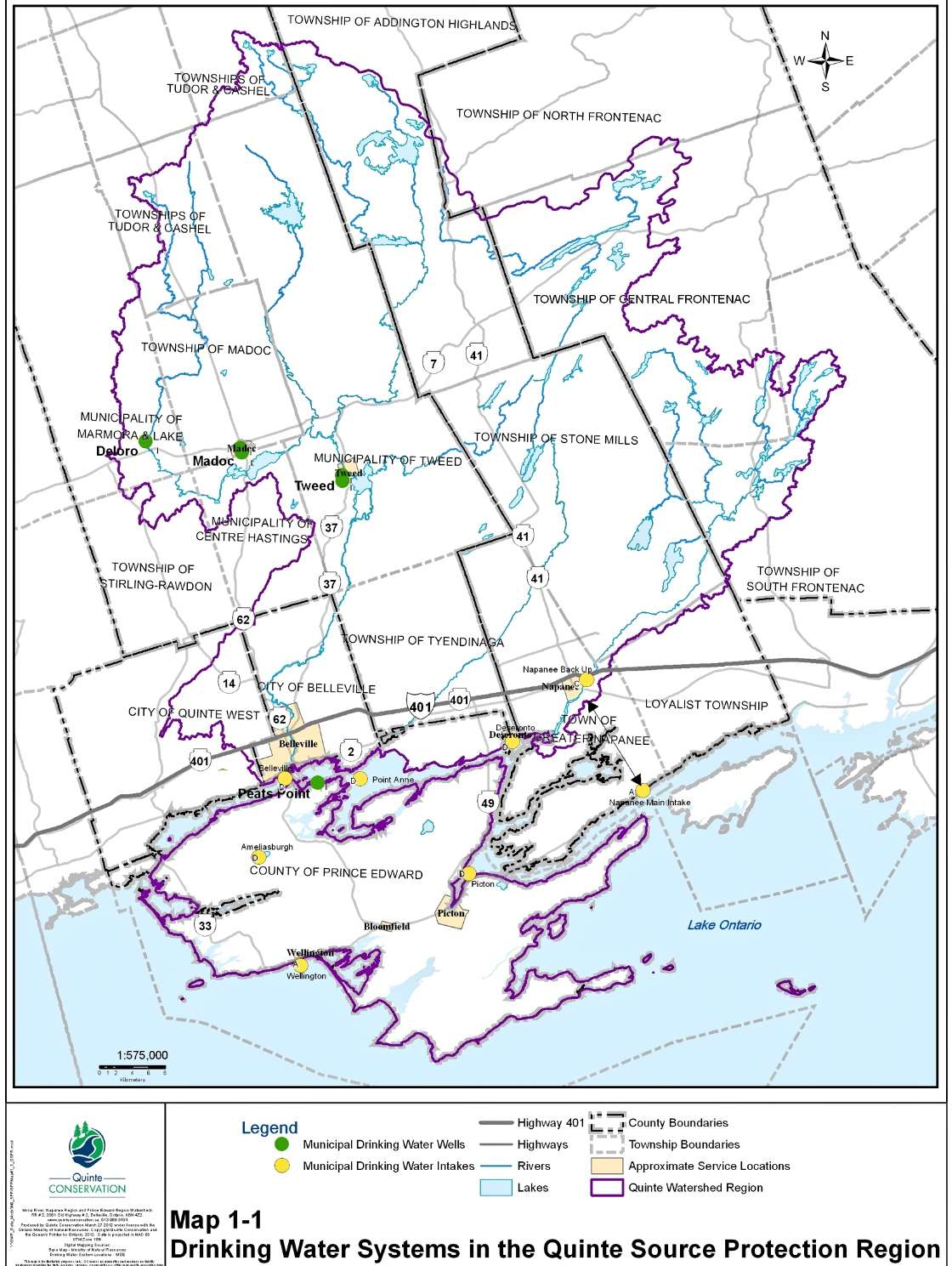
“Over the past three months, there has been less than 80 per cent of total normal precipitation across the Quinte watershed. This statistic is even more stark when reviewing the rainfall received over the last month or two,” Christine Phillibert, Water Resources Manager for Quinte Conservation, shared with Kingstonist.
She also noted that this is the “most significant drought” since 2016.
“Remarkably, the flows measured at the lower end of the Napanee River have never been this low at this time of year for the entire period that data has been recorded (since 1974). This is particularly interesting because the flows in Depot Creek, which are augmented by the dams on the Depot Lakes, are not lower than typical flows experienced over the past decade.”
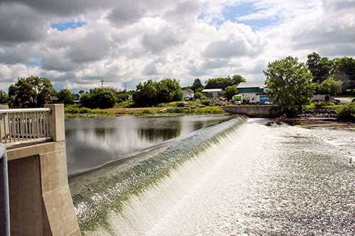 The Arthur Holgate Dam on the Moira River in the City of Belleville. Photo via Quinte Conservation.
She explained that there are a number of dams within the Quinte watershed, and some of the dam operations have operating rules for low water.
“This allows water to be released from the dams to augment flow in the river downstream. Unfortunately, these operations only provide limited flow increases for a few kilometres over a short period of time. This means that for prolonged periods without rainfall, the dams are unable to maintain sufficient flow in the rivers,” Phillibert detailed.
She provided a summary of why the dams cannot alleviate the flows and water levels throughout the rivers downstream:
Dam operators can only operate within the confines of the operating plan.The lakes above the dams are already lower than normal, leaving little or no room for further operation.Flow increases downstream are limited in their effect because water spreads out as it travels downstream. Picture a running hose lying on the ground. At the end of the hose, the water flow is well defined, and you can see the effect of the hose being on (or the dam being open). As the water travels further away, it spreads out, slows down, and blends in. Eventually, it is only leaving a dampness on the ground without an increase in flow or water level that can be seen or measured.
All of those responsible for water management concur — if residents can reduce water usage it will help ensure a reasonable amount of water to go around.
To that end, they all provided tips or suggestions to help keep local water levels manageable, including:
Limit non-essential water uses: stop washing vehicles, driveways, and sidewalks, and watering lawns (which will recover after significant rainfall)Conserve inside the home: only run washing machines and dishwashers with a full load, turn off the tap while brushing teeth and shaving, install low-flow showerheads, faucet aerators, and retrofit with more efficient plumbing options, repair leaky faucets and plumbing, and take shorter showers. (Quinte Conservation stated that on average, bathing is the highest water use inside the home, making up 35 per cent of household water use.)Use rain barrels to harvest the rainwater: even a small shower can provide significant water for your gardens, water the base of plants in the morning to reduce evaporationKeep jugs of water in the fridge rather than running the tap while waiting for the water to get cold.
As the summer continues, Kingstonist will monitor the alerts and releases from the local conservation authorities and municipalities, and provide updated coverage.