

Listen to this article
Estimated 2 minutes
The audio version of this article is generated by AI-based technology. Mispronunciations can occur. We are working with our partners to continually review and improve the results.
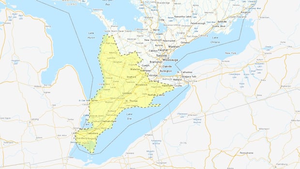
Environment Canada has placed southwestern Ontario under a yellow-level severe thunderstorm watch for Thursday afternoon and evening, and is warning of a brief tornado risk.
“Conditions are favourable for the development of severe thunderstorms that may be capable of producing strong wind gusts and large hail,” the weather agency’s statement said, adding that “once the storms have intensified, there is a risk of a brief tornado.”
Local utility outages are possible, Environment Canada said, with wind gusts up to 90 km/h and the possibility of toonie-size hail.
Environment Canada meteorologist Peter Kimbell said the severity of the storm depends, in part, on how much sun the region gets over the course of the afternoon.
“It’s kind of a double-edged sword,” he said. “We want the sun, but the more sunshine we get on day like today, it will increase the temperatures and increase the instability and cause some thunderstorm activity.”
The probability of a tornado, however, is very low, he said, explaining that while some of the atmospheric conditions are favourable, it’s not a high risk.
“It’s not like in some situations, we have the (wind) shears being very high, and that would increase the likelihood of a tornado. That’s not the case today.”
Kimbell stressed that Environment Canada has not issued a tornado watch for the region.
If threatening weather does approach, the weather statement advised, take cover in a basement or interior room.
Anyone outside, it adds, should protect themselves from flying debris and hail, and secure any loose objects.