
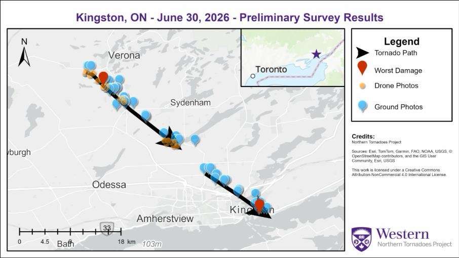
Survey summary map showing the tracks for the confirmed Verona and Kingston tornadoes. Image via Northern Tornadoes Project.
Northern Tornadoes Project at the University of Western Ontario has confirmed that two tornadoes touched down in eastern Ontario during a powerful storm that swept through the Kingston area on June 30, 2026.
The project said that it confirmed an EF1 tornado near Verona and an EF0 tornado in Kingston following ground and drone surveys conducted on July 3, along with satellite imagery analysis and radar data.
Researchers said both tornadoes formed “beneath a mesovortex along the leading edge of a bow-echo thunderstorm that tracked southeast from the Verona area toward Kingston.”
The stronger of the two tornadoes touched down near Verona at approximately 12:35 p.m. before travelling just over 18 kilometres through the Verona, Hartington and Harrowsmith areas.
The tornado damaged farm properties and trees but caused no reported injuries.
Survey teams determined the tornado reached EF1 strength, with estimated peak wind speeds of 150 km/h. The damage path reached a maximum width of about 510 metres and moved from the northwest.
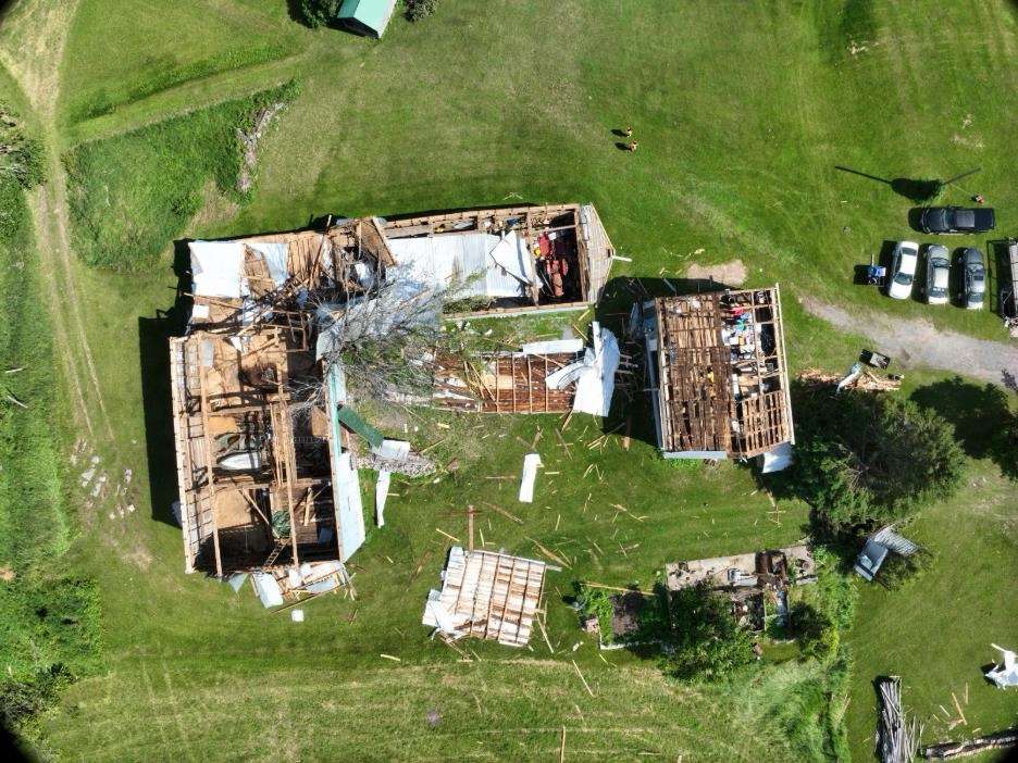 A drone photograph of roof damage to two barns (worst damage for the Verona EF1 tornado). Parts of the roof structure from the large barn were carried southeast into a neighbouring field. Image via Northern Tornadoes Project.
Investigators identified the most severe damage at a farm property, where roofs were torn from two barns. Drone imagery showed sections of the larger barn’s roof carried well into a neighbouring field, while survey crews also documented extensive convergent treefall along the tornado’s path.
About 15 minutes later, at approximately 12:50 p.m., a second tornado touched down in the Kingston area.
Classified as an EF0, the tornado tracked 10.9 kilometres from the Silver Corners area southeast toward CFB Kingston, damaging trees along its path. No injuries were reported.
The Northern Tornadoes Project estimated the Kingston tornado’s peak wind speeds at 115 km/h. Its damage path reached a maximum width of 250 metres as it travelled from the northwest.
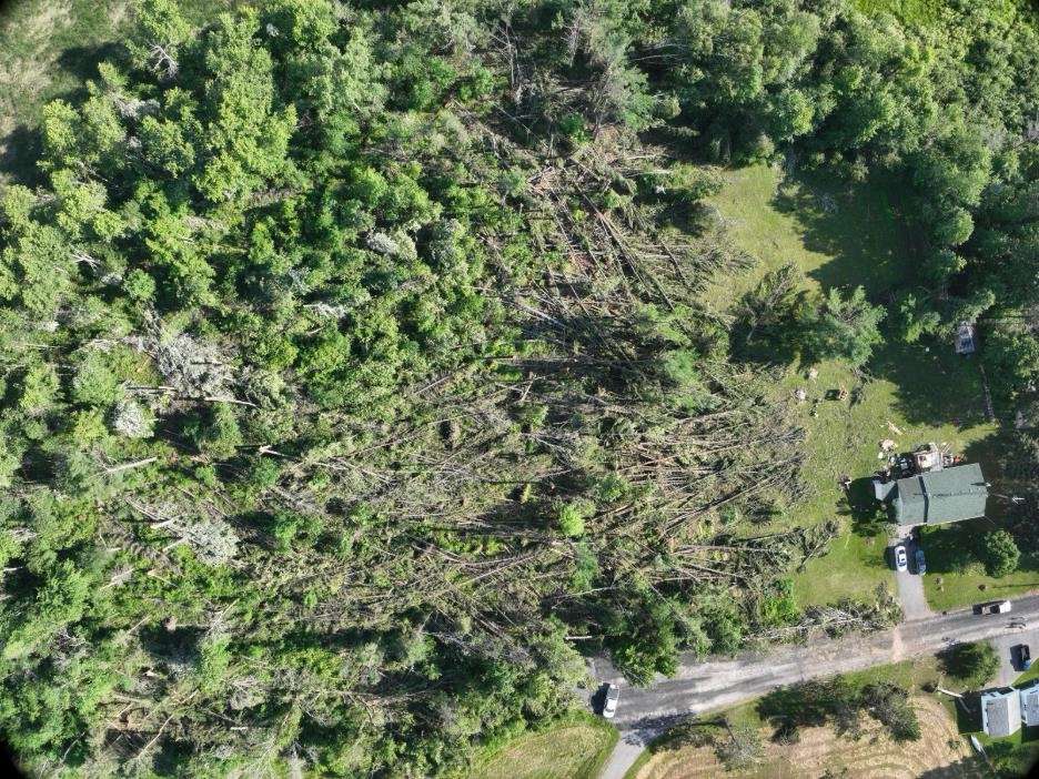 Evidence of “convergent treefall”, a hallmark of a tornado, along the damage path of the Verona EF1 tornado. Image via Northern Tornadoes Project.
Survey crews documented a long corridor of tree damage, including several snapped mature trees, while satellite imagery confirmed visible damage along the track.
Radar imagery captured mesovortex rotation associated with both tornadoes. Researchers said the Verona tornado developed near Harrowsmith, while the Kingston tornado formed as the same bow-echo thunderstorm moved into the northeastern part of Kingston.
The Northern Tornadoes Project, based at the University of Western Ontario, investigates and documents tornadoes and other severe wind events across Canada using field surveys, remote sensing and meteorological analysis.