
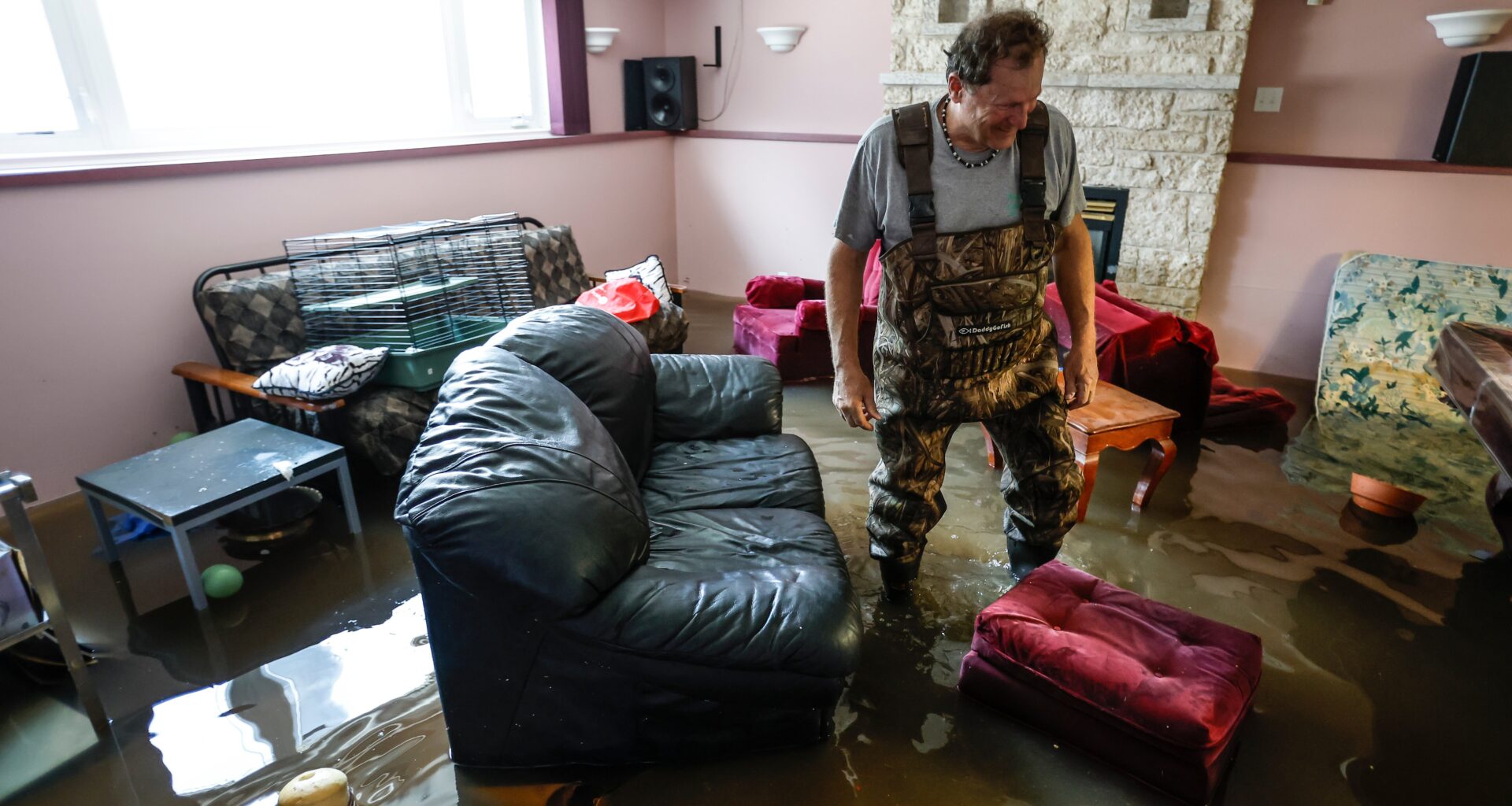
On the afternoon of August 4, 2014, the sky opened up over Burlington, Ontario.
An MPP at the time, Eleanor McMahon visited the site of the ensuing flood, where she destroyed pair after pair of shoes wading through basements full of backed-up sewage in ruined homes. “There was fecal matter in the water. In hindsight, I should have wrapped those shoes with plastic bags.”
McMahon, who represented the provincial Ontario riding of Burlington from 2014 to 2018 and served in then-premier Kathleen Wynne’s cabinet, has a clear memory of the flood’s aftermath. The microburst was hyperlocalized and hammered just one section of the city, yet still flooded some 3,000 homes and caused about $80 million in damages, she said.
“It happened very quickly. The water came down escarpments into eroded creek beds, trees fell over, and the water started to build up.”
“One family I met described a six-foot-tall wall of water that flooded their house within minutes,” said McMahon in an interview with Canada’s National Observer. “They grabbed a few keepsakes and ran out the door. They were terrified.”
Canada is exceptionally vulnerable to flooding, a problem that is getting worse thanks to climate change. But the country is also struggling with a housing crisis — and that’s leading governments to cut regulations designed to ensure new housing is flood resilient. The urgent need for housing is running into the equally urgent need to implement effective flooding mitigation and prevention strategies, and a critical lack of coordination, consistency and communication between jurisdictions is undermining efforts on both fronts.
“It’s widely acknowledged that we have a housing crisis in Canada,” says Jennifer Drake, Canada Research Chair in Stormwater and Low Impact Development at Carlton University. “We need to build more houses more quickly. But some of the policy changes that are being implemented to achieve that goal are coming at the cost of resiliency measures.”
Invisible solutions
Most Canadian cities were built next to bodies of water, and much of Canada’s housing stock lies in floodplains. About 80 per cent of Canadian cities are built, in whole or in part, on floodplains and 1.5 million homes are in areas now considered to have a high flood risk. Yet one of the outstanding issues is flood mapping — it hasn’t kept pace with climate change. Stormwater management is equally outdated. The result is a habit of making the same mistake over and over. In 2023, the Canadian Climate Institute reported that Canada was on track to build 540,000 homes in flood-prone areas by 2030, despite the obvious dangers.
Complicating matters are new extreme weather events, from increased winter precipitation to earlier spring freshets and summer microbursts.
According to the Canadian Climate Institute, flooding caused about $800 million in insured damages annually between 2014 and 2024.
Updating flood maps and installing new rain gauges can help plan for the future, but the information they provide will have serious consequences for people who suddenly find themselves living in high-risk areas. Because so many homes across Canada were built where the risk of flooding is now higher, there’s a distinct possibility significant numbers of properties may become uninsurable and unsaleable. This, in turn, could have devastating consequences for people depending on the sale of their home for retirement income, to say nothing of squeezing available housing stock.
Mitigating the risk of future floods will require an unprecedented level of cooperation between levels of government, massive investments in new flood mitigation infrastructure and a much better understanding of where the risk is highest.
Flooding is an inherently multi-jurisdictional issue in a country where all levels of government struggle to coordinate and cooperate. Improvements to stormwater infrastructure can be expensive and may not result in the same political returns as a new school, hospital or park. If new stormwater infrastructure works, you likely won’t notice it. It’s only when it fails that people pay attention.
Mercifully, flooding doesn’t kill many Canadians, most years. But the devastation costs families, governments and insurance companies a fortune. In addition to the extreme financial hardship imposed upon its victims, flooding inevitably packs an emotional wallop: The contents of anyone’s basement can be considerable and irreplaceable.
To put the extent of the problem in context, consider that eight of the 10 highest insured severe-weather loss years on record occurred within the last decade and six involved major flooding. Losses in Canada ranged from $6.5 to $9.4 billion.
But it’s at the local level that the complexities of responding to flooding come into focus, including governments working at cross purposes.
Last November, Ontario quietly repealed legislation that had allowed Toronto to force new buildings to have green roofs, which soak up rainwater and aid flood prevention. Then, in early March, the Ford government introduced Bill 98, which effectively killed the Toronto Green Standard, a landmark building policy that incentivized homebuilders to develop sustainably, lower their carbon footprint and provide chargers for electric vehicles. According to a recent report by Corporate Knights, the Toronto Green Standard had the effect of removing nearly one million tonnes of greenhouse gas emissions over the past 16 years and, further, saved homeowners roughly $407.6 million in utility costs.
Increased carbon dioxide in the atmosphere increases the impact of climate change, and this in turn means an increased flooding risk.
Ontario’s apparent disregard for flood mitigation comes at a time when most regions in Canada now experience more extreme storms and torrential rain. The 2014 Burlington storm dumped 200 millimetres — about two months’ worth of rain — in a very localized area. Rain gauges located close to one another recorded vastly different amounts of rainfall. Neighbouring Hamilton had no rain at all. At the time, David Phillips, then an Environment Canada senior climatologist, described it as a “new breed” of storm. Since then, Canada has experienced many more extreme rains, including BC’s 2021 atmospheric river that flooded huge swaths of farmland and city streets.
The warming of the planet means warm air can hold more water, which is released in heavier and more extreme rainfall events. This, in turn, increases the likelihood of flash flooding, particularly in urban areas where antiquated infrastructure is quickly overwhelmed.
A predictable disaster
Media coverage of flooding shows that often, Canada’s major cities are unprepared for an annual problem. Instead of investing in better infrastructure, governments tend to take a reactive approach. When flood warnings are issued, mayors activate various local emergency plans and try to reassure nervous homeowners. But those plans are usually limited to filling sandbags, asking residents to check to make sure their sump pumps are working and waiting to see what happens next.
In an interview with CBC Montreal earlier this year, Jim Beis, borough mayor of the Montreal suburb of Roxboro-Pierrefonds, neatly summarized — perhaps unintentionally — what might be climate change’s “thoughts and prayers” equivalent: “You never know with Mother Nature.”
Beis was borough mayor during floods that occurred in 2017 and 2019. The 2017 flood was the most destructive, causing an estimated $223 million in insured damage to the region and leaving some residents unable to return home for more than six months. Though the 2019 flood only cost Montreal $17 million, it lasted longer. Those floods prompted the regional planning body for Greater Montreal to develop new flood maps, which became available in October 2024. They deemed 1,800 properties with an approximate value of $10 billion in Roxboro-Pierrefonds alone to now lie within the flood zone. That was a 150-per-cent increase over the previous estimate.
On June 20, Roxboro-Pierrefonds flooded again. Between 150 and 170 millimetres of rain fell in two hours, overwhelming the borough’s stormwater infrastructure, some of which hasn’t been updated since it was first built in the 1960s. The adjacent city of Dollard-des-Ormeaux was also hit by flooding. Twenty thousand people lost power, basements flooded in hundreds of homes and cars were seen floating in the middle of streets.
The problem isn’t limited to cities, however, as recent flooding in Western Manitoba amply demonstrates.
“We’ve never seen a flood of this size,” says Bill Gade, Reeve of Swan Valley West, a rural municipality about 380-kilometres northwest of Winnipeg, straddling the Saskatchewan border. “We had three more feet of water than any of the previous floods, it’s a massive volume.”
Heavy rain on June 7 and 8 caused various rivers that crisscross the area to spill over their banks, resulting in flash flooding throughout the area. “At first it was for five or six hours,” says Gade, “but then it stayed over for three days.”
The flooding forced 150 residents of the town of Swan River to evacuate, and Gade says about 600 more were affected in the surrounding area. The storm knocked out power and ripped roads apart, stranding some.
Gade estimates damage caused by the storm will run between $8 to $12 million dollars. “We have an annual budget — for the whole municipality — of $4 million,” he said. And while no one was killed or injured, the flood has nonetheless been devastating.
“Where homes have flooded, they have two or three feet of water in their basements, some have water on the main floors,” Gade said. “All those basements have to be gutted, stripped down to the studs, and then cleaned to prevent mold. People are doing the work themselves, but they need help. There are perhaps 10 to15 residents who’ve lost everything; all their belongings have to go straight to the landfill.”
Like most Canadians, those impacted by floods in Swan Valley West don’t have overland flood insurance, Gade said in an interview with Canada’s National Observer. “We’re talking about people who live several miles away from the river — they never thought they would need it.”
A 2021 CBC News investigation revealed that about 10 per cent of all homes in Canada may be completely uninsurable due to flood risk.
“Most people don’t know they live in a flood-vulnerable zone and there’s often no requirement to disclose,” Drake said.
Drake knows this from personal experience looking to buy a home. “When I moved to Ottawa, I looked at properties, and then later, realized they were in a 100-year flood zone. If I wasn’t a water nerd, I wouldn’t have known that.”
Some experts use the term “flood amnesia” to describe Canada’s reluctance to update flood maps and treat the warnings they offer seriously.
New models of a worsening risk
Meanwhile, cities in high-risk areas need to invest heavily in flood mitigation measures, starting with maps that lay out the scope of the problem, and then infrastructure upgrades to protect homes and buildings, Drake said.
This requires sophisticated models that consider worsening climate change, she added.
“If we don’t have a good drainage plan, and we’ve got huge sections of our cities that were built before modern drainage design, the municipal system can be overwhelmed, and then, you end up with basement floods.” Storms that flooded Ottawa on Aug. 3, 2023, and caused an estimated $100 million in insured damages, are, according to Drake, a good example of inadequate infrastructure being overwhelmed by new kinds of flash flooding caused by climate change.
“We also have changing winter hydrology, so our spring floods may be flashier than they were in the past, or they may occur later. We may get more rain in the winter, and then we have winter floods. So there’s lots of uncertainty for the future.”
Monitoring the propensity of rivers to seasonal flooding is a particularly challenging problem in a place like Canada, where a river and its watershed may extend over many thousands of kilometres, and local climatological conditions may differ by region.
In Drake’s estimation, this all requires more academic research and investment in ever more precise tools to refine data collection.
“You can do a lot of great stuff with remote sensing and satellites, but sometimes you need a system on the ground to actually collect and measure how much rain we had, to measure the wind speed and those sorts of things.”
The lack of high-resolution monitoring can cause big problems, says Drake, citing one Toronto storm as an example. The Toronto Conservation Authority has a network of rain gauges and the storm was so small that it missed every one, she said.
“So they didn’t get the alert that there was going to be a flood in one of the major creeks because it just went right through this tiny little gap in their network.”
The challenge of getting funding to solve the problems — be they hard engineering solutions or monitoring and modelling — is compounded by the fact that they’re often unglamorous or difficult to explain to the public. There aren’t many ribbon-cutting ceremonies for rainwater gauges or sewer system diverters.
“The problem is that we’re trying to catch up with the mistakes of the past and working in the environment of more challenging climate conditions,” says Drake, “and this is happening as our cities get bigger — both in terms of population and physical size — so there are more vulnerable places that require attention.”