
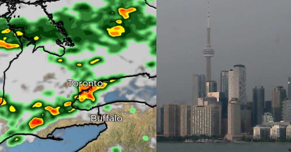
Toronto remains under a severe thunderstorm watch after Environment Canada lifted a series of thunderstorm warnings that had been issued earlier Thursday afternoon.
The national weather agency says conditions remain favourable for the development of severe thunderstorms capable of producing strong wind gusts, heavy rainfall and frequent lightning across Toronto and much of the Greater Toronto and Hamilton Area.
Environment Canada says localized rainfall amounts of more than 60 millimetres and wind gusts reaching 90 km/h are still possible through the rest of the afternoon and into the early evening.
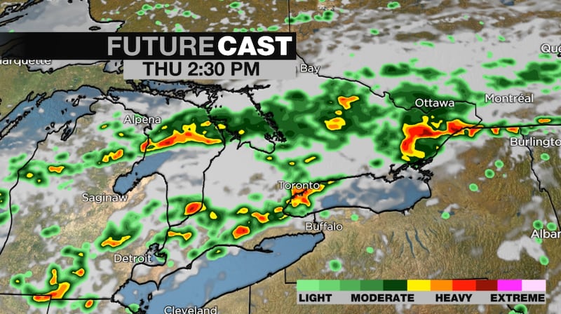 STORM FORECAST
The agency warns that some areas could receive higher rainfall totals if multiple thunderstorms move over the same location.
Residents are urged to monitor weather alerts, seek shelter if threatening weather develops, avoid driving through flooded roadways and secure loose outdoor objects.
Follow along for live updates:
4:34 p.m. – Toronto is currently under a ‘yellow’ watch. What does that mean?
Environment and Climate Change Canada introduced a new colour-coded, tiered alert system last year for hazardous weather.
The system has three alert levels, moving from yellow (circle) to orange (diamond) to red (triangle) as the potential risk increases.
The weather agency says it issues a “yellow” alert — the most common of the three — when hazardous weather could cause damage, disruption or health impacts.
It forecasts these impacts as moderate, localized and/or short-term, whereas orange and red alerts are reserved for more severe conditions.
Jesse Wagar, with Environment Canada, previously told CTV News that the colour-coded system looks to modernize the public weather program, incorporating “the confidence of our meteorologists” to help people plan ahead.
– Ethan Morneau, CTVNews.ca national digital producer
4:20 p.m. – How to prepare if there’s an extended outage
On Thursday morning, Hydro One warned customers of the storm and encouraged them to prepare for any possible outages.
“We understand the disruption an outage can cause. Taking a few steps now to prepare can help keep you and your family safe should severe weather impact the power system,” the social media post reads.
If an outage is going to last, Hydro One recommends having a preparedness kit with everything needed to last up to 72 hours without power.
The company also advises having items like a battery-powered flashlight and radio, portable battery chargers for smart devices, two litres of water per person per day, candles and matches, and a first aid kit, among other things.
During a storm, Hydro One urges residents to report a power outage by calling them through their cell phone to avoid getting an electromagnetic shock from their landline.
The company also advises unplugging all appliances and electronics, bringing outdoor items inside, and avoid opening the fridge and freezer to retain the cold.
For a complete guide on a storm checklist, head here.
– Alex Arsenych, CTVNewsToronto.ca journalist
4:25 p.m. – Power restored to 4,000 in Milton
The lights are now back on at about half of the homes in Milton that were without power due to the storm.
However, Milton Hydro says roughly 3,668 homes are still without electricity, with power expected to be restored by 8 p.m. Thursday.
– Alex Arsenych, CTVNewsToronto.ca journalist
4:00 p.m. – Road closure near Dundas, Ont.
Provincial police are warning drivers of a road closure on Highway 5, between Highway 8 and Middletown Road near Dundas, Ont., due to a downed tree and hydro wires.
Police are asking drivers to avoid the area at this time and consider alternate routes.
– Alex Arsenych, CTVNewsToronto.ca journalist
3:55 p.m. – Flooding reported on roadways, sidewalks in downtown Toronto
Toronto police are advising motorists to use alternate routes after reports of flooding on the roadway and sidewalk in the downtown core.
In a post on X made just before 3:30 p.m., police say the flooding is affecting the area of Simcoe Street and Front Street West.
No injuries have been reported.
Currently, Simcoe Street is closed between Front Street West and Bremner Boulevard.
– Joanna Lavoie, CP24.com Journalist
3:52 p.m. – Rounds of showers and storms still possible in GTA
A severe thunderstorm warning has now ended for the city of Toronto, but rounds of showers and storms are still possible through the late afternoon and early evening. A severe thunderstorm watch remains in place.
The biggest threats with these kinds of storms are heavy downpours and strong winds, although there has also been frequent lightning. There have been reports of power outages and downed trees in parts of the GTA.
Timelapse video shows massive thunderstorm roll into Toronto CP24’s storm cam captures a massive thunderstorm rolling into Toronto on Thursday.
Conditions have been ripe for the development of storms today with our hot, humid airmass and a cold front slicing through.
Strong thunderstorms are now tracking into Niagara region, with areas like St. Catharines, Welland, Fort Erie and Cayuga all in the path.
– Lyndsay Morrison, CTV News Toronto weather anchor
3:50 p.m. – Power outages impacting parts of Burlington, Milton
There are roughly 8,000 customers in Milton experiencing power outages at this time, according to the local hydro company.
Milton Hydro says crews are working to remove branches and trees, and repair lines to restore power to homes. At this time they anticipate, power will be restored at around 8 p.m.
Burlington Hydro says it is also aware of several outages across the city as a result of Thursday’s storm, adding that crews are assessing the damage and working to restore power “safely and quickly.”
– Alex Arsenych, CTVNewsToronto.ca journalist
3:45 p.m. – High winds down trees on roadways in Halton Region
Police in Halton Region say they’ve received multiple calls for downed trees on roadways throughout the area “due to high winds.”
As a result, they’re urging drivers to “exercise caution” this afternoon and evening and stay home, if possible.
– Joanna Lavoie, CP24.com Journalist