
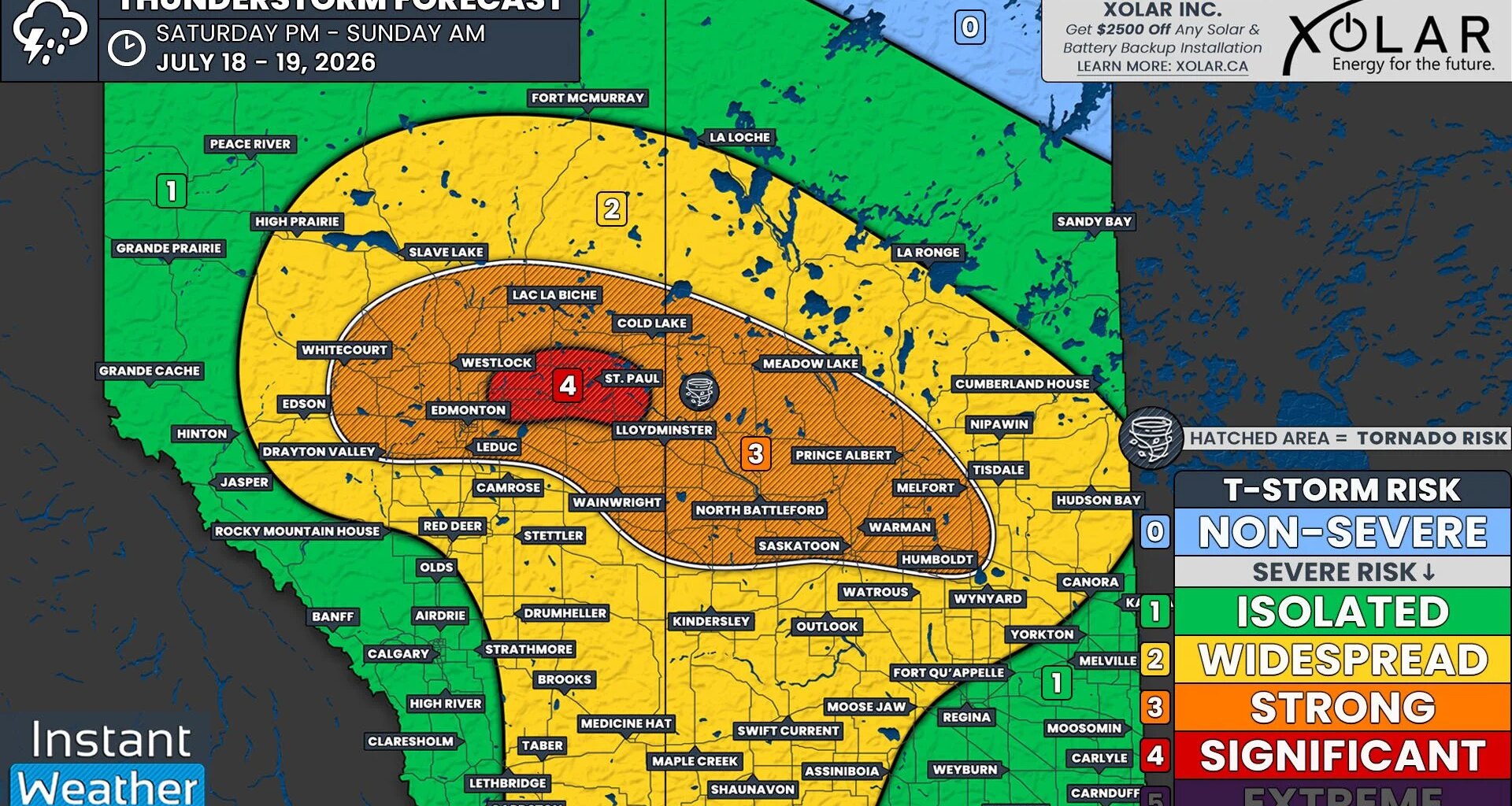
The week of daily severe weather risk in Alberta continues on Saturday, and much of Saskatchewan, with the greatest threat we’ve seen so far this week.
Not only are we looking at the possibility of strong severe thunderstorms across a considerable stretch of both Alberta and Saskatchewan today, but there is also the risk for some significantly strong storms to the east and northeast of Edmonton, in an area that includes Vegreville and St. Paul.
Today’s environment will be primed for the formation of strong supercell thunderstorms.
Models are showing that there will be an incredible amount of instability across the region today, with well over 3000J/kg of CAPE (Convective Available Potential Energy) expected for the Edmonton area. CAPE values of this magnitude are very uncommon for areas this far north, which indicates how strong of a risk we are truly looking at.
Dew points in the upper teens to low 20s today will provide plenty of moisture. Combined with the significant amount of shear that’s expected through the atmosphere, supercell storms will be easily supported.
Overall, we’re looking at a very dangerous setup that would look more at home in the Great Plains of the United States, not in Central Alberta and Saskatchewan.
A low that is set to develop this afternoon, and its associated cold front, will be the trigger for today’s severe weather. The location of this low will be the key to where the very strong thunderstorms will end up impacting.
As it stands, it appears that the low will set up over Edmonton, which would bring the greatest severe threat to areas northeast and east of the city.