
When we have thick smoke throughout the atmosphere, not as much sunlight is able to reach the ground and as a result, it end ups being a few degrees cooler at the surface than expected. A decrease in surface heating while the air aloft is able to heat up also greatly reduces the instability and creates a capping inversion that could block thunderstorm development.
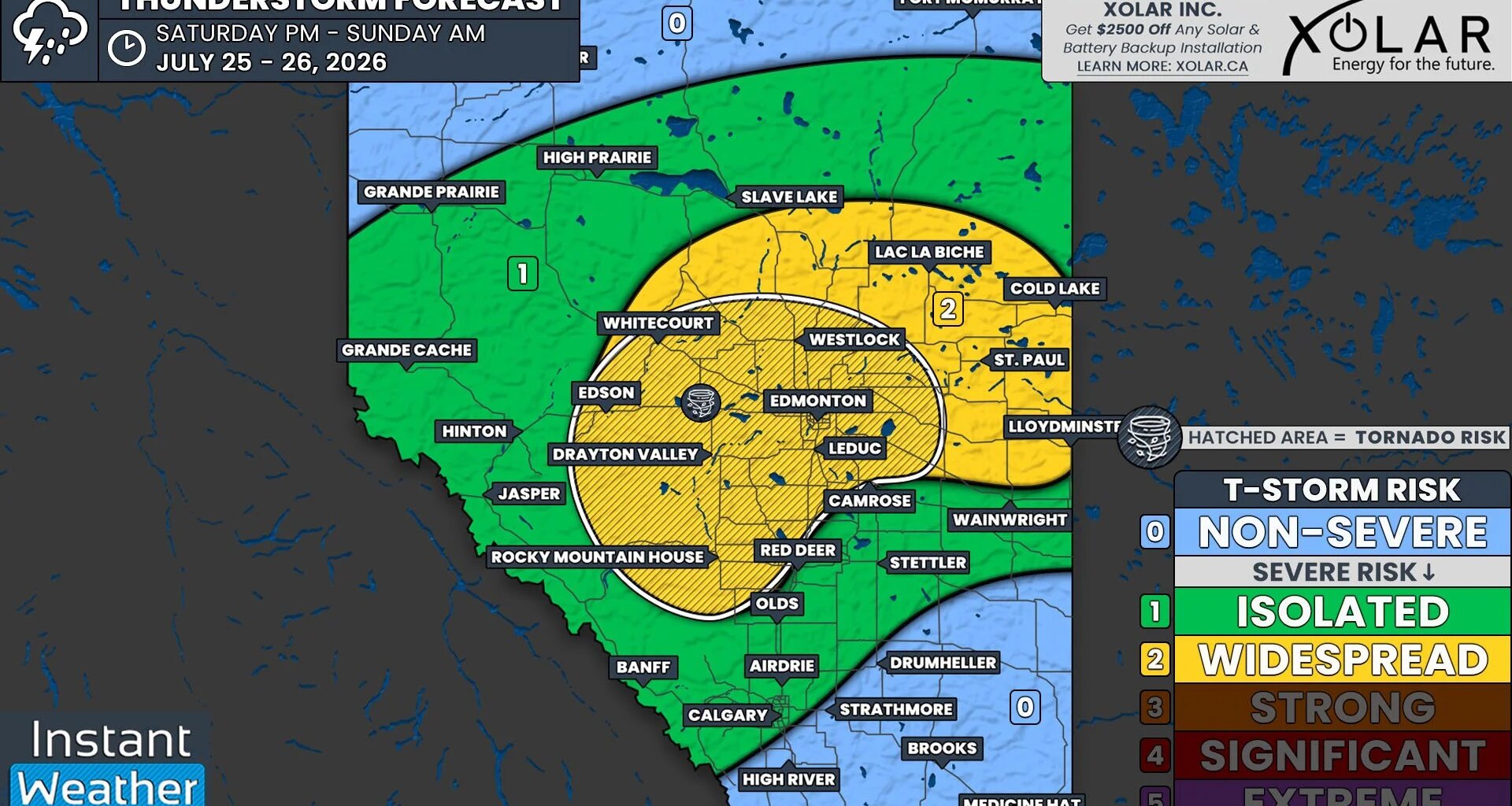
Despite the smoke, there is still a chance that we could see some severe thunderstorms fire up today, but it is not a guarantee. Models are showing that a decent amount of instability could still be available, along with plenty of moisture and shear, to fuel thunderstorms if they are able to break through the cap.
Thunderstorm activity could initiate early this afternoon, particularly in the Foothills, and storms that develop are expected to gradually track northeastward through the remainder of the afternoon and into the evening and overnight hours, with additional storms possibly popping up through this period.