
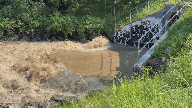
The summer of 2026 is the wettest summer on record in Edmonton. As a result, the city has seen flooded basements, flooded roads, construction delays, and saturated soil has led to downed trees.
A local watershed expert says something called urban creek syndrome — or urban stream syndrome — could be part of the reason why Edmonton hasn’t been able to keep up with the deluge.
Decades ago, the City of Edmonton altered natural creeks and waterways using pipes to help facilitate the city’s growth. Now, Edmonton seems to be dealing with the consequences.
Digging up culverts and freeing the creeks to help restore the watershed is something the city has been looking into.
So, what is urban creek syndrome?
Worldwide phenomenon
According to Jillian Calvert, watershed communication manager with the non-profit North Saskatchewan Watershed Alliance, urban creek syndrome is a wide-scale degradation of urban creek environments and city watersheds.
She said the phenomenon occurs all over the world.
It can be seen in Europe, for example, in creeks that are made into straight canals and lose their natural curve — and therefore also lose their natural ability to absorb pollutants, Calvert told CBC News in an interview.
WATCH | Can we reverse urban creek syndrome?: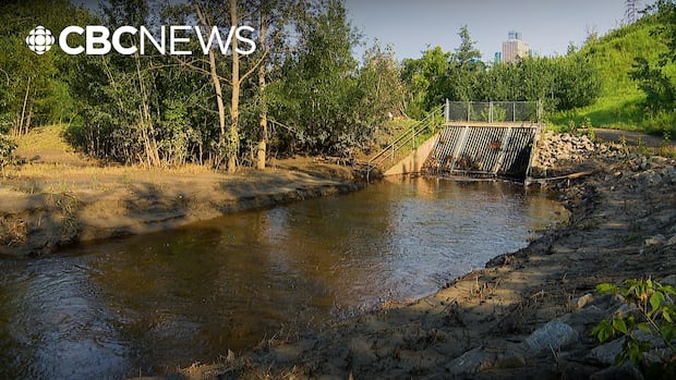
What’s urban creek syndrome and why does it make flooding worse?
In the midst of a high flooding season in Edmonton, CBC’s Natasha Riebe explores how urban creek syndrome is making it worse and what can be done to reverse the actions of decades past that favoured development over nature.
“We’ve culverted creeks below ground, so they’re no longer running through their natural water course,” she said, adding that it was common practice as cities grew during the last century.
Edmonton has many urban streams, including Whitemud Creek, Blackmud Creek, Mill Creek, Fulton Creek, Wedgewood Creek and Horsehills Creek. Calvert said all these creeks are part of the North Saskatchewan River watershed.
But she noted the city has lost some creeks too, like one that used to run along Groat Road.
According to City of Edmonton spokesperson Jim Stang, a significant diversion happened more than 50 years ago.
“A portion of Mill Creek in the Argyll Road area was diverted and tunnelled in the 1960s in order to facilitate industrial land development and roadway infrastructure in the Argyll area,” he wrote in an email to CBC News.
“Flows from the nearby Fulton Creek have also been diverted to tunnels and Mill Creek, thus increasing the total drainage area and amount of industrial run-off contributing to Mill Creek.”
Calvert said draining wetlands and replacing them with roads and “impermeable surfaces” makes it so the water can’t penetrate into the system naturally anymore.
“We’ve lost the capacity of the system to handle these big peak stormflows that we’re seeing lately.”
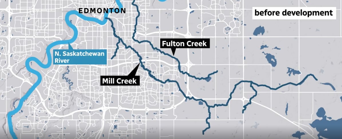 Take a look at the flow of Mill and Fulton creeks in Edmonton before development. (CBC graphic based on information from Epcor and the Urban Creeks Collaborative)
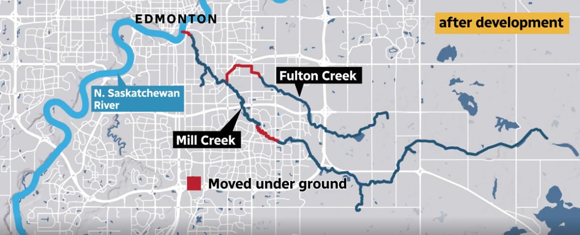 Now, here’s what Mill and Fulton creeks look like today. (CBC graphic based on information from the NSWA and the Urban Creeks Collaborative)The Mill Creek example
Calvert said she thinks the altered sections of Mill Creek could have contributed to the flooding at Connors Road.
“Mill Creek would have flown into the North Saskatchewan River a little bit more west of where it … [does] now, and it would have naturally flown in with trees surrounding it,” she said.
“[It would have been] a regular ravine heading into the river rather than going underground, under infrastructure and then going into an outflow.”
Calvert estimated that around 70 per cent of Mill Creek is still in its natural state.
Mill Creek is now in the spotlight as the city considers the future of the Low Level Bridge. The construction presents a “unique opportunity to re-examine road connections on the north and south sides,” according to Stang.
He wrote that opportunities associated with potentially uncovering Mill Creek will be integrated into the project’s strategic assessment process as planning continues.
Experts call this reclamation process daylighting.
Freeing the creeks
Nearly 10 years ago, the city did a feasibility study on daylighting Mill Creek. At the time, it was estimated that to do so would cost $10 million, but council ditched the idea.
Now, there’s a push to make daylighting a reality.
The city and its water and sewer utility Epcor are working on a 20-year flood mitigation plan, building things like storm-water ponds to help manage run-off, and, in turn, curb flooding.
“This isn’t a nice-to-have. This is a must-have,” Ward papastew Coun. Michael Janz told CBC News in an interview.
“We’ve seen the floods, we’ve seen that it’s only going to get worse,” he said. “But we know the causes of climate change are only going to worsen for Edmonton. And as such, we must invest in mitigation.”
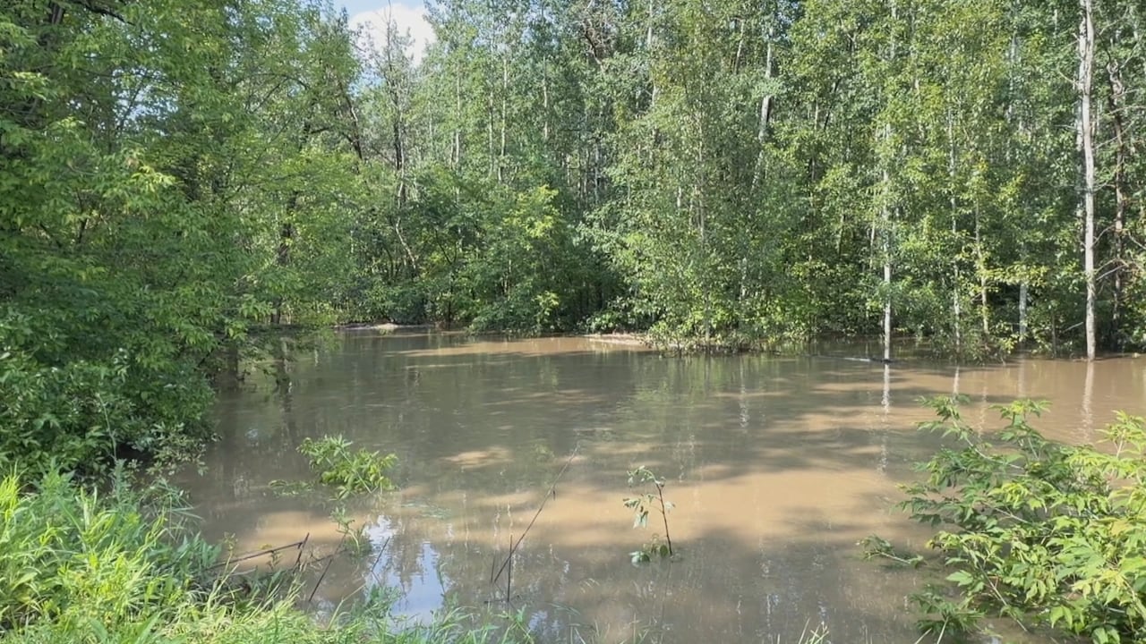 A look at Mill Creek flooding after heavy rain in late July. (Geneviève Potvin/Radio-Canada)
The city is facing a $30-million price tag this year alone to clean up from the floods, something Janz said he’s keenly aware of.
The daylighting opportunity that could come with the rehabilitation of the Low Level Bridge is something Janz said he believes the city should take advantage of.
“When it does, that whole connection with Muttart [Conservatory] and the spaghetti of roads that we have there will be reconfigured, giving us an opportunity,” he said.
“To open up the culvert, open up the creek, bring it back up to daylight, connect it with the river and have an opportunity for fish habitat, for birds, for walking paths.”