
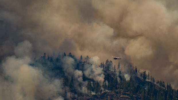
The latest on the wildfires:
The B.C. Wildfire Service is asking people recreating on Okanagan Lake to clear the way for firefighting aircraft that are gathering water to battle nearby fires. The Pear Lake wildfire is the largest burning in B.C. right now, at roughly 1,247 square kilometres. The Thompson-Nicola Regional District says about 120 properties, not including the Village of Clinton, have suffered structural loss.The chief of the Okanagan Indian Band estimates at least 200 homes have been destroyed by the Bradley Creek wildfire, west of Vernon. It’s grown to roughly 28.5 square kilometers. However, officials say there was little growth overnight. Across B.C., about 8,000 people are under evacuation order and 7,100 are under evacuation alert.Wildfire officials say conditions are “explosive and extremely dangerous,” with a forecast of hot temperatures and potential lightning ahead.Hotter weather returns
The period of cooler, more humid weather that provided some relief for crews battling the Pear Lake wildfire has come to an end, according to the B.C. Wildfire Service (BCWS).
It says hotter, drier conditions have returned and are expected to increase fire activity in the coming days.
In the southern Interior, temperatures are expected to hit the mid-30s this week, with the possibility of dry lightning.
Of the 112 wildfires burning across B.C., 84 are believed to have been caused by lightning. Seven new fires started in the last 24 hours.
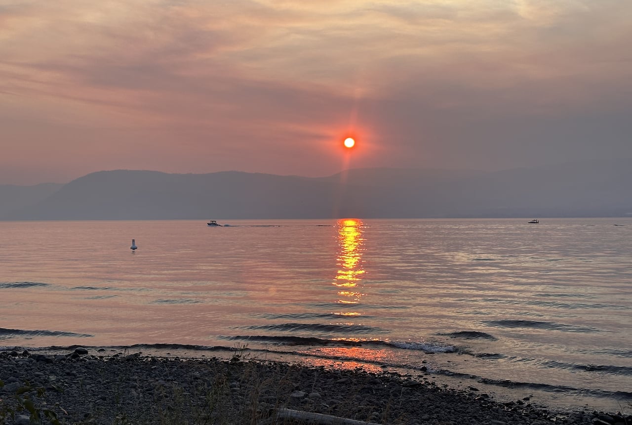 Sunset in Kelowna, B.C., on Tuesday, Aug. 4, as wildfires burn nearby. (Jay Bertagnolli/CBC)
The BCWS said Wednesday that winds are forecast to remain “light” in most areas.
That’s a welcome reprieve from last weekend when 80 km/h winds and 115 km/h gusts quickly spread the Bradley Creek fire near Vernon.
“We are seeing fuel conditions that we have never seen before. We are seeing fire behaviour and fire growth that we have never experienced in B.C. up until this point,” said BCWS director of wildfire operations Cliff Chapman Tuesday.
“It is an explosive and extremely dangerous situation.”
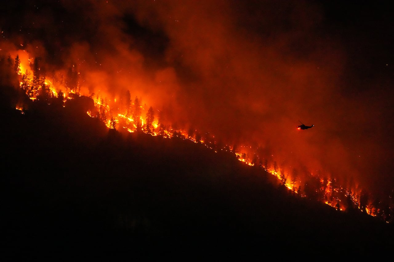 A helicopter conducting night operations prepares to drop water on the Quilpituk Creek wildfire on Monday, Aug. 3. (Darryl Dyck/The Canadian Press)Homes destroyed
Officials say hundreds of properties have been damaged or destroyed in multiple parts of the province.
The Thompson-Nicola Regional District says about 120 properties have experienced structure loss from the Pear Lake wildfire, excluding the Village of Clinton.
The hardest-hit places include Big Bar Lake, south of Clinton near Highway 97, an area west of Clinton around Kelly Lake Road and the Chasm area north of the village.
District spokesperson Colton Davies said the number will likely increase as crews safely reach more affected areas.
West of Vernon, Okanagan Indian Band Chief Dan Wilson estimates the Bradley Creek wildfire has destroyed at least 200 homes, though the figure is preliminary.
He said the fire has been “one of the most devastating events in our history,” and many people in the community have lost everything they own.
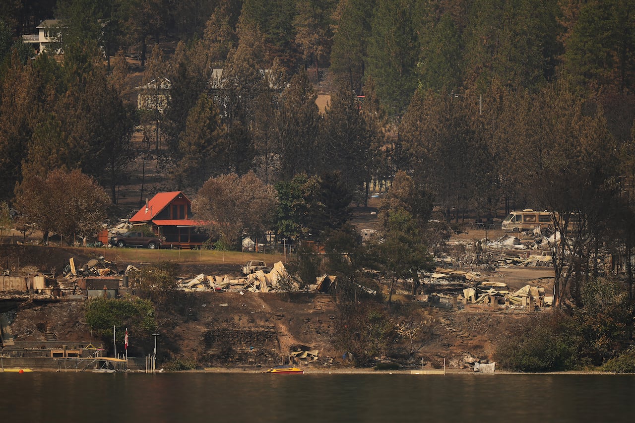 Properties on Okanagan Indian Band land that were destroyed by the Bradley Creek wildfire are seen on Tuesday, Aug. 4. (Darryl Dyck/The Canadian Press)
B.C. Hydro says an early investigation has found “significant damage” to its infrastructure in some areas. Public affairs coordinator Dave Cooper said at least 150 power poles in the Bradley Creek fire area will need to be replaced.
Crews have not yet been able to finish their assessment of the area around the Quilpituk Creek fire, but Cooper said he expects there will be more poles there that need to be repaired and replaced.
He said crews will begin work once it’s safe to do so.
Evacuation orders
About 8,000 people across B.C. are under evacuation order, while another 7,100 are under evacuation alert and have been told to be ready to leave at a moment’s notice.
Anyone placed under an evacuation order should leave the area immediately.
Emergency support services are available for evacuees throughout the province. The Ministry of Emergency Management and Climate Readiness said anyone in immediate need of financial support or help finding lodging should head to the nearest reception centre or call 1-800-387-4258.
Many of those impacted are being threatened by the Quilpituk Creek and Bradley Creek wildfires, both burning along Okanagan Lake.
The Central Okanagan Emergency Operations Centre says 2,223 properties remain under evacuation order due to the Quilpituk Creek fire, while another 425 properties are under evacuation alert.
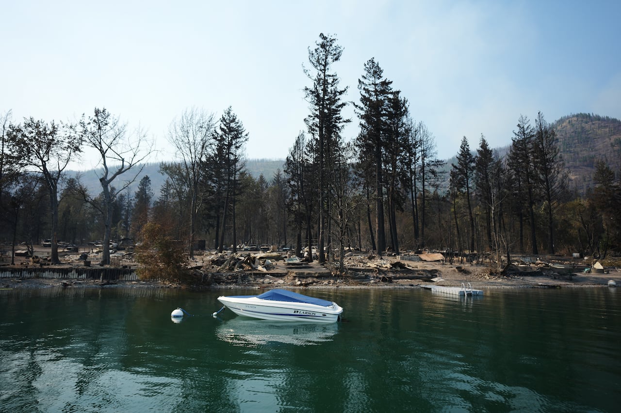 Numerous properties on Okanagan Indian Band land, seen here on Tuesday, Aug. 4, have been destroyed by wildfire. (Darryl Dyck/The Canadian Press)
The Regional District of Northern Okanagan expanded an evacuation order on Tuesday, as a result of both fires, to include several dozen more properties.
Evacuation orders also cover the Okanagan Indian Band.
The Spallumcheen evacuation order and alert areas related to the Bradley Creek fire were shrunken on Tuesday.
Those in need of emergency support services are being directed to the Westbank Lions Community Centre in West Kelowna and Kal Tire Place in Vernon.
Wildfire officials say firefighting aircraft are active on Okanagan Lake, and are asking people recreating on the lake to make space for them.
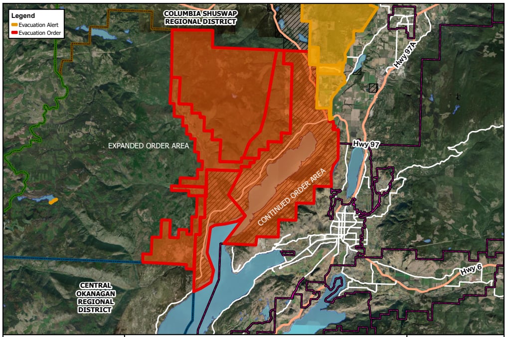 A map showing the expanded evacuation order for the Bradley Creek and Quilpituk Creek wildfires as of Aug. 4. (Regional District of North Okanagan)
Evacuation orders remain in effect for the French Bar Creek fire in the Thompson-Nicola Regional District, the Pear Lake fire near Clinton and the Brunswick fire complex near Boston Bar, which is now more than 484.17 square kilometres in size.
An evacuation order issued by the Lytton First Nation due to the Riley Creek wildfire was downgraded to an alert earlier this week.
In the East Kootenay, an evacuation order was partially downgraded to an alert on Sunday after crews made progress on the Wait Creek wildfire.
Road closures
According to DriveSafeBC, several major routes remain closed because of wildfire activity.
Highway 1 is closed between Toll Road and Jackass Summit, north of Hells Gate, because of the Brunswick wildfire complex. Drivers are being directed to use highways 3 or 5.
The Big Bar Reaction ferry, which runs across the Fraser River 72 kilometres west of Clinton, is not currently operating due to wildfires in the area.
Just past Cache Creek, Highway 97 is closed between Loon Lake Road and 76 Mile Frontage Road. Traffic is being detoured using highways 5 and 8, through Merritt. Big Bar Road is also closed between Jesmond Road and Highway 97.
Westside Road along Okanagan Lake is closed between Shelter Cove and Highway 97 north, cutting off a key route. The road is open as far as Shelter Cove, with Highway 97 serving as the alternate route.
Highway 95A near Kimberley is closed in both directions between Thomason Road and the Highway 93/95 Junction.
Toward the U.S. border, Silver Skagit Road is closed south of Flood Hope Road to the Canada-U.S. border because of the Hozomeen Mountain wildfire. Silver Lake remains open, but Ross Lake Campground and Skagit Valley Provincial Park are closed.
Do you have a story to share?
If you’ve been affected by the B.C. wildfires and want to share your story, email cbcnewsvancouver@cbc.ca.