
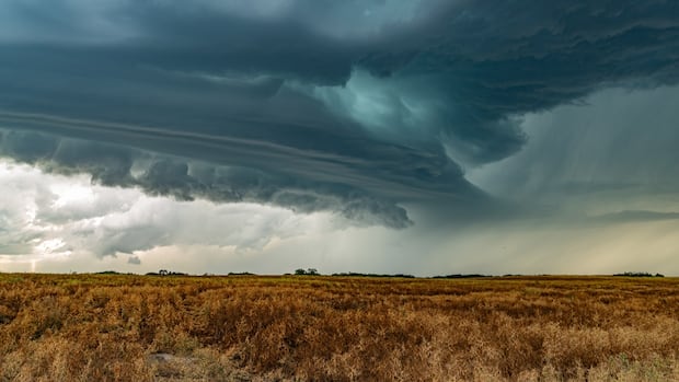
People are assessing the aftermath of an intense series of storms that charged across central Saskatchewan Wednesday night.
Treena Wynes was traveling from Big Island Lake Cree Nation to Warman late Wednesday afternoon when it started to rain. She said it wasn’t until the skies started to look a bit more “ominous” that she thought a bigger storm might be brewing.
Wynes says hail started to come down so hard she had to pull over around 16 kilometres out of North Battleford.
“Other people were pulling over and I’m sitting there like, it’s going to come through my windshield,” she said.
“Well, sure enough, yeah, great big crack.… It was so loud.”
 “The storm was hitched to my tailgate as I brought it all the way home with me,” said Treena Wynes. (Submitted by Treena Wynes)
After starting and stopping a few more times, she was able to make it to a Co-op parking lot in North Battleford. She opened her phone to see a tornado alert.
“I phoned my husband and I was like, ‘I don’t know, you might like … be hearing me being blown away … so I better call you,'” Wynes said.
She said the hail sounded like rocks pelting her car and continued for over two hour.
“He could hear it through the phone.”
She then made her way to Warman, stopping and starting about six more times.
“I really did think my, you know, after that crack … I thought if this busts completely … I’m not going to even get home,” Wynes said.
Wynes’s car ended up with a “big spiderweb” crack in the middle of the windshield, hail damage and chipped paint.
“I should have recorded it because I don’t think anybody would believe how crazy that was,” Wynes said.
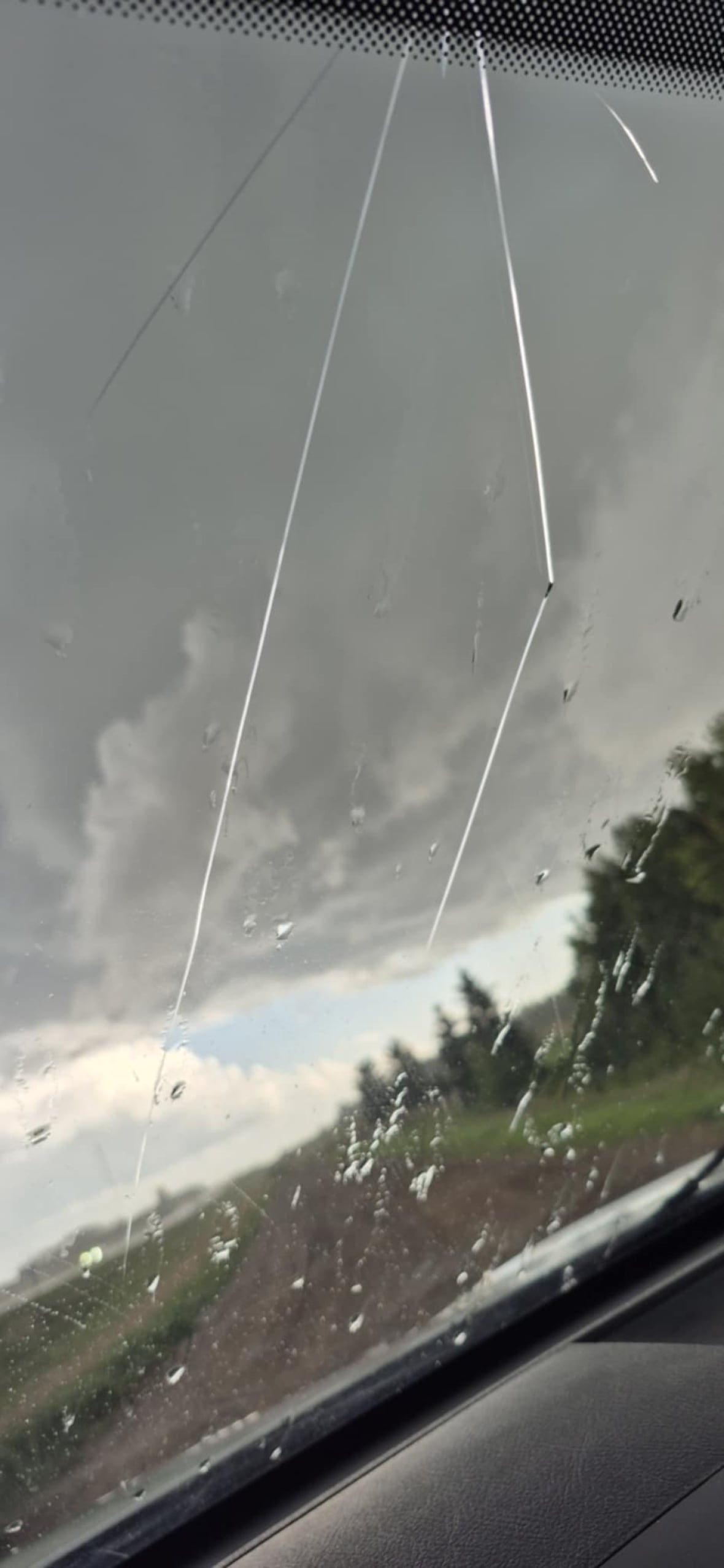 “I thought it was going to come through the sunroof,” Treena Wynes said. A large piece of hail cracked her windshield during Wednesday’s hail storm. (Submitted by Treena Wynes)’5 or 6 potential tornadoes’: Northern Tornadoes Project
Dave Sills, director of the The Northern Tornadoes Project (NTP) at Western University, said groups have been sent to central Saskatchewan to investigate Wednesday’s severe weather events.
He said they have received “lots” of damage reports from people in the province’s central region associated with Wednesday’s storm. Now, groups are assessing what kind of “phenomenon” was the cause — whether it be a tornado or plow winds.
He said plow winds occur when air is coming out of a thunderstorm and spreading out ahead of the storm, causing damage.
“I think people are surprised sometimes … how strong that damage could be,” Sills said. “It can be rated up to EF2, which is the same as a strong tornado.”
He says EF2 winds “could take the roof off the house.”
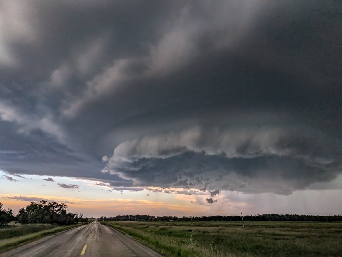 The Northern Tornadoes project is investigating reports of wind damage right across the country, said its director David Sills. (Submitted by Gunjan Sinha)
Sills said he was able to identify “five or six potential tornados” using radar data and the group was investigating Friday morning.
He said a storm of this calibre “this late in the season on the Prairies is pretty rare.”
“It was a storm that went quite far,” he said. “There’s continuous damage or near continuous damage for tens and tens of kilometres.”
Preliminary numbers: SGI
SGI said it has received 496 auto claims related to storms in the province on Aug. 20 and 21st. SGI Canada has received 115 property claims.
“These numbers are preliminary, and we may continue to receive claims related to this storm in the following weeks,” Kelley Brinkworth, a spokesperson for SGI said.
Brinkworth said it is too early to determine if Wednesdays’s storm is the costliest of year, but the picture will get clearer in the coming weeks.
On Wednesday, reports of hail compared to eggs, loonies and quarters came from all over the province, but the towns of Radisson and Langham got the worst of it, with hail the size of tennis balls or baseballs cracking multiple car windshields. Other towns hit by hail included North Battleford, Mendham, Blumenthal, Sceptre and Hague.
The strongest wind gusts recorded on the day were from North Battleford, according ECCC. There are two ECCC weather stations in the area; one of them recorded 129 km/h, and the other recorded 113 km/h.
Elsewhere in the province, Kindersley saw gusts up to 116 km/h, Leader reached 111 km/h and Swift Current hit 93 km/h.
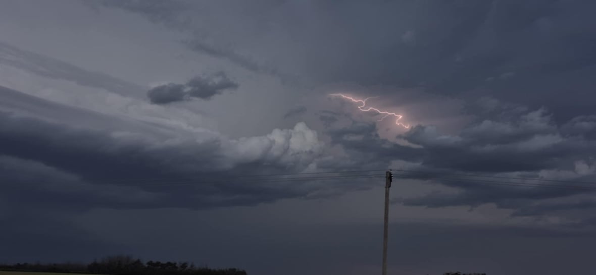
According to Environment and Climate Change Canada (ECCC), 5,750 lightning strikes were recorded within a 50 kilometre radius of Saskatoon during Wednesday’s storms, the most in one day since 2022.
Saskatoon receives an average of 16,228 strikes from May through September, according to data recorded since 2013. Wednesday’s storm put Saskatoon at 17,141 for 2025, above the average for the season.