
Chilly conditions are in the forecast, which has prompted a weather alert for parts of the Greater Toronto Area.
Environment Canada has issued a yellow frost advisory for Toronto, Mississauga, Brampton, Burlington, and Oakville.
For Toronto, Mississauga, and Brampton, forecasters said patchy frost is expected to develop overnight into Tuesday morning, particularly for areas north of the 401 corridor.
In Burlington and Oakville, the alert said frost is expected to develop overnight, particularly for areas along and north of the 407 corridor.
“Damage to plants, trees, and crops is possible,” Environment Canada said.
“Take preventative measures to protect cold-sensitive plants, trees, and crops. Cover up plants, especially those in frost-prone areas.”


The coldest conditions are expected in Mississauga and Brampton, where a low of just 1 C is expected.
Toronto, Burlington, and Oakville have a low of 2 C in the forecast.
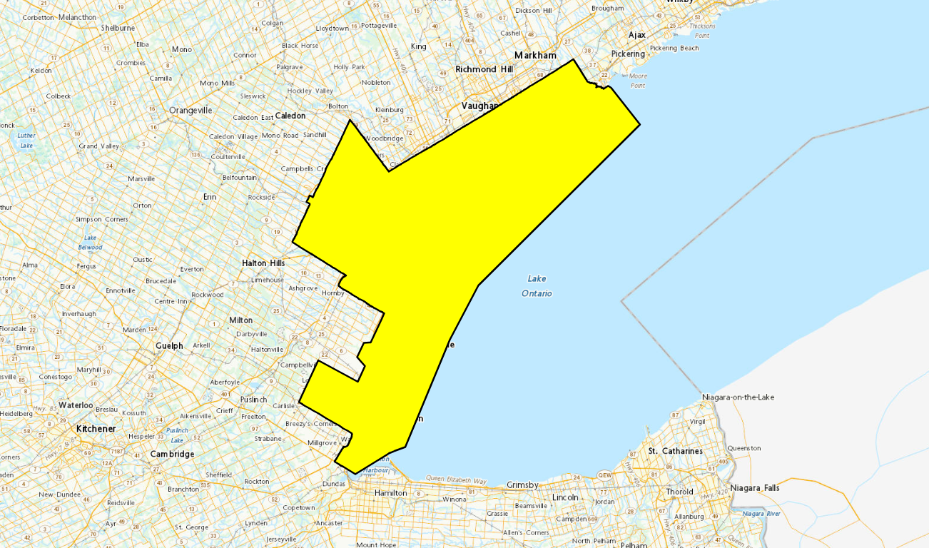
Areas shaded in yellow are under a frost advisory from Environment Canada. That includes Toronto, Mississauga, Brampton, Burlington, and Oakville.
No precipitation is expected overnight.
Those areas are then expected to see a high of 11 C on Tuesday with mainly sunny conditions, or a mix of sun and cloud.
High temperatures will remain above normal for the rest of the week, however, with temperatures in the mid to upper teens expected though Sunday.
The normal maximum temperature for this time of year is 11 C.
The warmest day is expected to be Thursday, with Environment Canada forecasting a high of 19 C in Toronto, Mississauga, Brampton, Burlington, and Oakville, along with a 30 per cent chance of showers.
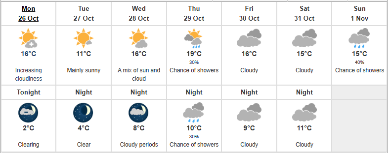
The forecast for Toronto through Sunday. (Credit: Environment Canada)
INSAUGA Canada’s Editorial Standards and Policies
Stay in the know.
Subscribe now to receive our daily email of today’s top stories in your city!