
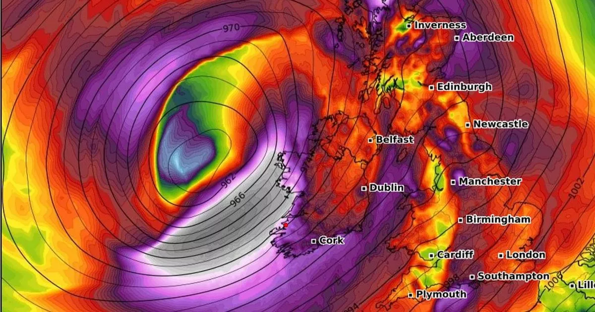
Very strong winds and heavy rain are being forecast for Thursday and Friday, although there’s still some debate over the final path of the storm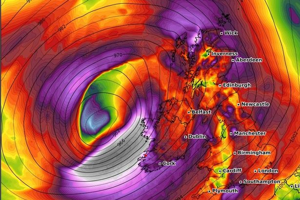 Wind speeds potentially hitting Ireland in the early hours of Halloween
Forecasters have warned a powerful storm could hit Ireland later this week.
If named by Met Eireann, the storm will be called Bram and will be the latest winter storm to hit the country. Very strong winds and heavy rain are being forecast for Thursday and Friday, although there’s still some debate over the final path of the storm.
This could lead to weather warnings for wind and rain being issued later this week. Some weather models are showing the centre of the storm west of Ireland, which would mean the strongest winds would be offshore.
Weather Alerts Ireland has said: “Ireland will likely see a storm on Thursday into Friday as a deep low-pressure system moves towards Ireland. This low-pressure system is expected to drop as low as 960hPa, which is a very deep system which would bring very strong winds and heavy rain.
“The models are mostly all in agreement that this storm will directly impact Ireland. One or two of the models have the centre slightly further west which could result in the strongest winds remaining offshore but time will tell!
“Some uncertainties on the exact path of the centre which we said above and this would affect where the strongest winds would hit but the south west looks likely to see the strongest winds. This storm will likely be named by Met Eireann and would be Storm Bram if named.”
Donegal Weather Daily has also warned of what’s to come with more clarity over the strength and path of the storm in the next few days. They “said: At the moment, models are in fairly good agreement of a storm depression moving up close to Ireland on late Thursday and Friday with most showing fault strong winds.
“This could get named Storm Bram and details will become a little more clear over the next 2 or 3 days on its track and how strong the winds are. Along with strong winds heavy rainfall also looks likely.”
Today in Dublin, things will start bright and breezy this morning, but some scattered showers will develop this afternoon. Temperatures will hit 13 degrees, with moderate to fresh and gusty west to southwest winds.
Tonight should remain dry, with lows of 5C. And here is Met Eireann’s full forecast for the upcoming week as it stands:
Overview: Low pressure drives a mixed, and at times, unsettled weather pattern.
Wednesday: Mainly dry but still breezy tomorrow, Wednesday, with bright or sunny spells and just the chance of an isolated shower in the afternoon or evening. Highest temperatures of 11 or 12 degrees with moderate to fresh southwesterly winds easing moderate southwest to west later in the day.
Wednesday night: Largely dry on Wednesday night and turning chilly quickly after dark under clear skies. Cloud will increase from the southwest overnight, with outbreaks of rain pushing into Munster towards morning. Lowest temperatures will range 0 to 5 degrees, with a touch of frost possible away from the southwest. Light variable breezes becoming southeasterly and increasing moderate to fresh in west Munster towards morning.
Thursday: Wet and windy on Thursday with rain spreading northeastwards over the country during the morning and early afternoon accompanied by fresh to strong and gusty southeasterly winds with gales developing along coasts. The rain will be heavy at times with spot flooding likely. A clearance to showers will follow from the southwest towards evening, with winds veering southerly but remaining fresh to strong and gusty. Becoming milder from the south during the afternoon with afternoon highs ranging from 8 degrees in the north to 14 degrees in the south.
Thursday night: Continuing windy with fresh to strong and gusty southerly winds and coastal gales. Remaining rain in the east and north will clear away northeastwards early on Thursday night giving way to the clear spells and showers elsewhere. Some of the showers will be heavy and they may merge to longer spells of rain in parts of the west and northwest. Lowest temperatures of 8 to 11 degrees.
Halloween: Uncertainty in the details for Friday, but current indications suggest a dry and bright start for most away from the northwest where showers will be gradually clearing northwards through the morning. It looks as though cloud will increase over southern and eastern parts of the country through the morning and afternoon with outbreaks of rain moving up from the south. Drier in the west and northwest with just a few showers. Quite blustery to begin, with moderate to fresh southerly winds, but the winds will tend to ease as the day goes on and they’ll become mainly light by evening. Highest temperatures of 11 to 14 degrees.
Halloween night: Confidence in the forecast for Friday evening and night is lower than would be normal for the time interval. There is a chance that the rain may clear for a time in the east and south but further spells of rain or showers will tend to move in either from the south or the west. Lowest temperatures of 4 to 7 degrees with light southerly or variable winds becoming light to moderate westerly overnight.
Next weekend: Mixed and changeable weather conditions persisting with low pressure driving the weather pattern.
Join our Dublin Live breaking news service on WhatsApp. Click this link to receive your daily dose of Dublin Live content.
We also treat our community members to special offers, promotions, and adverts from us and our partners. If you don’t like our community, you can check out any time you like. If you’re curious, you can read our Privacy Notice.
For all the latest news from Dublin and surrounding areas visit our homepage.