
Very cold weather with possible accumulations of snow across the country have been predicted as we enter the new year 2026
07:38, 30 Dec 2025Updated 07:43, 30 Dec 2025
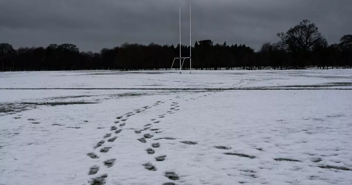
 DUBLIN, IRELAND – MARCH 2: Footprints on the snowy foreground can be seen, and a Gaelic football goal posts in the background, on March 2, 2024 in Dublin, Ireland. Following heavy snowfall across Ireland, a Status Yellow ice warning is in effect with temperatures expected to drop as low as -1 degree according to Met Éireann. (Photo by Natalia Campos/Getty Images)
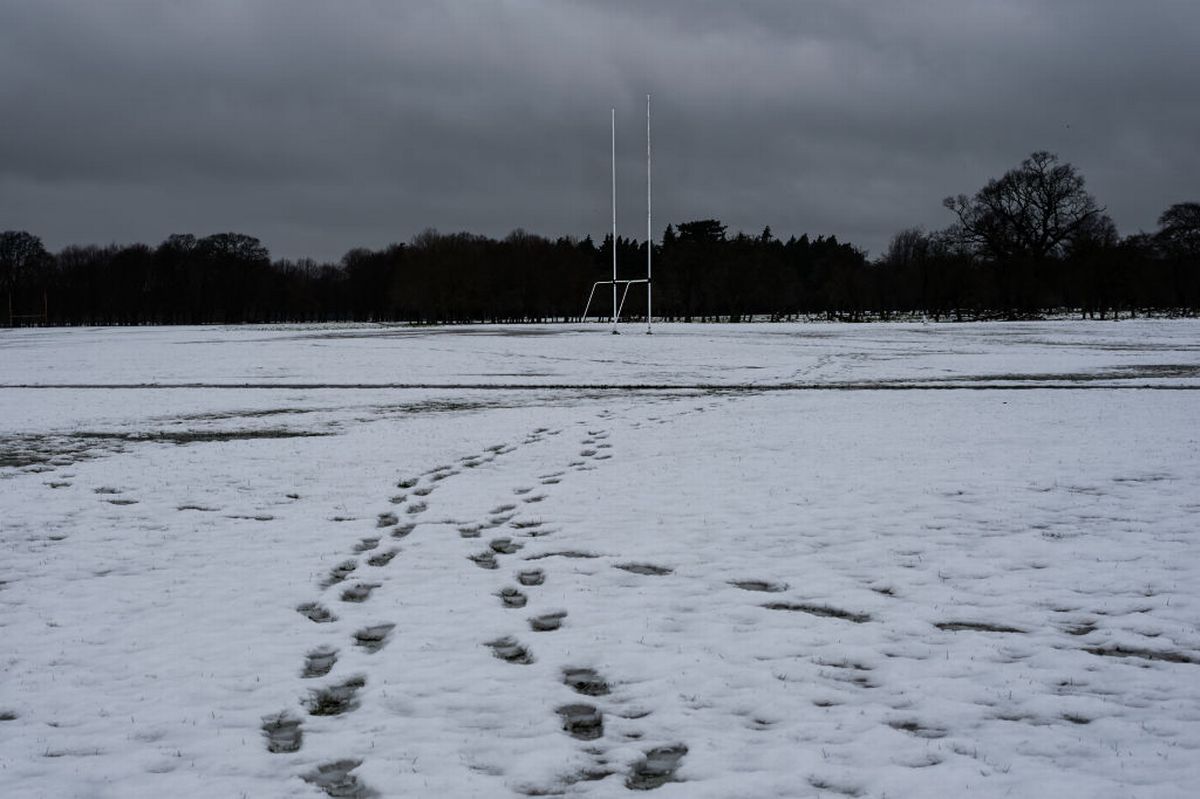
It has been confirmed that Dublin may see some snow over the coming days as we usher in the new year 2026.
The “floodgates” will open to cold Arctic air, according to one weather forecaster. Snow may even be disruptive, with weather warnings likely, predicted Cathal Nolan of Ireland’s Weather Channel.
Temperatures may get as low as -10C degrees as we enter the new year. “Thundery” wintery showers are also possible in the early days of the new year.
Cathal Nolan predicted that the cold snap will arrive around new years day and stick round until at least January 6. “That is set to make its presence felt across the country from New Year’s Day onwards really, and that will continue on until at least the 6th of January, if not a little longer, based on some of the trends that we’ve seen with the weather models over the last 24 hours or so,” he said in a video forecast via social media.
“On New Years Eve we see the ridge of high pressure extending from Ireland right the way up to Greenland, that area of high pressure is expected to retrogress, push back up towards the north west and form quite a strong block as we go into New Year’s Day. We see this first cold front pushing down as the high acts as a block out to our north west and that starts to feed in this much colder flow of arctic air, bringing with it very low temperatures. This is sufficient for snow to to reach the surface of the country as well, especially so by the time we get into Friday the 2nd, watch as that cold front passes its way down across the country, bringing with it some falls of snow, potentially maybe more so over hills initially, but… that could very well turn to snow in some part.”
“Behind that we open the flood gates to this very cold arctic air that will bring plenty of heavy, and at times even thundary wintery showers to parts of Ulster, much of Connacht and then along the west coast as well. Some heavy falls of snow possible here especially so a little bit inland where those showers near the coast can be very intense and they fall as hail as they move inland they start to lose that updraft and intensity so they convert then more so towards snow let’s say. So across many parts of Ulster into Connacht and Leinster, that’s where we’d see those accumulations of snow falling but also potentially along the east coast as well.”
We can see that there are some signs that we may see some wintry showers if those winds switch around to a more northeasterly direction. We see these streamers developing and this is as a result of what is traditionally known in the US as lake effect snow, but because it’s happening over the sea it becomes sea effect snow, so parts of Leinster, Dublin for example and down into Wicklow and WExford could see some snow during this period as well.”
 Alan Reilly Carlow Weather via X
He added that this potential snow may last into January 4 or even as long as into the January 6 depending on how fast it travels. He warned that there may be some “disruptive snow” along the Northern edge of the country.
“What we can say for certain is, very cold weather developed from the 1st of January onwards. It continues right the way up until the 6th at a very minimum. During that period, parts of Connacht much of Ulster and indeed West Munster and along the east coast of Leinster is at risk of seeing snow. Accumulations are likely, moderate to heavy accumulations, in parts of Ulster and North West Connacht in particular with a risk of some disruption here and bitterly cold everywhere.”
“Daytime temperatures no higher than freezing by day and night time values in some parts where we see being more sheltered from the winds getting down to minus seven, minus eight degrees celsius. Over snow fields or in valleys, we could see temperatures drop even lower than minus 10 degrees Celsius. So a very cool spot of weather is on the way. There’s likely to be weather warnings issued.”
Moving into the first days of 2026, Met Eireann is predicting low temperatures of -2C and some very cold weather. Their forecast update for next weekend reads: “Very cold and mostly dry though some wintry showers will occur, mainly in the north and northwest. Daytime highs will reach just 1 to 5 degrees in mostly light to moderate northwesterly winds. Sharp frosts and ice will develop during the nights.”
As for the further outlook, the national forecasting service said: “Continuing cold into early next week. While there will still be plenty of dry weather, there will be some wintry showers or falls of rain at times.”
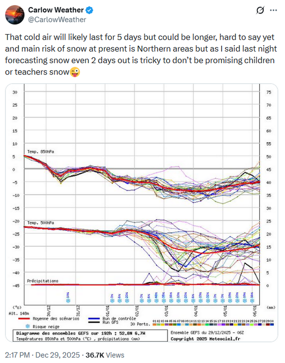
Alan Reilly of Carlow Weather said that no promises could yet be made regarding snow at this stage. Posting to Facebook he said: “A cool and bright start to 2026 is likely before temps drop back from Friday as we get a blast of cold air from the North.
“That cold air will likely last for 5 days but could be longer, hard to say yet and main risk of snow at present is Northern areas but as I said last night forecasting snow even 2 days out is tricky to don’t be promising children or teachers snow.”
Follow Alan Reilly of Carlow Weather and Cathal Nolan of Ireland’s Weather Channel for more updates, and check out www.met.ie for the latest forecasts.
Join our Dublin Live breaking news service on WhatsApp. Click this link to receive your daily dose of Dublin Live content.
We also treat our community members to special offers, promotions, and adverts from us and our partners. If you don’t like our community, you can check out any time you like. If you’re curious, you can read our Privacy Notice.
For all the latest news from Dublin and surrounding areas visit our homepage.