
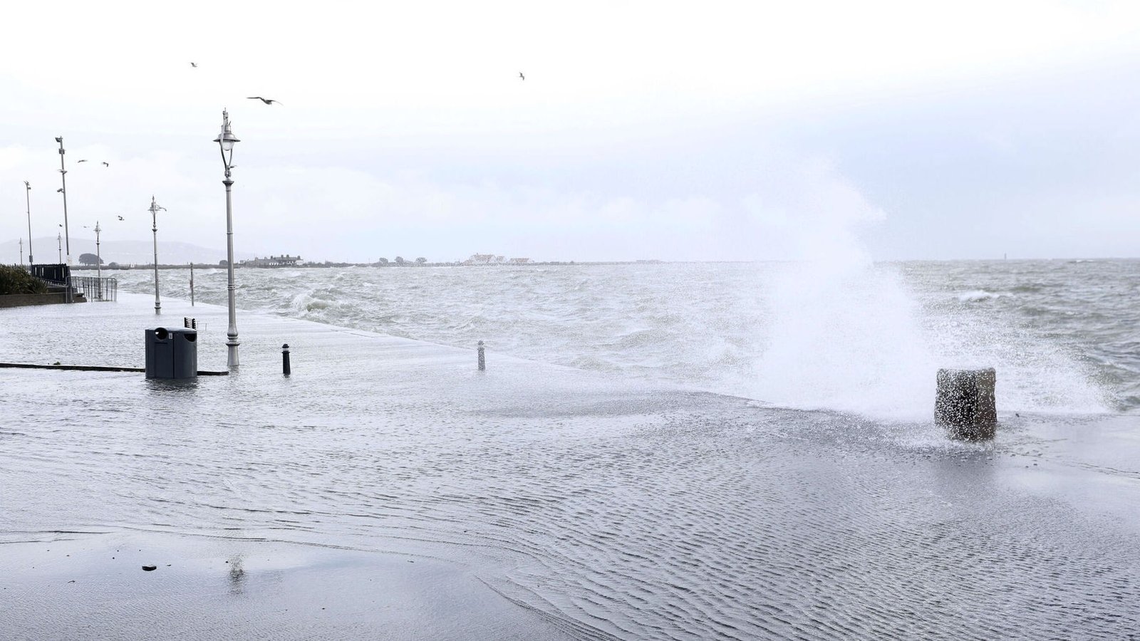
Met Éireann has warned of hazardous travel conditions as Storm Chandra brings strong winds and heavy rain across the country.
The forecaster said persistent rain will fall on already saturated ground, leading to a risk of localised and river flooding.
A Status Yellow rain warning is in effect for Carlow, Kilkenny, Louth, Wexford, Wicklow and Waterford until 11pm.
The entire country also remains under a Status Yellow wind warning until the same time as Storm Chandra passes over the country.
Wet & windy today as #StormChandra tracks northwards over Ireland.
Heavy rain this morning will gradually clear northwards with heavy or prolonged showers following. Fresh to strong, gusty E to SE winds with gales near coasts, later becoming W to SW in Munster.
Highs of 5-9 C pic.twitter.com/xCx7HxjzKS
— Met Éireann (@MetEireann) January 27, 2026
Met Éireann has warned the strong gust could lead to wave overtopping, fallen trees and loose debris.
There are reports of some localised flooding around Co Dublin and north Wicklow this morning.
Meanwhile, Iarnród Éireann said major disruptions are expected to DART and commuter services with reports of flooding at several locations.
Update: Phoenix Park Tunnel services can expect delays due to flooding.
Services have resumed through Broombridge with speed restrictions in place.
DART, Commuter & Intercity services can expect significant delays due to flooding at several locations. -AD #StormChandra https://t.co/zjtX82ENME
— Iarnród Éireann (@IrishRail) January 27, 2026
A number of ferry sailings have been cancelled, with Irish Ferries, Stena Line both reporting cancellations between Dublin and Holyhead.
An Amber wind warning is in place for Antrim, Derry and Down until 9pm, with the remaining counties in Northern Ireland under a Yellow level warning until midnight.
Gust of 95-110km/h will affect eastern Northern Ireland, with possible 120km/h gusts in coastal locations, with the UK Met Office warning that “easterly winds of this strength are unusual and are likely to be impactful”.
A Status Orange marine warning will also come into effect for coastal areas in the south from 9am until 4pm.
With rain falling on already saturated ground and many rivers already at high levels, there is a significant risk of flooding over the coming hours.
The River Slaney in Enniscorthy, Co Wexford, is of particular concern with Wexford County Council saying its crews remain on standby to provide assistance if required.
Waterford County Council said last night the “situation at Passage East and Tramore Prom is being monitored and flood defence barriers will be activated if required”.
It advised the public “to exercise caution, heed public safety advice and avoid unnecessary journeys” as driving conditions may be hazardous, with surface water flooding expected.
In a statement, Louth County Council warned “rivers across the county may break their banks and spill onto floodplains”, adding sandbags will be available from a number of locations.
The Cooley Peninsula, it said, is “expected to experience very high rainfall, leading to swollen rivers and streams, which may burst their banks and cause significant runoff from mountain areas”.
Conditions are expected to worsen from this afternoon onwards based on the low pressure, winds and rainfall forecasted.
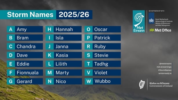
Storm Chandra is the third named storm of the year.