
Met Eireann has issued an unprecedented nine day weather advisory for Ireland, describing the situation as a ‘combination of the worst case scenario’.
17:18, 03 Feb 2026Updated 17:28, 03 Feb 2026
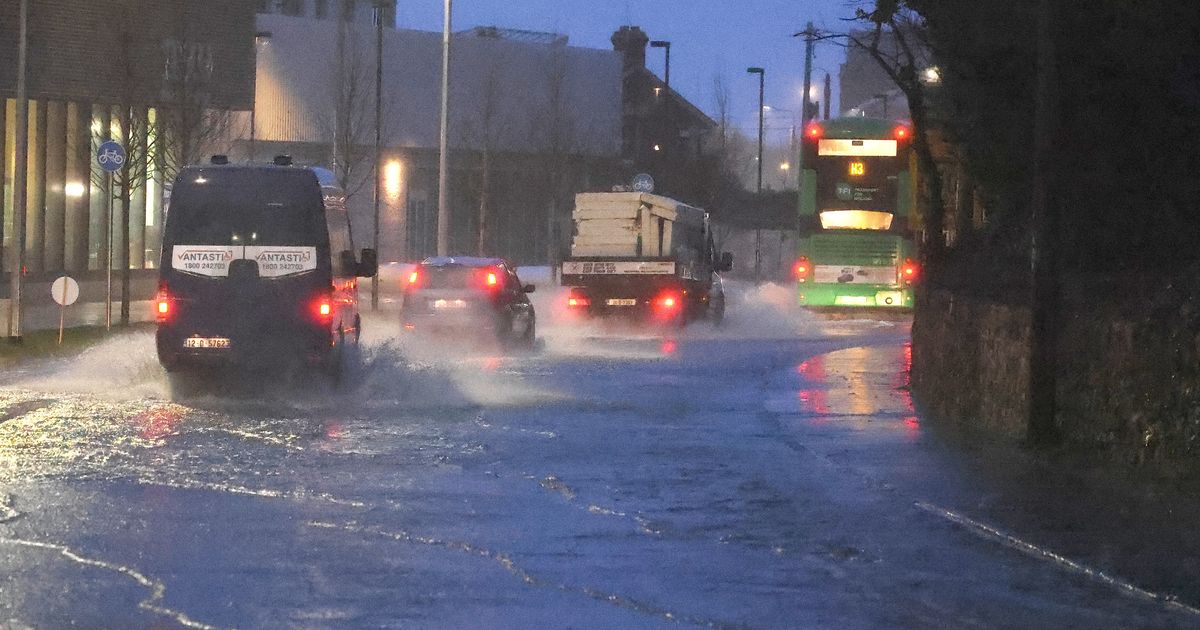
Clean up continues after flooding in Co Wicklow
Met Eireann has taken the unusual step of issuing a staggering nine day weather advisory as rain continues to fall on already saturated ground across Ireland.
The national forecaster has urged the public to “be aware, stay updated and stay safe”, as further flood risks emerge for parts of the south and east.
Many areas are still recovering from last week’s Storm Chandra, which brought heavy winds, torrential rain and widespread disruption. Around 20,000 homes lost power, some flights were cancelled, hundreds of schools were closed and rivers including the Slaney in Wexford and the Dodder in Dublin burst their banks.
Now, Met Eireann has warned that heavy and persistent rain throughout this week could trigger additional flooding, particularly in already affected areas.
A Status Yellow Rain warning remains in place until 9pm for Dublin, Louth and Wicklow, with flooding and difficult travel conditions expected.
On top of this, an unprecedented nine day national weather advisory is in effect from Sunday, February 1 until Monday, February 9. It states: “Spells of heavy and persistent rainfall will continue through the week of February 2, particularly in southern and eastern coastal counties.
“Rain will fall on saturated ground where river levels are high with high tides expected this week. This will lead to further flooding along rivers and in coastal areas.
“Close monitoring of local weather conditions via www.met.ie and river gauge data www.waterlevel.ie is strongly advised.”
Looking further ahead, the national forecaster added that more rain warnings are possible next week. The outlook for February 9 to 15 reads: “Low pressure will remain the dominant feature of our weather with a predominantly east to southeast airflow across the country.
“This will bring continued spells of rain through the period, with conditions likely to be wetter than average for most of the country, with highest accumulations in the south and southeast. In northwestern areas, rainfall amounts will be closer to normal. Further rain warnings are possible during this week. Temperatures will remain around normal.”
Met Eireann forecaster Holly O’Neill declared the current conditions as “a combination of the worst case scenario”. She told RTE Radio 1’s Morning Ireland: “The rain has nowhere to go at this point, because the ground is so saturated, the rivers are so high or at bank full conditions.
“So the most likely impacts are going to be for those in the south east, unfortunately, because they have already beared the brunt of that rain for such a prolonged period.” River flooding is a major concern with high spring tides contributing to this. We have higher than normal high tides and coinciding with this we also have quite strong easterly winds, particularly on the south east and east coasts.
“So that means that rivers can’t discharge, which then means that rather than the levels gradually falling, the rainfall is actually just exactly exaggerating the risk of river flooding. So it’s really a combination of the worst case scenario.”
Government ministers and the National Emergency Coordination Group are set to meet on Tuesday evening to assess the ongoing impacts of the storms and heavy rainfall.
Subscribe to our newsletter for the latest news from the Irish Mirror direct to your inbox: Sign up here.