
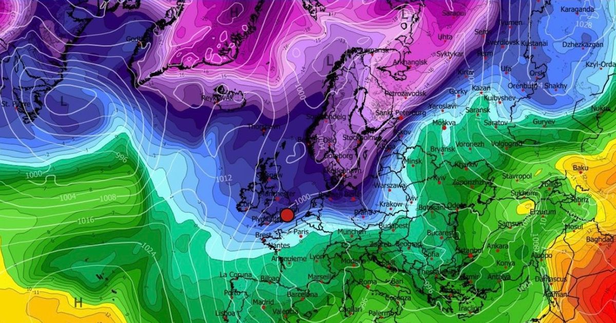
Weather Alerts Ireland said that colder air and a low pressure system making its way up towards Ireland from Friday on could equal some “wintry precipitation” on Sunday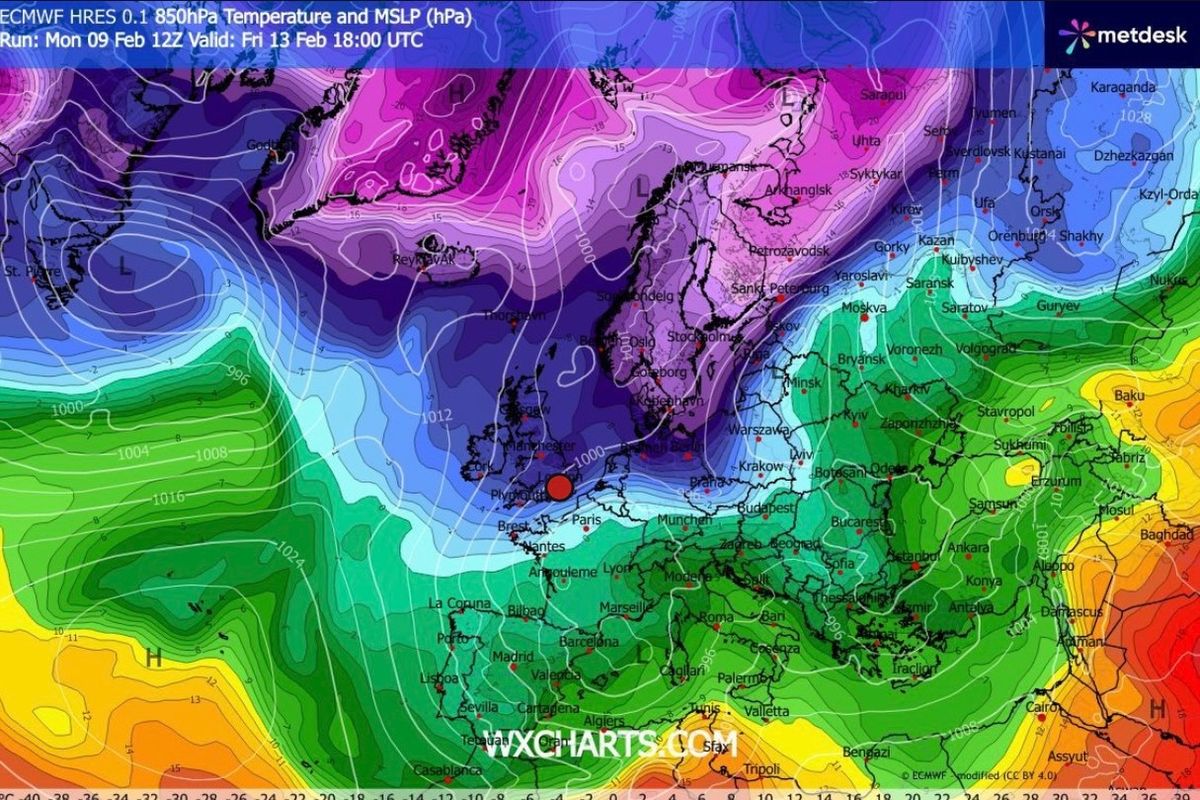
Weather Alerts Ireland said that colder air and a low pressure system making its way up towards Ireland from Friday on could equal some “wintry precipitation” on Sunday(Image: Facebook/WXCharts/Weather Alerts Ireland )
An Irish weather boffin has told followers to “watch this space” as a risk of snow is firmly on this weekend’s radar.
Weather Alerts Ireland said that colder air and a low pressure system making its way up towards Ireland from Friday on could equal some “wintry precipitation” on Sunday. And they added that “a fairly persistent cold airflow over Ireland” could also be on the way.
They said: “Colder air still likely to push over Ireland on Friday. There is a chance of a low pressure system pushing close to Ireland on Sunday which could bring a risk of wintry precipitation so watch this space!
“Latest ECMWF is forecasting a fairly persistent cold airflow over Ireland as we continue after the weekend! Will be interesting to see how this develops.”
And it is no better news today, either, as consistent bands of rain are set to continuously sweep over the country. They said last night: “That band of persistent rain will slowly push north throughout the night!
“Unfortunately more rain is expected to push in from the south in the early hours tomorrow. More bands of rain are expected throughout the day tomorrow also.
“Over 20mm is possible in parts in a 24 hour period.” That rain is set to arrive in Dublin this afternoon from the southwest, interrupting a dull but dry morning.
Temperatures should get up to around 9C. Tonight will be mostly cloudy with scattered showers or more persistent spells of rain and drizzle, along with some mist and fog patches too, and lowest temperatures of 5C.
And here is what the rest of the Met Eireann forecast is saying for the week ahead currently:
Overview: Generally dull and damp conditions for the next few days. A switch to a northerly airflow will lead to a brief cold snap with drier and brighter conditions towards the end of the week, before turning unsettled again over the weekend.
Wednesday: Another generally dull day with some limited bright spells possibly developing. It will be mostly dry, with just some light showers possible. Highest temperatures of 9 to 11 degrees, with light to moderate southwesterly winds becoming light and variable through the day.
Wednesday night: Mostly cloudy, with just very limited clear spells, and with scattered showers or more persistent outbreaks of rain and drizzle. Some mist and fog patches too. Lowest temperatures of 2 to 7 degrees, coldest in Ulster, with a light to moderate westerly or variable breeze, fresher in the southwest.
Thursday: A generally dull and damp day, it will be mostly cloudy with outbreaks of rain and drizzle. Highest temperatures of 7 to 10 degrees over the southern half of the country, but just 3 to 6 degrees over the northern half. Moderate northerly winds will develop through the day.
Thursday night: Starting off cloudy with outbreaks of rain and drizzle, a clearance will develop from the north. Turning cold with frost and ice developing as temperatures drop to -3 to +1 degrees generally, but possibly remaining milder further south depending on the timing of the clearance. Winds will be light to moderate and northerly.
Friday: A bright, cold, and mostly dry day. A few showers, some of which could be wintry, will feed in from the north. Highest temperatures of just 3 to 6 degrees, with a light to moderate northerly breeze.
Saturday: Starting off dry and very cold with frost and ice. However, wet and breezy conditions will spread across the country from the west through the second half of the day, with some wintry falls possible further north. Highest afternoon temperatures of 4 to 7 degrees, with light southerly winds increasing fresh to strong through the day.
Further outlook: Continuing unsettled for the remainder of the weekend and into next week.
Join our Dublin Live breaking news service on WhatsApp. Click this link to receive your daily dose of Dublin Live content.
We also treat our community members to special offers, promotions, and adverts from us and our partners. If you don’t like our community, you can check out any time you like. If you’re curious, you can read our Privacy Notice.
For all the latest news from Dublin and surrounding areas visit our homepage.