

Further spells of heavy rainfall are forecast for the week ahead – but a much-needed dry spell could be just on the horizon
A period of ‘nice and settled’ conditions is on the way after Ireland was lashed by downpours and gale-force winds across the weekend
Ireland has endured a miserable few weeks in terms of the weather, with the country facing a near endless run of rainfall since the start of the year.
Last month was the wettest January since 1948 – and second wettest on record – in the Phoenix Park and at Dublin Airport, with 22 of the 31 days in the capital being subject to rainfall.
These extended periods of heavy rainfall resulted in substantial flooding in the Southeast and East during and following Storm Chandra. The storm delivered strong winds and heavy rain on January 26 and 27, making the storm the most significant weather event of the month.
February has proven to be equally as gloomy, with spells of heavy rainfall continuing to lash the country while a cold snap sent temperatures plummeting well below zero in recent days.
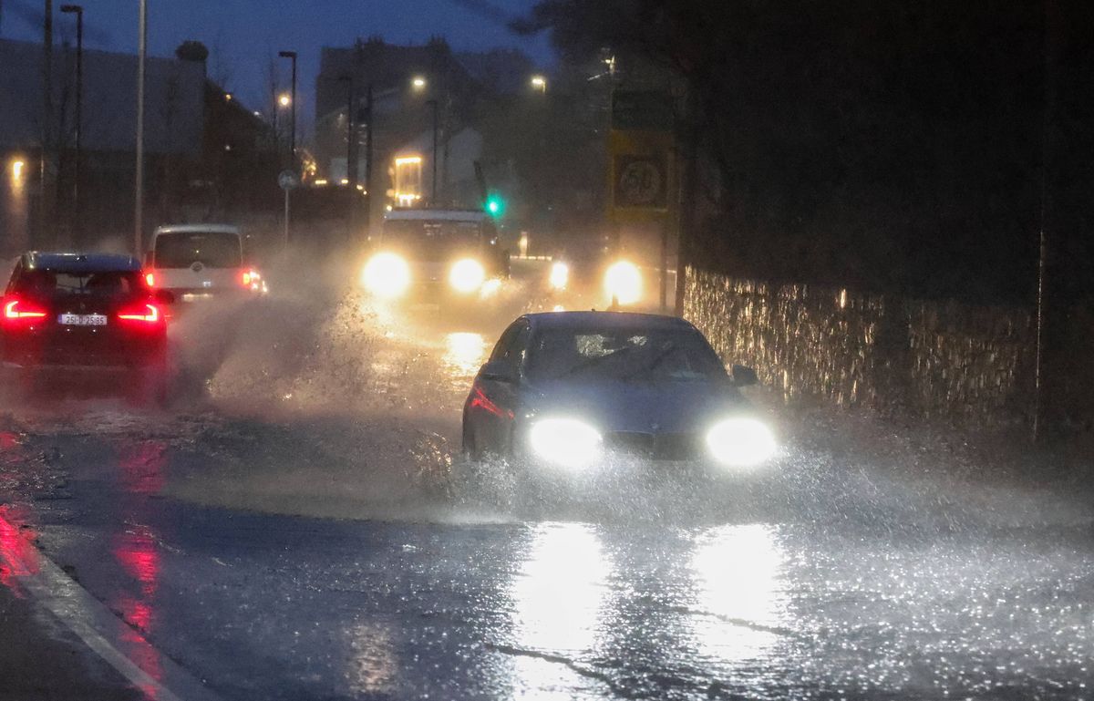
Storm Chandra battered the country with heavy rainfall(Image: Colin Keegan, Collins, Dublin)
Unfortunately, further spells of heavy rain are forecast for the week ahead, with Met Eireann warning that we are in for more unsettled days with overcast skies.
However, there is some light at the end of the tunnel, with Met Eireann revealing that atmospheric pressure are set to build over Ireland which will see temperatures rise and dry conditions dominate.
The national forecaster’s extended outlook, which was updated on Tuesday, points to a much-needed dry spell of the week of Monday, February 23 to Sunday, March 01.
According to Met Eireann, there are tentative signs that High Pressure will have a greater influence over Ireland’s weather from next week which will bring more settled conditions than in the preceding weeks.
The national forecaster said: “From February 23 to March 2, it looks like atmospheric pressure will build over Ireland. Temperatures are likely to be above normal and rainfall amounts below normal for late February.”
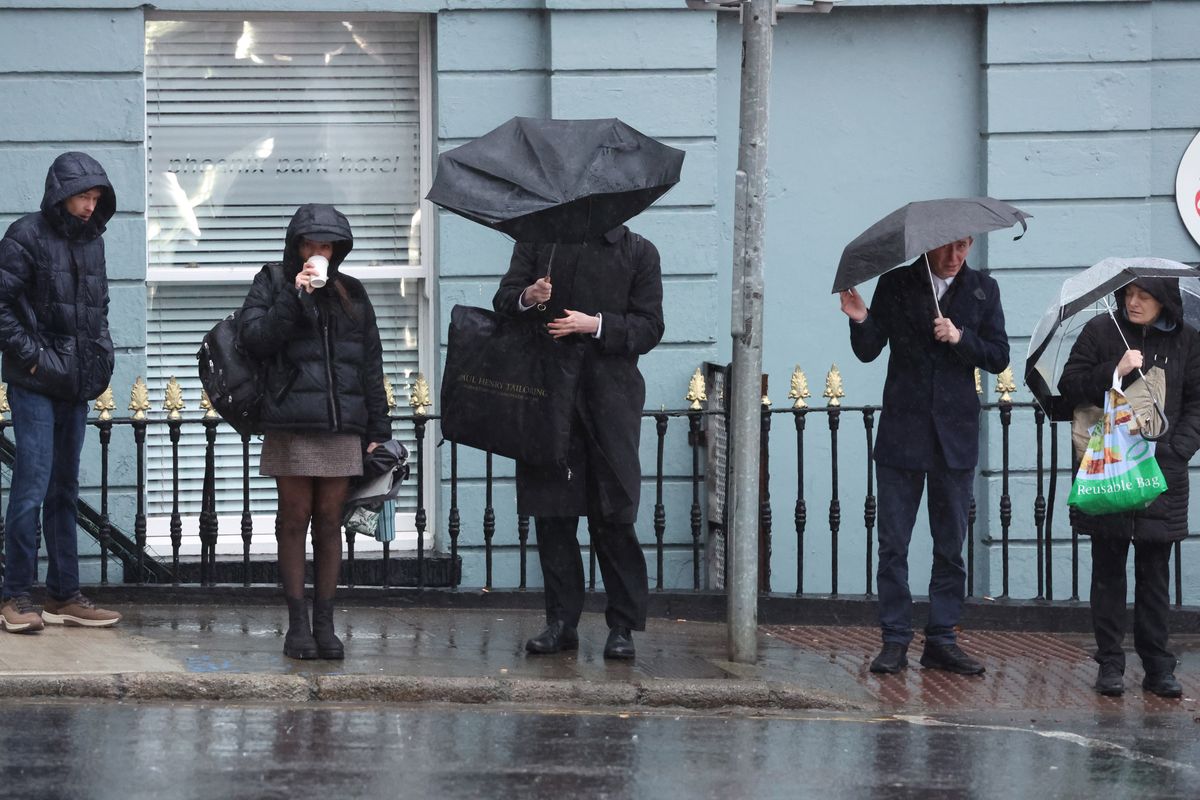
The end of the reign of rain could be in sight(Image: Collins Photo Agency)
The improved conditions are set to continue into next month, with Met Eireann adding: “From March 2 to 9, it looks like high pressure will continue to dominate. So, rainfall amounts should continue below normal and mean temperatures continue above normal.
The weather is also looking promising as we head towards St Patrick’s Day, with current indications suggesting that for the week of March 9 to 15, “it will be drier than average,” while “mean temperatures are expected to be around average”.
But Ireland will have to endure further spells of heavy rainfall over the coming days before we get a break from the wet conditions, with showers forecast almost everyday this week.
You can check out Met Eireann’s national forecast for the next few days below.
Sunday (February 15): Cloudy but dry for many this morning. A band of squally showers will continue moving eastwards across Leinster and Ulster this morning, with more persistent falls over Munster. The showers will be heavy at times with hail and thunderstorms possible. Sunny spells and scattered showers will follow from the west throughout the country later this afternoon with fresh and gusty westerly winds. Highest temperatures of 7C to 10C.
Scattered showers continuing tonight with fresh westerly breezes. Staying mostly dry in the east with just the odd isolated shower passing. Lowest temperatures of 1C to 4C.
Monday (February 16): Blustery tomorrow with widespread showers feeding in from the west in a fresh westerly breeze. The showers will ease from the north later in the day, with more in the way of sunny spells. Highest temperatures of 6C to 10C but turning cooler later as winds become northerly.
Apart from a few isolated showers in the north and west, it’ll be dry for much of Monday night with clear spells. Cloud will thicken overnight with rain moving into the southwest. Cold with frost and some icy patches. Lowest temperatures of -3C to +1C degrees in generally light winds.
Tuesday (February 17): Any frost and icy patches in the north and east will soon clear as cloud thickens and southerly breezes strengthen. Staying mostly dry but overcast through to the evening. Highs of 4C to 7C in southerly winds.
Overcast and turning wet in the southwest on Tuesday Night with bands of rain moving in. Staying dry elsewhere but the rain will spread through Connacht, Munster and south Leinster overnight. Lowest temperatures of 0C to 4C.
Wednesday (February 18): Another unsettled day with overcast skies and rain spreading in from the west early in the morning and becoming widespread by evening. Moderate to fresh southwesterly winds with highest temperatures of 4C to 9C degrees.
Want to see more of the stories you love from the Irish Mirror? Making us your preferred source on Google means you’ll get more of our exclusives, top stories and must-read content straight away. To add Irish Mirror as a preferred source, simply click here