
This year has seen a dreary display of weather all over Ireland, with nonstop rain hitting the country for weeks.
While the past few days have finally seen some breaks of sunshine, the wet and windy conditions look set to continue over the next week.
On Thursday, the damp forecast may even take a step up to a full-blown storm, with powerful winds predicted to hit the country.
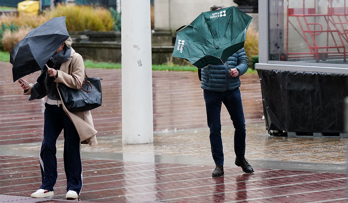 Strong winds are expected over the next week. Pic: Jacob King/PA Wire
Alan O’Reilly of Carlow Weather has warned that a storm may be on its way to Ireland, citing current projections which point to gale-force winds.
He wrote on X: ‘The ECMWF model latest update once again shows risk of a storm Thursday night but other models don’t develop the low. Interesting one to follow.’
Meanwhile, Met Éireann has not issued a clear forecast for Thursday, though early signs have pointed to rain.
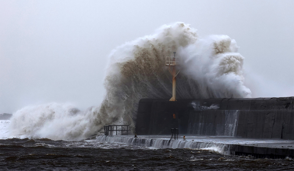
 Stormy conditions may arrive on Thursday. Pic: Leah Farrell/ RollingNews.ie
The national forecaster said: ‘Confidence in the forecast is low at present, but current indications suggest a mostly cloudy day with outbreaks of rain extending from the Atlantic and becoming widespread in mostly moderate, occasionally fresh southwesterly winds.’
The rest of the week has a similar outlook, with rain and wind in abundance.
In a slightly positive change, the temperature is set to be milder than recent weeks, though it will cool down again by next weekend.
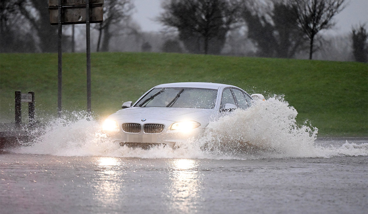 Ireland has been battered by rain in 2026. Pic: Charles McQuillan/Getty Images
While Sunday had a mostly bright and clear morning, the evening is forecast to be wet with scattered showers that will turn to drizzle overnight.
Monday will then be mostly cloudy, with rain and drizzle spreading from the west and turning heavy for bursts.
Met Éireann stated: ‘Continuing mostly cloudy on Tuesday with outbreaks of rain and drizzle. The rain and drizzle will be heaviest and most persistent in Atlantic and southern coastal counties with a fair amount of dry weather across parts of the midlands, east and north.
‘Outbreaks of rain and drizzle will spread to most parts on Tuesday night, with some heavy bursts in places. A few clearer breaks and showers will extend from the west towards morning.’
Wednesday looks set for a few sunny spells, but widespread showers will soon follow.
Just ahead of the potential Thursday storm, there is the possibility of heavy thundery downpours and hail.
The ECMWF model latest update once again shows risk of a storm Thursday night but other models don’t develop the low. Interesting one to follow pic.twitter.com/k3e6KWVrOH
— Carlow Weather (@CarlowWeather) February 22, 2026