
Sea level around Africa climbed higher during the 2023-2024 El Niño than during any comparable event recorded since the early 1990s.
That record surge leaves densely populated coasts more exposed as forecasters consider the likelihood of another El Niño later this year.
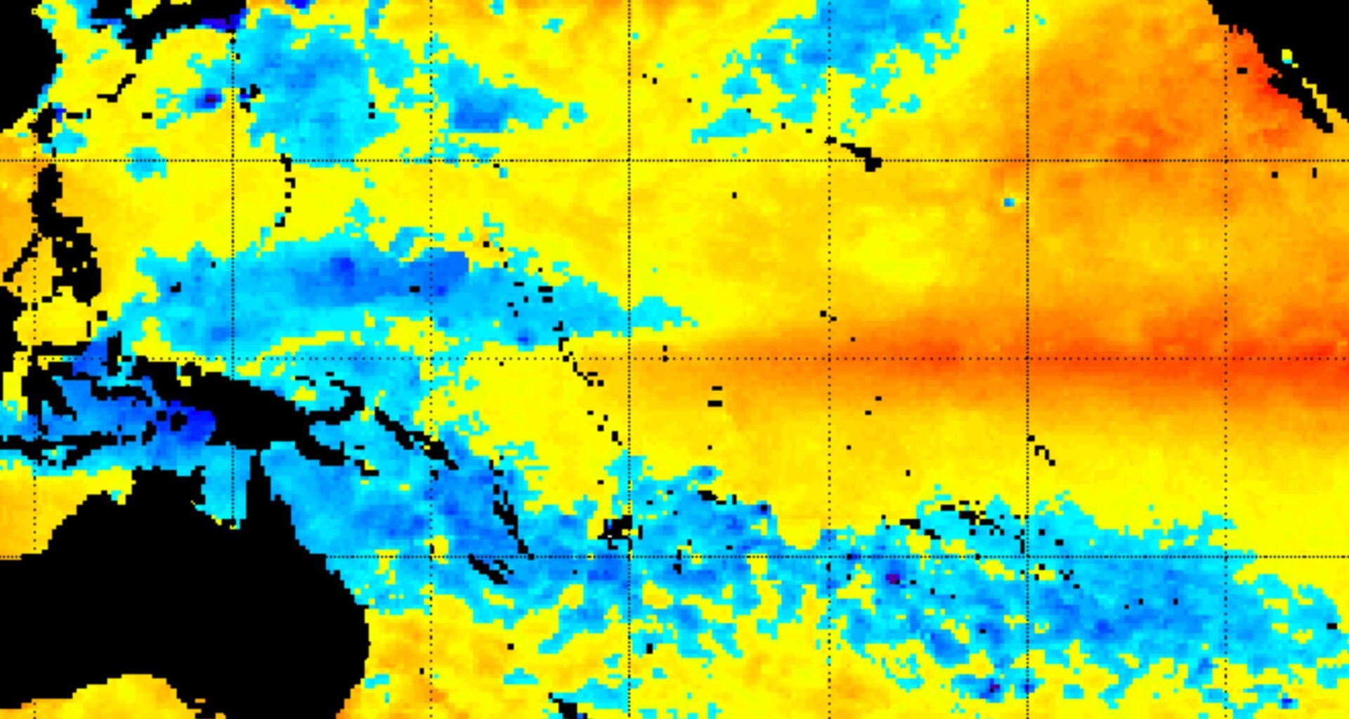
Satellite record of sea rise

Along Africa’s shores, satellite measurements from 1993 through 2024 captured a sharp spike in ocean height during the recent event.
Drawing on those records, Franck Eitel Kemgang Ghomsi at the University of Manitoba documented that sea surface levels rose about 1.1 inches (2.8 centimeters) above normal.
Unlike earlier El Niño episodes, this increase unfolded on top of decades of steady sea level rise already underway.
Starting from that higher baseline, the same climate pattern now pushes water closer to critical thresholds for flooding in vulnerable coastal cities.
Why warmer water rises
Warm ocean water expands, so heat stored near the surface can lift sea level without adding extra water.
In the study, thermal expansion accounted for over 70 percent of the rise, as warmer water occupies more space.
Weaker winds over tropical seas slowed cooling and kept more heat trapped near the surface.
That kind of heat-driven swelling can raise water levels in weeks, leaving coastal defenses little time to catch up.
A faster baseline rise
Long before El Niño showed up, the background sea level around Africa had been climbing for decades.
From 2009 to 2024, the rise accelerated by 73 percent, as the yearly pace jumped from about 0.11 to 0.19 inches (0.28 to 0.48 centimeters).
With that higher starting point, even moderate ocean cycles produced larger spikes along coastlines than they did in the 1990s.
Higher baseline seas made extreme water levels more likely, so past flood maps can underestimate future risk.
Compound coastal risks
Along much of Africa, the spike did not stay offshore; it pushed high water into bays, deltas, and crowded ports.
Across the Indian Ocean, Atlantic Ocean, Mediterranean Sea, and Red Sea, some event-time anomalies topped 3.5 inches (8.9 centimeters).
“For 38 coastal nations, these findings reveal compound threats to low-lying deltas and Small Island Developing States from flooding, ongoing land subsidence, and declining marine productivity,” wrote Ghomsi.
When land slowly sinks while sea levels climb, towns can lose safe margins even on calm days.
Forecasters weigh the odds
In a February 12 discussion, NOAA said the Pacific stayed in La Niña, with cooler-than-average surface waters persisting near the equator.
By spring, NOAA expected near-neutral conditions, as subsurface warming weakened the atmospheric patterns that kept La Niña in place.
For late summer and beyond, NOAA put the odds of El Niño at 50 percent to 60 percent, warning models vary.
Odds do not guarantee an El Niño, but a developing El Niño can lock in patterns for winter storms and droughts.
El Niño and global heat
Global temperature records do not rise smoothly; El Niño can add a short burst of heat to the air.
A 2024 climate report noted that every month of 2024 saw record or near-record warmth during El Niño conditions.
Human-made greenhouse gases keep oceans storing more heat, so each El Niño now starts from a warmer floor.
If another El Niño forms late in 2026, its warming influence can linger into 2027 and strain heat-response plans.
Oceans hit coastal economies
Alongside higher water levels, unusually warm seas damaged fisheries and tourism businesses that depend on predictable seasons.
During marine heatwaves – long ocean hot spells that disrupt food webs – fish moved or died and catches fell.
Warmer water also holds less dissolved oxygen, and that change can squeeze species into smaller zones near shore.
Economic pain arrives early, long before a new El Niño shows up in global temperature charts.
Tracking tools remain scarce
Many African coastlines lacked dense monitoring, so some communities learned about unusual sea levels only after damage appeared.
Local tide gauges, coastal sensors that record water height, can catch a rising trend that satellites miss near shore.
Budget limits and equipment gaps left fewer measurements to feed early warnings, especially during fast-moving El Niño years.
When signals arrive late, emergency planners must rely on broader forecasts instead of local readings tailored to each harbor.
Preparing ahead of impact
Regional planners need lead time, and forecast centers try to provide it even when the ocean signal stays noisy.
A forecast from the International Research Institute for Climate and Society showed El Niño odds rising later in 2026.
City engineers can update flood zones, raise key roads, and protect power gear before the next high-water season.
Flexible plans paid off even if El Niño failed to appear, because long-term sea rise keeps advancing.
Next steps for coasts
The new sea-level record shows how a warmer ocean can turn a familiar El Niño into a sharper hazard.
As NOAA watches probabilities for late 2026, coastal decisions that reduce risk now stay useful even if forecasts change.
The study is published in Communications Earth & Environment.
—–
Like what you read? Subscribe to our newsletter for engaging articles, exclusive content, and the latest updates.
Check us out on EarthSnap, a free app brought to you by Eric Ralls and Earth.com.
—–