
A year’s worth of rain has drenched parts of South Australia, Victoria and New South Wales, as remnants of a tropical low moved east, bringing record-breaking falls to desert towns and crop losses for agricultural areas.
The Bureau of Meteorology issued severe weather warnings for south-west NSW and north-west Victoria on Monday, with six-hourly falls of 40 to 70mm forecast, and isolated falls of up to 100mm in places.
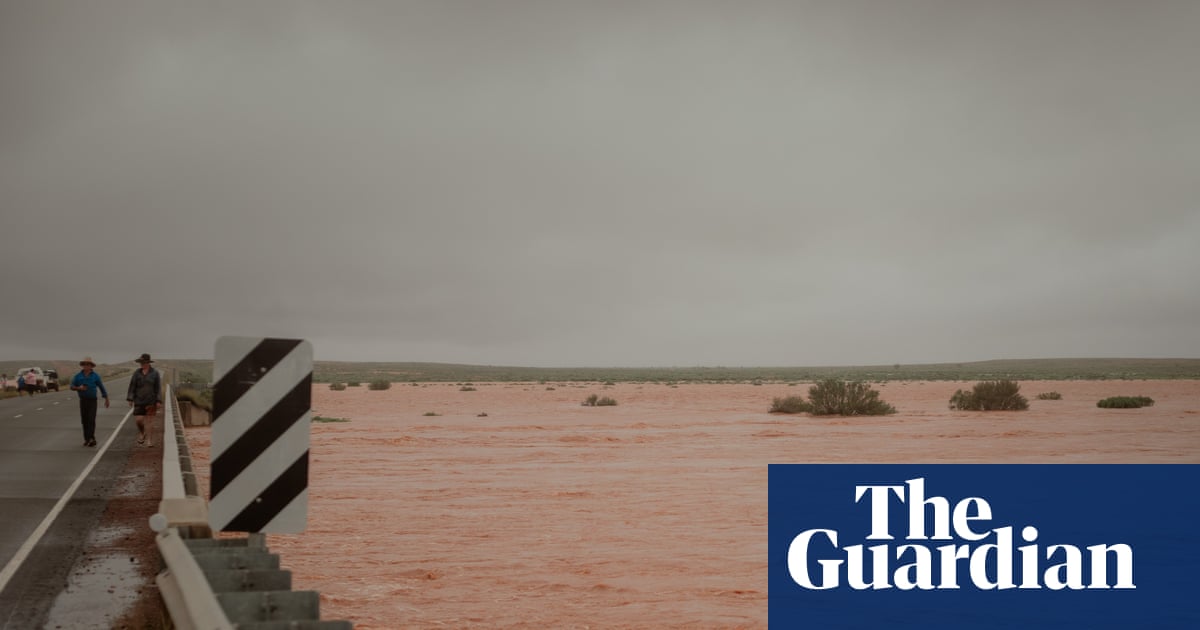
It was the culmination of a lingering monsoon low that has delivered a deluge across inland areas, with dozens of places receiving more rain in a week than for all of last year.
“It has been a very impressive and in some areas record-breaking rainfall event,” bureau senior meteorologist Dean Narramore said.
Nearly 150mm of rain fell in Mildura within a week, compared with 159mm throughout 2025. In SA, 136mm fell in Marree, which recorded 37mm in total last year.
Several places experienced their wettest day ever, including Ouyen in Victoria (92.6mm, 25 February), and Ceduna (75mm, 28 February) and Yunta (126.8mm, 1 March) in SA.
Lately the atmosphere in desert towns had been “unbelievably moist”, he said, more akin to places such as Darwin or Cairns.
Sign up: AU Breaking News email
It was almost like “weather whiplash”, Narramore said, given only a few weeks ago many of those same areas were sweltering through temperatures in the high 40s, and in some cases 50C.
Rain in agricultural areas might seem like good news, but it was too much at the wrong time of year for many grape growers.
“This is just another hammer blow for the industry,” said Paul Derrico, chief executive of Murray Valley Winegrowers, which represents about 260 wine grape growers in the Murray, Darling and Swan Hill regions.
Most had received between 100 to 180mm of rain in the last five days, he said, which was a huge concern for growers. When vines take up too much water before harvesting, it can cause berries to split and lead to bunch rot, he said. Water on the ground could cause tractors and harvesters to get bogged. Crop losses were expected.
It was more bad news for growers, who were already suffering due to low prices.
“They’ve had the cost of growing those grapes for the last 12 months,” Derrico said. “There’s potential for them to have little or no income, depending on how badly those grapes are affected.”
Crews from Victoria’s state emergency service were clearing the last of 392 requests for assistance received between 6am Sunday and 10:30am Monday, most due to flooding, fallen trees and building damage. Mildura was by far the worst hit, with 143 requests for assistance.
In NSW, crews responded to 103 calls in the 24 hours to 11am Monday, with 50 in the west and 30 in metropolitan Sydney.
The rain was expected to clear southern and central Australia by Wednesday, just as multiple tropical lows develop across the north of the country.
The climate crisis is making Australia more vulnerable to extreme weather and natural disasters, including locally intense rainfall. In 2025, the third-hottest year on record, global surface air temperatures averaged 1.48C above preindustrial levels.
Kati Thanda-Lake Eyre was expected to fill for the second year in a row, with many of its rivers and tributaries “well and truly swollen” after the basin’s third-wettest February on record, Narramore said.
Griffith University professor Fran Sheldon, a river ecologist specialising in dryland river systems, said historically, sequential wet years often led to large, and sometimes back-to-back, lake filling events.
The largest lake filling event was in 1974, she said. “But you never know, with this water coming down, 2026 may top it. We’ll just have to wait and see.”