
Status Yellow wind warning will be in place nationwide until 6pm on ThursdayStatus Yellow rain warning for 21 counties until 3pm, Thursday Met Éireann adds snow-ice warning for 11 counties, to come into effect on Thursday night
The Status Yellow warning will apply to counties Cork, Kerry, Limerick, Tipperary, Waterford, Donegal, Galway, Leitrim, Mayo, Sligo and Wicklow.
It will come into effect at 9pm on Thursday and remain in place until 6am, Friday.
A Status Yellow rain warning is currently in place for counties Cavan, Donegal, Monaghan, Clare, Kerry, Limerick, Tipperary, Dublin, Kildare, Laois, Longford, Louth, Meath, Offaly, Westmeath, Wicklow and Connacht.
This will be in place until 3pm on Thursday.
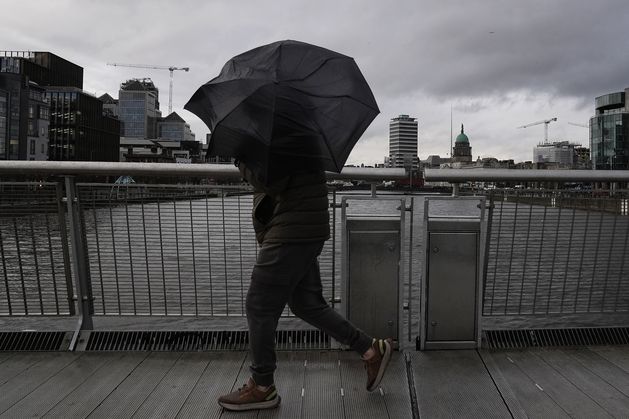
The national forecaster said heavy downpours are expected, with spot flooding, poor visibility and difficult travelling conditions.
And a Status Yellow wind warning is in place nationwide from until 6pm on Thursday.
Potential impacts will include difficult travelling conditions, debris or loose objects displaced and some fallen branches or trees.
Met Éireann meteorologist Holly O’Neill said it will be blustery across the country, but counties along the Atlantic coast will be the worst affected.
Speaking to Today with David McCullagh on RTÉ Radio 1, she said the country is set for “quite a wet and blustery day”.
“We’re going to be seeing very strong and gusty southwesterly winds moving in across the country.
“With regards where we’re going to see those strongest winds, it’s most likely it’s going to be blustery everywhere, like you know, but it’s along those Atlantic coasts that we’re going to see the brunt of those winds, parts of the northwest and south.”
Ms O’Neill said rain will turn heavy at times and there may be some spot flooding, poor visibility and difficult travelling conditions, and temperatures will drop later on as the rain clears.
“When we see that rain clear this afternoon to the southeast, we’re going to see a kind of a freshening of the winds coming in as well.
“So, it’s going to feel a little bit cooler too, with showers feeding in from the west.
“Now, some of those may turn wintry at times, particularly on higher ground or up in the northwest, but most likely for the majority of the country it will just be showers.”
Speaking to the same programme Dublin Airport Authority head of media relations Graeme McQueen said there have been “challenging winds” at Dublin Airport this morning.
“In the last couple of hours, we’ve had three flights divert to other airports.
“We’ve had eight go-arounds as well, that’s where the incoming plane tries to come down and land on the runway, but the wind levels are too strong, and it goes back up again and then tries again.
“So, a bit of disruption so far. The winds are actually due to get a bit stronger over the next two, three hours, so we’re expecting the potential for further disruption as the morning goes on.”
We need your consent to load this Social Media content. We use a number of different Social Media outlets to manage extra content that can set cookies on your device and collect data about your activity.
Please review your details and accept them to load the content
There will be both dry, sunny spells and rain in the mix for the days ahead. Photo: Brian Lawless/PA
7 Day Weather Forecast – 9th March to 15th March
Forecast
Saturday will be dry to start in the east with sunny spells, but the day will later become cloudy as rain and drizzle spread from the west becoming widespread by the afternoon.
Saturday will see highest afternoon temperatures of 5 to 9C.
The evening will see the rain ease and become lighter and patchier with some clear spells developing.
Lowest nighttime temperatures will range from 5 to 8C in moderate to fresh southwesterly winds.
Sunday will be a cool and breezy day with sunny spells and blustery showers, some turning wintry in places with sleet or hail possible.
There will be highest afternoon temperatures of 5 to 9C in fresh to strong westerly winds.