
Storm Dave was officially named by the UK Met Office on Thursday morning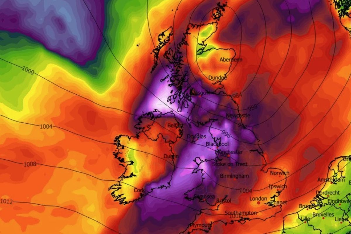
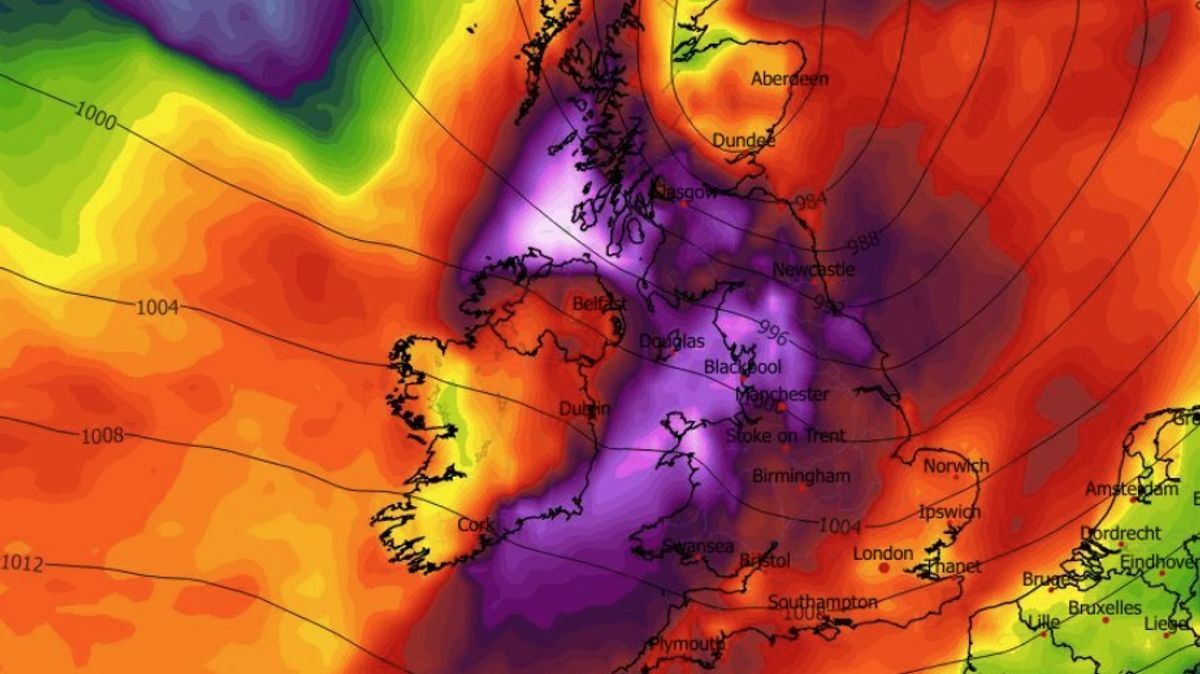
Storm Dave is set to strike Ireland on Saturday. (Image: WXCharts.com)
Met Eireann has recognised the threat posed by Storm Dave to the entire state by issuing a major nationwide weather warning.
The Status Yellow alert, which was issued on Thursday morning, is for wind and is valid between 3pm on Saturday and midnight on Easter Sunday.
Met Eireann list the potential impacts as some fallen trees, branches; wave overtopping; difficult traveling conditions and debris, loose objects displaced.
The Met Eireann warning came minutes after the Met Office in the UK officially named the storm as Storm Dave.
The latest weather alert also comes less than 24 hours after Met Eireann issued a weather advisory covering the entire Easter weekend.
The state forecaster issued the weather advisory for all of Ireland on Wednesday. The advisory applies to the entire state and it lists an array of potential hazards due to strike this coming Easter weekend.
The state forecaster issued the weather advisory for all of Ireland shortly 1.30pm on Wednesday. The advisory applies to the entire state is lists an array of potential hazards due to strike this coming Easter weekend.
The weather advisory issued by Met Eireann lists the following as potential impacts: stormy weather with a potential for severe gusts and potential damaging west to southwest gusts; coastal flooding; high astronomical tides (Spring Tides) coinciding with storm surge and persistent onshore winds; strong onshore winds combined with high waves may lead to wave overtopping.
Public Safety MessagesMonitor Met Éireann forecasts and/or visit https://www.met.ie/ for the most up to date information. Information is available across social media platforms and other news media sourcesCoastal flooding is likely, especially around high tide times and in exposed, low-lying locations along the Atlantic coastal countiesHigh astronomical tides (Spring Tides) coinciding with storm surge and persistent onshore winds will further increase the risk of coastal flooding. Areas along the west and north coasts are particularly vulnerableStrong onshore winds combined with high waves may lead to wave overtopping and flooding in low-lying and exposed coastal areasPeople travelling long journeys check weather/ road conditions, not just where they are starting from, but at their destination and along the route, as conditions may vary significantlyESB Emergency Services can be contacted at 1800 372 999. The public can monitor PowerCheck.ieMet Eireann National Outlook:
Overview: Unsettled through the Easter weekend. Becoming very windy and wet on Saturday. A brighter, breezy day on Easter Sunday with a few showers. Rather windy once again on Monday.
Friday night: Clear spells and isolated showers at first but it will turn cloudier through the night with outbreaks of rain and drizzle spreading northeastwards across the country. Lowest temperatures of 1 to 6 degrees, coldest in Ulster, in light to moderate southerly winds, fresher in the southwest.
Saturday: A windy and wet day on Saturday with strong and gusty southerly and gales on coasts, bringing the potential for wave overtopping. Outbreaks of rain will become widespread through the day, turning heavy at times with spot flooding possible. Highest temperatures of 11 to 14 degrees.
Saturday night: Wet and windy to start the night with outbreaks of rain and strong and gusty southwesterly winds. The rain will quickly clear, followed by clear spells and scattered showers. The odd shower of hail and sleet is possible. Becoming cold with lowest temperatures of 1 to 4 degrees and winds easing moderate to fresh overnight.
Sunday (Easter Sunday): A bright and breezy day on Sunday with sunny spells and scattered showers. There is a chance of some showers of hail or sleet early on, mainly on higher ground. Cool with highest temperatures of 7 to 10 degrees. Moderate to fresh westerly winds will ease during the evening.
Monday: Rather windy on Monday with fresh to strong southerly winds developing. Cloudy and damp for most with patchy light rain, drizzle and mist. A milder day with highest temperatures of 10 to 14 degrees.
Further outlook: Remaining unsettled for the rest of next week with Atlantic low pressure systems bringing further wet and blustery weather.
Want to see more from the Irish Mirror? Making us your preferred source on Google means you’ll get more of our exclusives, top stories and must-read content straight away. To add Irish Mirror as a preferred source, simply click here.