
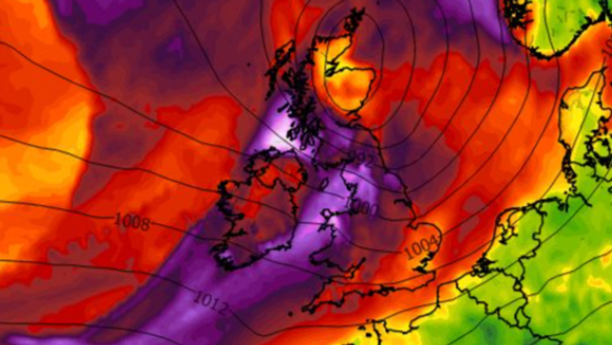
Storm Dave is set to make landfall in Ireland on Saturday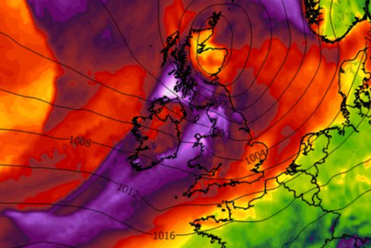
Storm Dave is set to batter Ireland this weekend(Image: wxcharts.com)
A meeting of the National Severe Weather and Flooding Coordination Group took place on Thursday ahead of the arrival of Storm Dave this weekend.
Local Authorities, Met Éireann, relevant Government departments, state agencies and utility providers all convened on Thursday afternoon in advance of the storm, which is set to make landfall on Saturday, bringing potentially “disruptive” conditions, according to the national forecaster.
A status yellow wind warning is in place for the whole country from 2pm until 11pm on Saturday – with travelling conditions expected to be impacted. High seas are also forecast for the Atlantic and Southern coasts on Saturday, along with high tides.
There are warnings that this may lead to wave overtopping and flooding in low-lying and exposed coastal areas at high tide times for Atlantic and Southern coasts. A meteorologist’s commentary on the Met Éireann website, meanwhile, warned that “areas along the west and north coasts are particularly vulnerable” to the threat of coastal flooding.
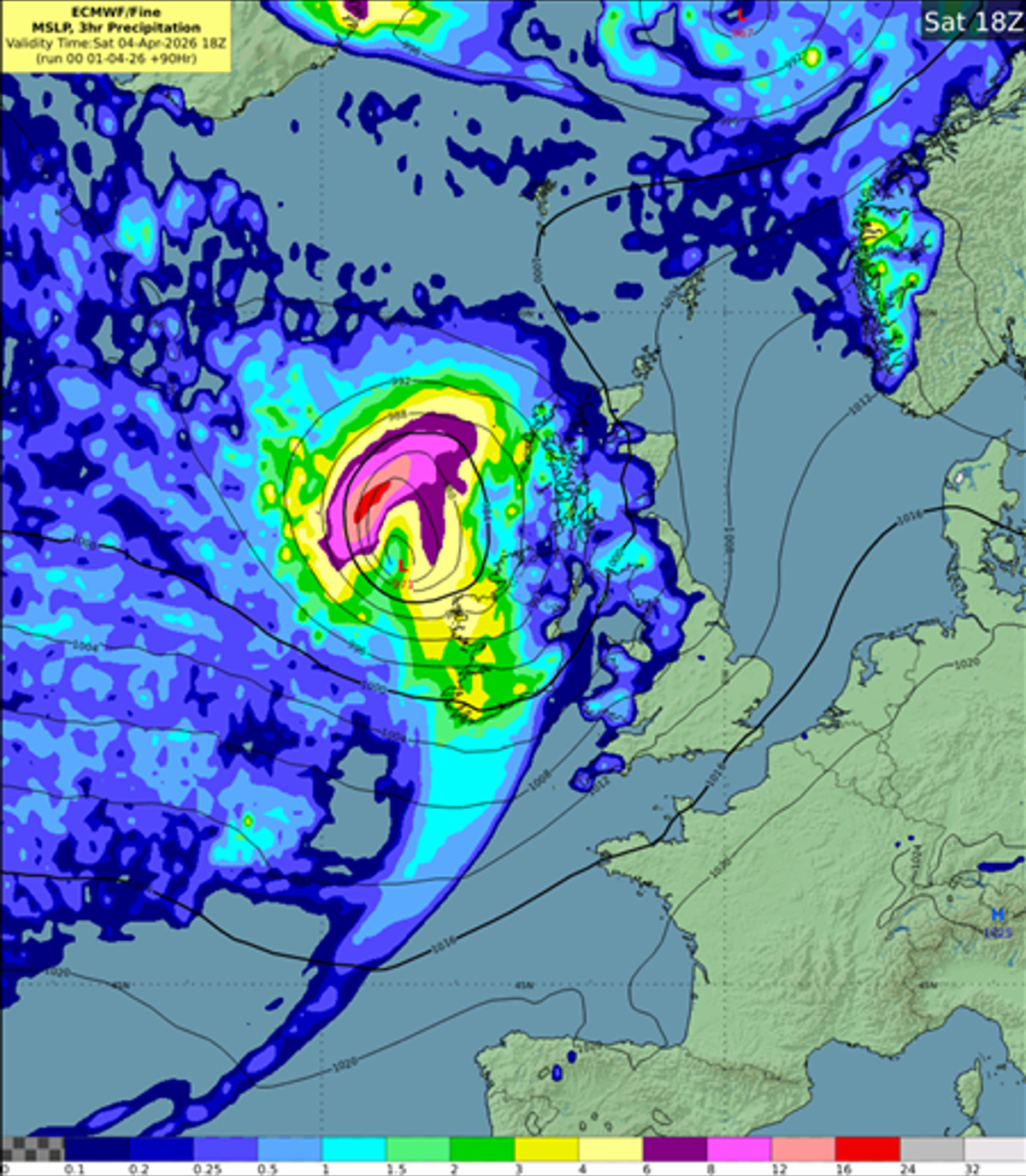
A graph showing expected precipitation on Saturday
The public is advised to stay away from coastal edges, harbours, piers and low-lying promenades during high tide in these areas.
A statement from the Department of Housing, Heritage and Local Government said: “Strong onshore southerly to westerly winds combined with high seas may lead to wave overtopping, storm surge and coastal flooding, especially in low-lying and exposed coastal areas. People should keep away from coastal edges, harbours, piers and low-lying promenades during high tide.
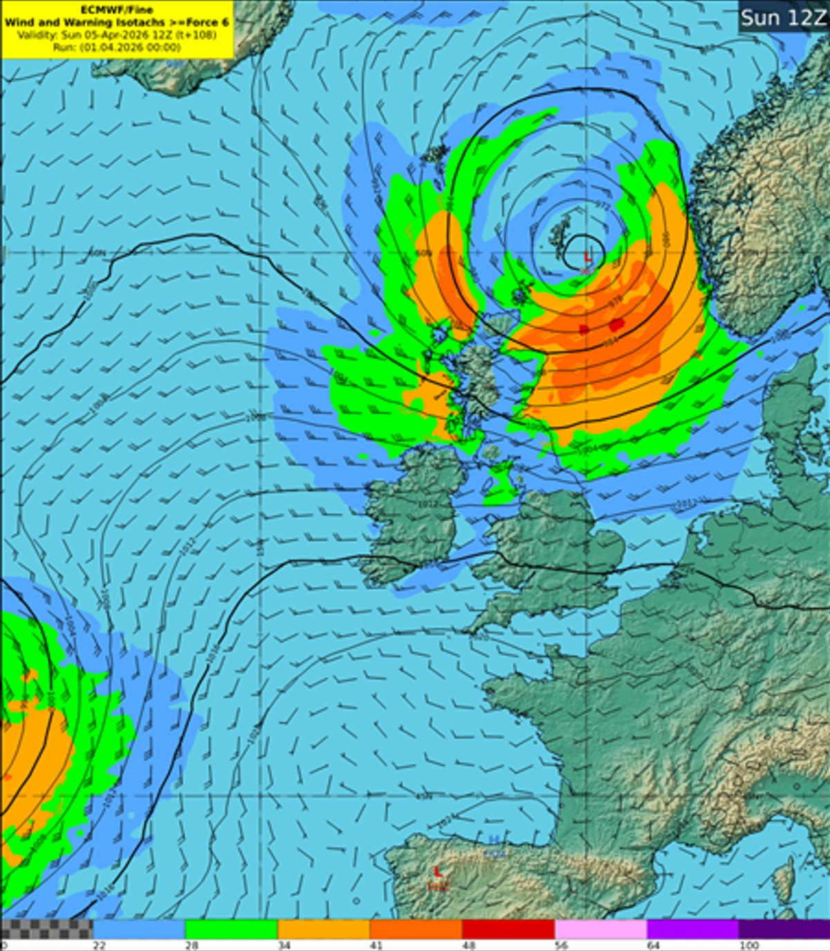
A graph showing expected wind speeds on Sunday(Image: Met Eireann)
“The Irish Coast Guard advice remains: “Stay Back, Stay High, Stay Dry.
“Drivers should also anticipate strong gusts and other hazards such as falling or fallen trees. High-sided vehicles and motorcyclists are particularly vulnerable to strong winds – slow down and give extra space to pedestrians and cyclists.
“The public can stay updated via Met Éireann’s website, app and social media channels.
“The National Severe Weather and Flooding Coordination Group will continue to monitor the situation and liaise with Met Éireann, local authorities and other stakeholders where necessary to coordinate the most appropriate response.”
Subscribe to our newsletter for the latest news from the Irish Mirror direct to your inbox: Sign up here.