

We’ll have to wait to see 25C and up again
07:18, 03 Jun 2026Updated 07:22, 03 Jun 2026
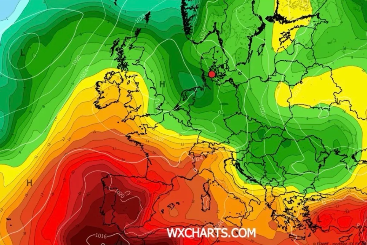
Back to better conditions by June 1tth(Image: WXCHARTS)
It’s about to get very chilly for June – with daytime temps in the low teens by the weekend – and plenty of cloud and showers to stop it feeling in any way summery.
Parts of Munster could struggle to get above 11C on Sunday in what would be very cold weather for the first week in June. If you were hoping to get the barbeque fired up for the first time this weekend, you’ll will almost certainly have to wait.
But if you are making plans for the weekned, Saturday afternoon into evening looks like our best chance for dry, bright weather across Munster, even if it will remain relatively chilly.
The better news this morning is that the long range models are showing a big change to come and even a specific day that will happen, but we still have a wait on our hands. It will be Thursday, June 11th that a high pressure system moves back in over Ireland and temps should jump into the mid-20s, with plenty of sunshine, around that date.
In the meantime, the full forecast for Munster this morning looks like:
TODAY – Wednesday 3rd June
Rain will clear away to the northeast early this morning and will be followed by scattered showers for the rest of the day. Some of the showers will be heavy and potentially thundery. Highest temperatures of 13 to 16 degrees with a moderate to fresh south to southwest breeze.
TONIGHT
Showers will continue to feed in from the west overnight. Lowest temperatures of 9 to 11 degrees in a moderate to fresh southwest to west wind.
TOMORROW – Thursday 4th June
Cool and blustery with scattered showers. The showers will become less frequent later in the day and some sunny spells will develop. Highest temperatures of 12 to 15 degrees with fresh and gusty westerly winds.
National Outlook
Overview: Unsettled with rain or showers each day, along with breezy conditions at times. Becoming cooler too.
Thursday night: Clear spells and scattered showers, mainly over the western half of the country. A cool night with lowest temperatures of 5 to 9 degrees in moderate to fresh westerly winds easing light to moderate southwesterly overnight.
Friday: A mix of well scattered showers and sunny spells at first on Friday. Cloud will build from the southwest through the afternoon with rain following and spreading into much of the south and west through the evening. Highest temperatures of 13 to 16 degrees in light to moderate south to southwest winds.
Friday night: Becoming wet in all areas overnight as the rain spreads northeastwards. Lowest temperatures of 9 to 11 degrees in a freshening south easterly wind.
Saturday: After a wet or damp start, the rain will gradually clear northeastwards through the afternoon and evening. Drier and brighter weather will follow from the southwest through the day. Highest temperatures of 13 to 18 degrees. Breezy with moderate to fresh southwesterly winds.
Sunday: Sunday will be a cooler day with blustery showers or longer spells of rain spreading from the west. Highest temperatures of 11 to 14 degrees in moderate to fresh southwesterly winds.