
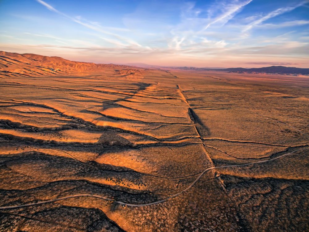
An earthquake strikes, the ground rips open along a fault, and the worst of the damage sits right there in that torn band of rock. That has been the assumption for decades.
Crews could map the crushed rock hugging the break and figured the harm faded within a mile or so.

New measurements tell a bigger story. The weakening reaches far past the visible crack – tens of miles past it – and it quietly governs how fast whole landscapes wear down.
The hidden reach
A global study now puts numbers on that reach. Drawing on more than 1,700 measurements of how fast rock wears away in river basins worldwide, researchers found that erosion speeds up sharply near active faults and tapers off with distance.
The effect stretches to roughly 60 miles from the largest fault systems.
Geologist Boontigan Kuhasubpasin led the work as a doctoral researcher at the University of California, Los Angeles (UCLA).
Damage runs hottest within about nine miles of a fault, then fades to almost nothing near that 60-mile edge.
Until now, most evidence kept the wreckage within a mile of the fault itself. No one had traced it spreading this far.
Evidence from the rivers
The clue came from rivers. As rock breaks down and washes downstream, the sediment carries a record of how fast the land upstream is being stripped away.
Hidden in that sediment is a rare, natural form of beryllium that builds up in rock left at the surface.
The longer the rock bakes in the open, the more it collects, so its level reveals how fast the surface has worn down.
Tally that across more than 1,700 basins, lay it over maps of faults and past ground shaking, and the pattern jumped out.
Rock near faults eroded far more quickly because the ground was weakest closest to the fault.
Forces that strain the land
Plenty of forces wear down a landscape. Rainfall loosens slopes; soft rock crumbles faster than hard.
To find which force dominated, the team fed everything into machine-learning models and asked them to rank the contenders.
Distance to a fault came out on top, beating rainfall and rock type across much of the restless, quake-prone world.
Adding a measure of how hard the ground shakes sharpened the models even more.
That ordering surprised the researchers. Climate and rock type have long been treated as the main controls on erosion.
Watching a fault outrank them, basin after basin, left the quakes as the likely culprit.
What shaking does
How a fault weakens rock so far from its edge is harder to pin down. The team cannot watch it happen underground, so the mechanism is an informed read, not a direct sighting.
Their best explanation is the shaking. Every quake jolts the surrounding rock. Over thousands of years, that repeated battering likely opens tiny cracks called microfractures.
“Repeated shaking can open microfractures, weaken contacts between mineral grains and reduce the strength of near-surface rock,” said study co-author Carolina Lithgow-Bertelloni, a UCLA earth scientist.
Once loosened, the rock becomes an easy target. Rivers cut down faster, hillsides slump into landslides, and weathering eats at the stone.
Slower waves and quicker erosion
A worldwide pattern is persuasive, but the team wanted to test it on familiar ground.
The researchers zoomed in on Southern California, where the San Andreas Fault and its many neighbors keep the crust in constant motion.
There, the rock near faults behaved just as the global data predicted. Seismic waves slowed as they passed through the fractured rock near the faults, revealing extensive damage.
Those same areas also eroded more quickly, reinforcing the link between repeated earthquake shaking and weakened rock.
The overlap of slower waves and quicker erosion is hard to pin on anything else. Here, faults were lifting the terrain and weakening the rock beneath it at once.
Earthquakes leave lasting scars
For a long time, faults earned their reputation mainly for building mountains. This study shows they also govern how fast the surrounding land comes apart, over distances no one had measured.
“This provides a physical explanation for why erosion is more efficient in tectonically active regions,” the team wrote.
That changes how scientists read quake-prone country. Worn landscapes near faults may have been carved less by rain or rock type and more by centuries of shaking.
The payoff lands in hazard planning. If weakened rock reaches dozens of miles past a fault, then landslide zones, reservoirs filling with sediment, and the slow build of mountains all stretch wider than current maps assume.
Quakes already move huge volumes of rock downhill, as one analysis of quake-driven slides found.
None of this erases rain or rock type. They still shape the landscape. But this study suggests earthquakes have been doing far more of the work than anyone realized.
A fault’s influence reaches far beyond the visible fracture, leaving weaker rock and faster erosion across a much broader swath of the landscape.
The study is published in the journal Science.
—–
Like what you read? Subscribe to our newsletter for engaging articles, exclusive content, and the latest updates.
Check us out on EarthSnap, a free app brought to you by Eric Ralls and Earth.com.
—–