
A significant prehistoric settlement uncovered in eastern Ireland challenges how archaeologists had previously understood population density and social organization during the Late Bronze Age. New research published in Antiquity details how evidence for over 600 dwellings was contained within the Brusselstown Ring hillfort in County Wicklow, making it the largest nucleated settlement to have been identified so far in prehistoric Britain or Ireland.
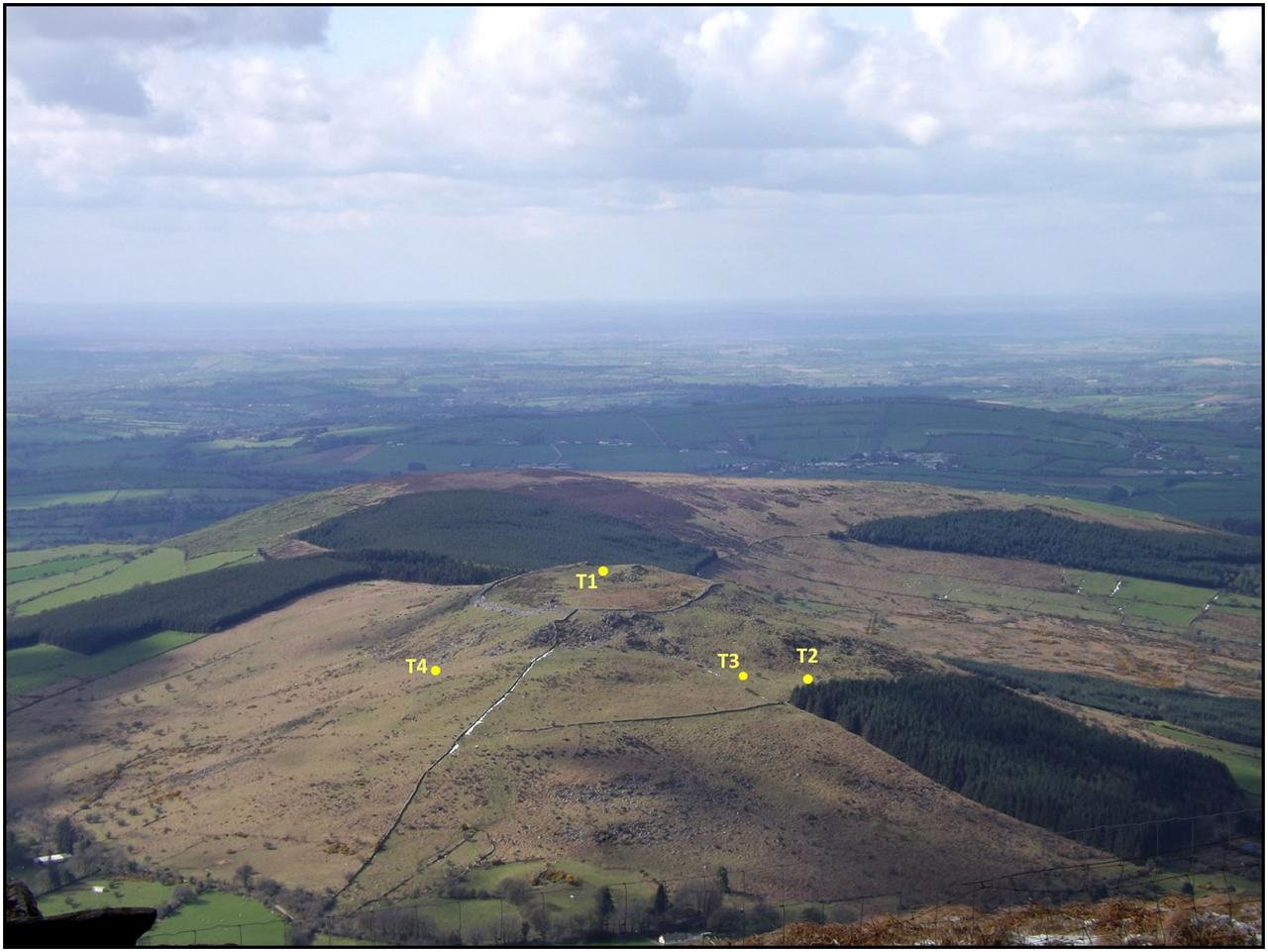 Aerial photograph with indication of test-trench locations. Credit: D. Brandherm et al., Antiquity Publications Ltd (2025)
Brusselstown Ring lies within the Baltinglass hillfort cluster, a landscape of up to 13 large hilltop enclosures that shows nearly continuous activity from the Early Neolithic through the Bronze Age. What is singular about Brusselstown, however, is its extraordinary scale and layout. Two widely spaced ramparts surround the site, with the outer boundary encompassing not only the main hillfort but also the nearby Neolithic enclosure at Spinas Hill 1. Enclosures extending across more than one hill are rare in Ireland and Britain and are very uncommon even in later Iron Age Europe.
Airborne and topographical surveys identified more than 600 subtle platforms interpreted as former house foundations. Ninety-eight lie within the inner enclosure, while more than 500 occupy the area between the inner and outer ramparts. This is a dense concentration of dwellings, implying a permanently occupied, tightly organized community rather than the small, scattered farmsteads that dominate most of prehistoric Ireland.
Researchers put these interpretations to the test with four targeted excavations across house platforms of varying size. Radiocarbon dates and material evidence suggest that the settlement’s occupation was primarily between approximately 1200 and 400 BCE, spanning the Late Bronze Age into the Early Iron Age. Significantly, houses of different diameters were in use contemporaneously, and the artifacts recovered from them reflect no clear differences in wealth or status. This pattern suggests a relatively egalitarian community despite the large population.
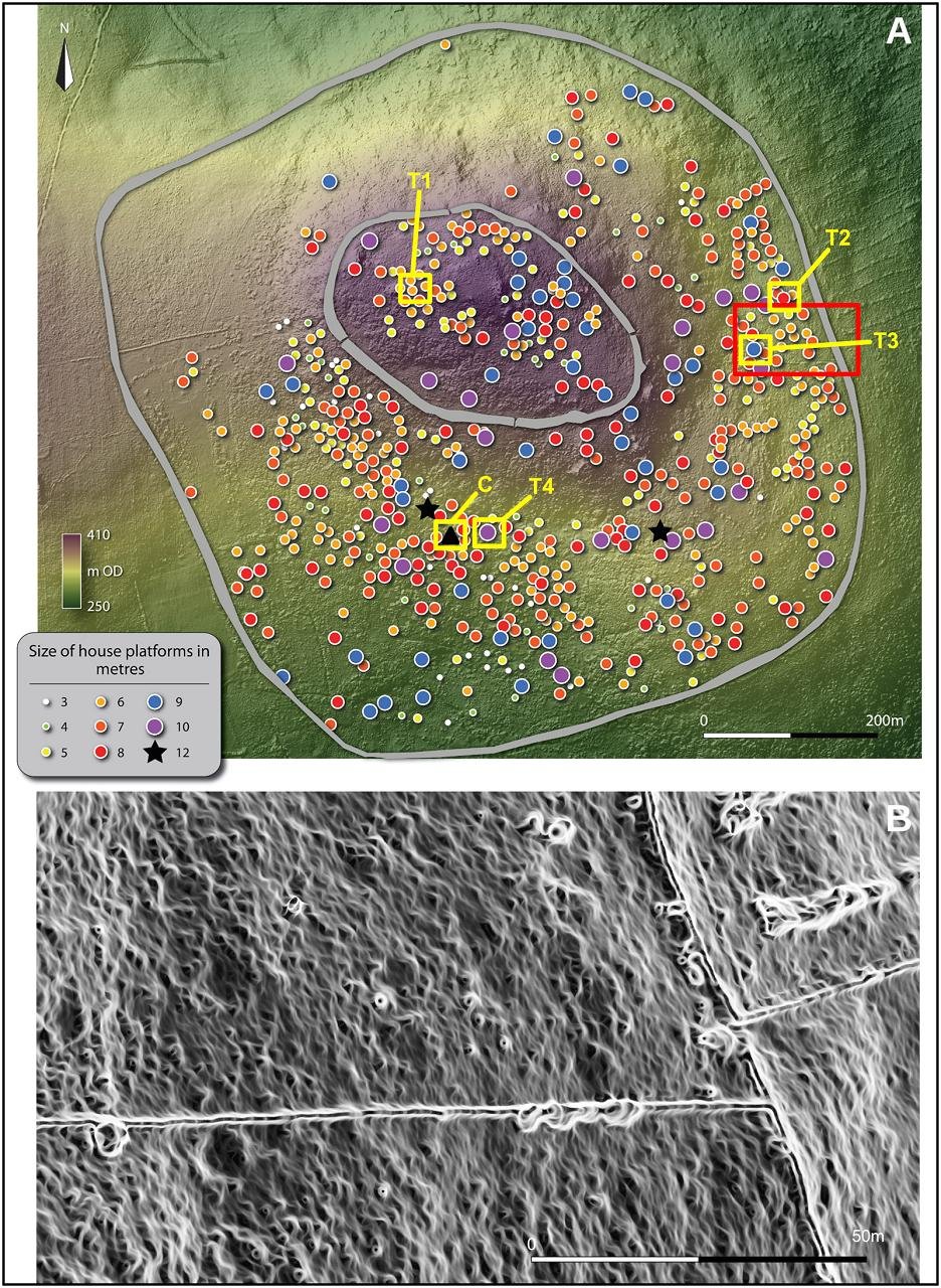 Photogrammetry map of Brusselstown Ring indicating potential roundhouse footprints, test trench locations and the potential cistern (A), with close-up lidar image of house platforms (visible as circular footprints) on the eastern slope (B). Credit: D. Brandherm et al., Antiquity Publications Ltd (2025)
Excavations also revealed a very unusual stone-lined structure near one trench. The flat interior and its association with a natural water source make it unlikely to be a typical roundhouse. Researchers instead believe that it may have served as a water cistern, a feature identified in parts of continental Europe but as yet undocumented in Irish hillforts. If confirmed, it would be evidence of considerable planning to support a large population on the hilltop.
The site was apparently gradually abandoned during the third century BCE, following trends seen at other smaller hilltop settlements in Ireland. This decline does not seem to be directly linked to climatic changes, suggesting that social and economic factors played a larger role in the process.
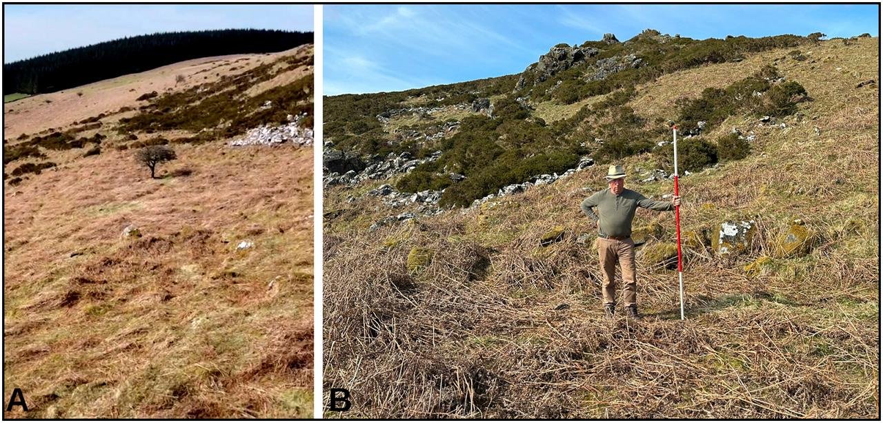 Aerial view of the potential cistern, in the foreground of the image (A) and a view from its interior showing a line of kerbstones (B). Credit: D. Brandherm et al., Antiquity Publications Ltd (2025)
Ongoing research thus seeks to confirm the function of the possible cistern, refine the chronology of the enclosing ramparts, and further contextualize why one of prehistoric Ireland’s largest communities ultimately faded from use.
More information: Brandherm, D., Edwards, C., Boutoille, L., & O’Driscoll, J. (2025). Brusselstown Ring: a nucleated settlement agglomeration in prehistoric Ireland. Antiquity, 1–8. doi:10.15184/aqy.2025.10247