
Storm Goretti has been named by the French Met Service and will sweep across England and Wales, whilst Ireland faces uncertainty with more unsettled conditions and potential snow
20:29, 06 Jan 2026Updated 20:38, 06 Jan 2026
Ireland finds itself in the grip of a harsh cold snap, with meteorologists cautioning that the snow threat remains far from resolved. Although temperatures are anticipated to rise slightly, Met Éireann warns that conditions will become more turbulent in the coming days – though the precise details remain “uncertain”.
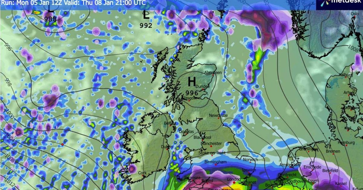
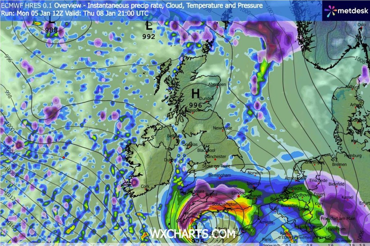
A fresh storm system, officially designated Storm Goretti by the French Met Service, is predicted to sweep across portions of England and Wales from Thursday through Friday, delivering torrential rain, extensive snow and fierce gales.
Present weather charts indicate that Ireland should escape the worst of the tempest, though Met Éireann has warned that “there is some uncertainty in the details” regarding local impacts as the system passes through.
The national weather service has confirmed that Ireland will experience “less cold than recently, but with a return to more unsettled conditions as low pressure takes hold again”. This low pressure system has been officially designated Storm Goretti.
Outlining Ireland’s prospects for Thursday and Friday, forecasters also confirmed that additional snowfall could be imminent. Met Éireann stated: “There is some uncertainty in the detail for Thursday. Current indications are that while there will be rain and drizzle further south, there will be drier and possibly brighter conditions further north with just some coastal showers. Highest temperatures of 3C to 7C , with light variable winds becoming northwesterly and increasing light to moderate through the day”, reports the Irish Mirror.
“A dry night for many Thursday with some clear spells. However, further west, some showers, possibly of hail, will feed in from the Atlantic. Frost in places with lowest temperatures of -1C to 2C , with light to moderate westerly winds.
“Plenty of dry and bright weather for many on Friday. However, showers will feed into Atlantic counties, with some of these wintery in nature. Highest temperatures of 3C to 7C , with light to moderate west to northwest winds, fresher in Atlantic coastal areas.”
The changeable conditions appear set to persist through the weekend, though there remains greater “uncertainty”. The national weather service continued: “It will start off cold and dry Saturday. While there is uncertainty in the timing, wetter and windier conditions are expected to arrive from the west later in the day. Highest afternoon temperatures of 3C to 8C.
“It will remain unsettled with mixed conditions for the remainder of the weekend and into next week.”
At present, Met Éireann has not issued any weather warnings for Ireland, though the UK Met Office has already put snow and wind warnings in place for large parts of England and Wales. Their alert cautions that Storm Goretti is expected to bring “heavy snow leading to disruption and difficult travelling conditions” from Thursday evening until Friday midday.