

Met Eireann has issued a 7 day alert as a ‘Beast from the East’ style weather event threatens to bring freezing temperatures to Ireland.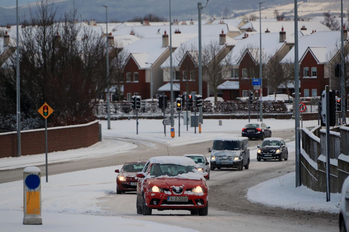
28/02/18 – Commuters make their way in the snow in Lucan, Co Dublin during the ‘Beast from the East'(Image: Colin Keegan, Collins)
Ireland is currently being lashed with unsettled conditions – but fears are growing that the country could experience a ‘Beast from the East’ style weather event before the end of the month.
Weather maps have indicated that a significant shift is on the way, with Arctic air signalled to push in from the east, raising the possibility of another cold snap.
While widespread snow appears unlikely at this stage, temperatures are currently forecast to plunge as low as -5C during the final week of January.
The term ‘Beast from the East’ refers to a cold, easterly airflow from continental Europe, which can bring frost, icy conditions, and in some cases, snow to Ireland. A similar event in 2018 saw deep snow cause widespread disruption across Ireland.
Met Eireann has now issued an ominous 7 day weather alert, confirming a period of below average temperatures and chilly easterly winds.
For the week of Monday, January 26 to Sunday, February 1, it warned: “A cool easterly airflow is likely to dominate bringing below average temperatures across the country. Rain and showers will likely lead to above average precipitation amounts for south and eastern counties, with more average accumulations further inland and below average amounts in the west and northwest.”
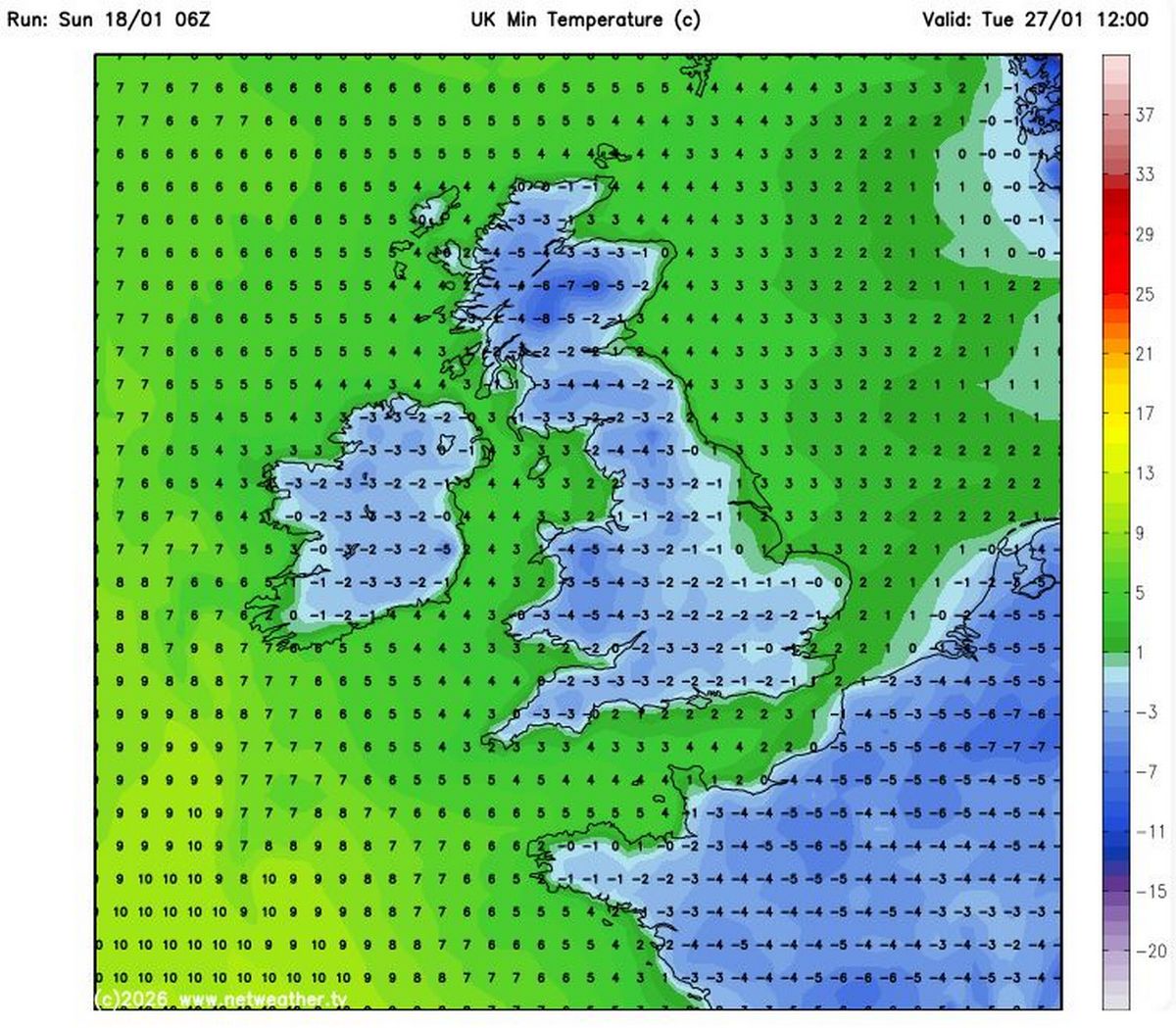
Weather models indicate temperatures could plummet as low as -5C on Tuesday, January 27(Image: Netweather.tv)
In the meantime, this coming week is expected to be wet and windy as a series of low pressure systems impact Ireland’s weather. The national forecaster has said there will be “rain and showers each day” as well as “cyclonic variable winds” at times.
Giving a day by day breakdown of what to expect, Met Eireann said: “A cloudy and wet start for many Monday, with widespread outbreaks of rain and drizzle. Rain will gradually clear from the south and southwest through the afternoon and evening. Highest temperatures of 5C to 9C in light to moderate cyclonic variable winds.
“Any lingering outbreaks of rain and drizzle in the north will clear early on Monday, leaving a clear, cold and dry night for many, with areas of fog developing in light southeasterly or variable breezes. Lowest temperatures of -2C to 2C with patches of frost and ice forming. Towards morning, outbreaks of rain will develop in the southwest with freshening winds.
“Areas of fog will clear through Tuesday morning as it becomes breezy with outbreaks of rain, heavy at times, gradually extending northeastwards through the day, alongside fresh and gusty southeasterly winds. Highest temperatures of 6C to 9C.
“Cloudy and breezy for most Tuesday night with limited clear spells developing and scattered showers. Lowest temperatures of 3C to 6C, with moderate to fresh and gusty southeasterly winds.
“Breezy Wednesday with outbreaks of rain, heavy at times. Highest temperatures of 6C to 9C with moderate to fresh and gusty southeasterly winds.
“Current indications show dry and bright conditions initially Thursday before a further spell of wet and blustery weather moves in from the Atlantic. Highest temperatures of 6C to 9C, with moderate southeasterly winds increasing fresh to strong.
“Likely continuing unsettled with further spells of rain and showers on Friday and for the weekend.”
Subscribe to our newsletter for the latest news from the Irish Mirror direct to your inbox: Sign up here.