
Fears are growing that the country could experience a ‘Beast from the East’ style weather event with temperatures forecast to plunge as low as -5C
18:24, 18 Jan 2026Updated 18:27, 18 Jan 2026
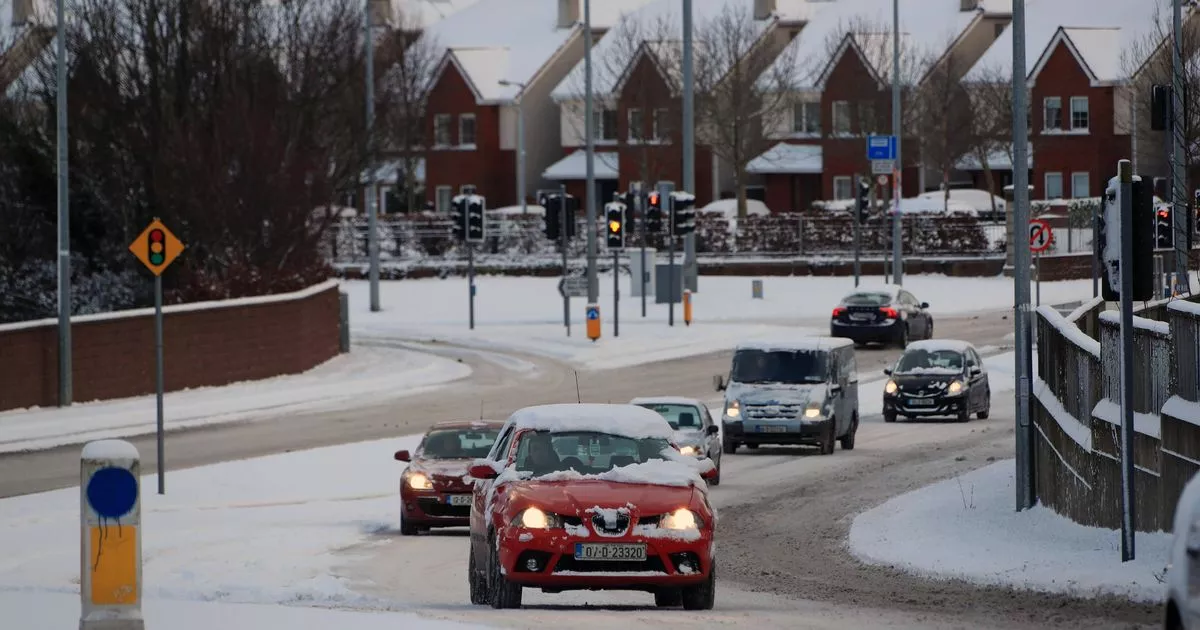
28/02/18 – Commuters make their way in the snow in Lucan, Co Dublin during the ‘Beast from the East'(Image: Colin Keegan, Collins)
Ireland is currently grappling with unsettled weather conditions, but there’s growing concern that a ‘Beast from the East’ type weather event could hit before the month’s end.
Weather charts suggest a significant change is on the horizon, with Arctic air expected to sweep in from the east, raising the prospect of another cold snap. While widespread snow doesn’t seem likely at this point, temperatures are predicted to plummet to as low as -5C during the final week of January, reports the Irish Mirror.
The phrase ‘Beast from the East’ refers to a chilly, easterly airflow from continental Europe, which can bring frost, icy conditions and, in some instances, snow to Ireland. A similar event in 2018 resulted in deep snow causing extensive disruption across Ireland.
Met Eireann has now issued a foreboding 7-day weather alert, confirming a spell of below-average temperatures and nippy easterly winds. For the week of Monday, January 26 to Sunday, February 1, it warns: “A cool easterly airflow is likely to dominate bringing below average temperatures across the country. Rain and showers will likely lead to above average precipitation amounts for south and eastern counties, with more average accumulations further inland and below average amounts in the west and northwest.”
The upcoming week is set to be a damp and blustery one as a series of low pressure systems affect Ireland’s weather. The national forecaster has predicted “rain and showers each day” along with occasional “cyclonic variable winds”.
Providing a daily forecast, Met Eireann stated: “A cloudy and wet start for many Monday, with widespread outbreaks of rain and drizzle. Rain will gradually clear from the south and southwest through the afternoon and evening. Highest temperatures of 5C to 9C in light to moderate cyclonic variable winds.
“Any lingering outbreaks of rain and drizzle in the north will clear early on Monday, leaving a clear, cold and dry night for many, with areas of fog developing in light southeasterly or variable breezes. Lowest temperatures of -2C to 2C with patches of frost and ice forming. Towards morning, outbreaks of rain will develop in the southwest with freshening winds.
“Areas of fog will clear through Tuesday morning as it becomes breezy with outbreaks of rain, heavy at times, gradually extending northeastwards through the day, alongside fresh and gusty southeasterly winds. Highest temperatures of 6C to 9C.
“Cloudy and breezy for most Tuesday night with limited clear spells developing and scattered showers. Lowest temperatures of 3C to 6C, with moderate to fresh and gusty southeasterly winds.
“Breezy Wednesday with outbreaks of rain, heavy at times. Highest temperatures of 6C to 9C with moderate to fresh and gusty southeasterly winds.
“Current indications show dry and bright conditions initially Thursday before a further spell of wet and blustery weather moves in from the Atlantic. Highest temperatures of 6C to 9C, with moderate southeasterly winds increasing fresh to strong. Likely continuing unsettled with further spells of rain and showers on Friday and for the weekend.”
Join our Dublin Live breaking news service on WhatsApp. Click this link to receive your daily dose of Dublin Live content. We also treat our community members to special offers, promotions, and adverts from us and our partners. If you don’t like our community, you can check out any time you like. If you’re curious, you can read our Privacy Notice.
For all the latest news from Dublin and surrounding areas visit our homepage.