
![]()
Listen to this article
Estimated 3 minutes
The audio version of this article is generated by AI-based technology. Mispronunciations can occur. We are working with our partners to continually review and improve the results.
Spring is in the air this fine Wednesday, and the sun will be up well past 5 p.m., a lovely reprieve from Monday’s harsh cold.
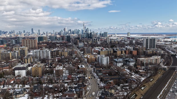
After a long, frigid and snowy winter, Torontonians can be forgiven for asking: “Can we move on to spring now?”
All immediate signs point to yes. Mild temperatures and some rain are in the forecast for the rest of the week, the city’s outdoor rinks are starting to melt and street parking spots long thought to be lost may soon re-emerge, no plow required. Wiarton Willie appears vindicated.
Unfortunately, long range forecasts suggest we might get at least one more blast of extreme cold.
Likely a good March break to head south
Environment Canada meteorologist Geoff Coulson says temperatures are expected to stay above the seasonal norm until about March 13. Then, southerly and westerly winds should shift, he says, with Arctic air from the north poised to take a victory lap through southern Ontario through March break.
“For people who are not fans of winter, it looks like there’s still winter to get through before we get onto the other side,” he said.
WATCH | It’s been a winter to remember in Toronto: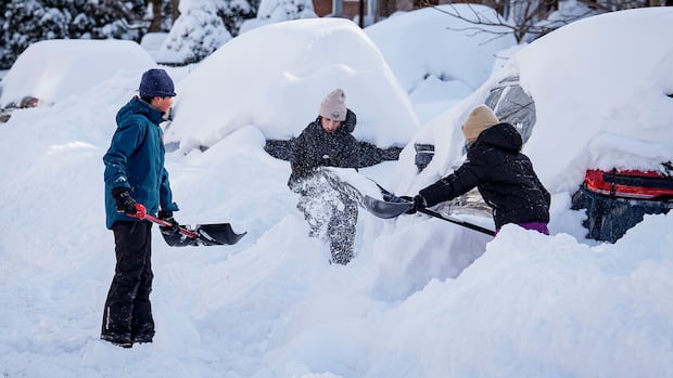
Toronto digs out after record daily snowfall
Toronto will likely spend days digging out after a major snowstorm dropped as much as 56 centimetres of snow on some parts of the city – the highest daily snowfall on record.
Colder air in the middle of March will bring temperatures back to their seasonal norms (usually a high of 3 C), if not colder, Coulson says. Models for the second half of the month indicate possible storm systems, he says, that could include — seasonal depressives, look away — freezing rain and snow.
Flood risks, poor air quality
But the cold isn’t expected to drag out too long.
Long-range models suggest April will be warmer than usual, Coulson says. And before the expected mid-March cold blast, he says temperatures are forecast to be in the double digits through the weekend and part of next week.
So it should at least look less like winter by next week. The current blast of spring should melt much of the snow pack that’s hung around Toronto since January, Coulson says.
That brings flood risks in the coming days, he says, and southern Ontarians should make sure their catch basins are clear and watch for any flooding updates from their local conservation authority.
Additionally, while Wednesday feels spring-like in Toronto, the province is reporting poor air quality in the city. The air quality health index is at seven for the downtown area, with Air Quality Ontario recommending people reduce or reschedule strenuous activities outdoors. Children and elderly people are also encouraged to take it easy.
Environment Canada issued a yellow air quality warning for Toronto on Wednesday afternoon, saying high levels of air pollution were expected in the evening. It said “stagnant winter weather conditions,” along with light winds, are to blame.
Toronto residents are encouraged to limit time outdoors when air pollution levels are high.
The federal weather agency said residents could experience mild symptoms, such as eye, nose and throat irritation, headaches or a mild cough. More serious but less common symptoms include wheezing, chest pains or severe cough.
Environment Canada said conditions will improve by early Thursday morning.