
Met Éireann issued their three month seasonal outlook with indications that average temperatures for March, April and May could prove up to one degree warmer than the normal seasonal average.
Sea surface temperatures around Irish coasts and over the Atlantic are also expected to be above average from March to May, trending 0.2C to 1C higher than normal generally.
Temperatures are expected to be highest in comparison to normal during May.
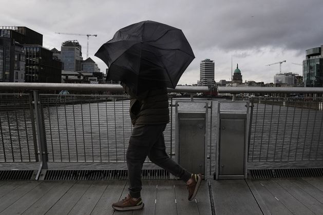
However, long-suffering Irish households will have to endure yet more rainfall in March despite January and February proving amongst the wettest months on record.
One weather station reported its wettest three month period for 85 years from November 1 to January 31.
After glorious spring sunshine for most parts of Ireland on Friday, showers will make a return over the weekend.
Some areas may even see pink or red sunsets as clouds of Saharan sand drift over Ireland and the UK in response to recent cyclonic events including Storm Regina off the Bay of Biscay.
Strong winds generated by the storm picked up the fine Saharan sand particles and swept them towards northern Europe.
If mixed with atmospheric moisture, the pink-hued sand particles can even produce what is known as ‘blood rain’.
The Copernicus Atmosphere Monitoring Service (CAMS) indicated that the east coast of Ireland is most likely to experience the phenomenon.
Many will simply experience the Saharan sand as a film of dust over their cars.
Forecast
The weather will be a mixed bag over the coming days, as there will be plenty of rain and cloud, but some drier weather too.
While conditions will turn wet as we move into the early part of next week, Met Éireann has said there will be some drier, brighter breaks.
The weekend will start off dry for the most part, with a mix of cloud and sunshine on Saturday. There will be a few light showers in the west and south, while parts of the east and northeast will enjoy the best of the sunshine.
Highest temperatures today will be between 9 and 13C.
It will stay mostly dry at first tonight, before cloud builds up to bring some light rain along the west and southwest coast. It will be a cold night with lows of -1 to 4C, though it will be milder in those western coastal areas.
Sunday morning will bring dry, sunny conditions for the midlands and east, but it will be cloudy in the west. Persistent rain will spread eastwards through the day, with highs of 9 to 12C.
Moving into next wek, Monday will be mostly cloudy and rainy at first, but sunny spells will follow and the rain will ease off during the day. Highest temperatures will range between 8 and 11C.
Rain and drizzle will spread across the country on Tuesday, with heavier falls expected in the west and southwest later in the day. It will be a breezy day, with highs of 9 to 13C.
Those wet, breezy conditions will continue into Tuesday night but clear by Wednesday morning, when it will be mostly dry with sunny spells in the east and midlands. Showers in the west will spread to the east in the morning and afternoon, but turn more isolated by the evening.
Conditions beyond that are expected to be “generally changeable and unsettled”, with spells of wet, windy weather being broken up by drier, brighter spells.
Met Éireann’s Aoife Kealy said showers will become an increasing ris early next week.
“Monday will see a dull and damp start to the day with patches of light rain and drizzle lingering. Sunny spells will develop through the afternoon as the rain and drizzle ease with highest temperatures of 8C to 11C.”
“Tuesday will be rather wet and blustery with outbreaks of rain and drizzle, turning heavier in the west and southwest later, in fresh southwest winds and highest temperatures of 9C to 12C.”
The further outlook is for a low pressure Atlantic front to bring further wet and windy conditions at times for the latter half of the week.