
Ireland is set for a dramatic weather shift with snow forecast for western and northern areas, as weather maps show potential blizzard-like conditions could develop by Friday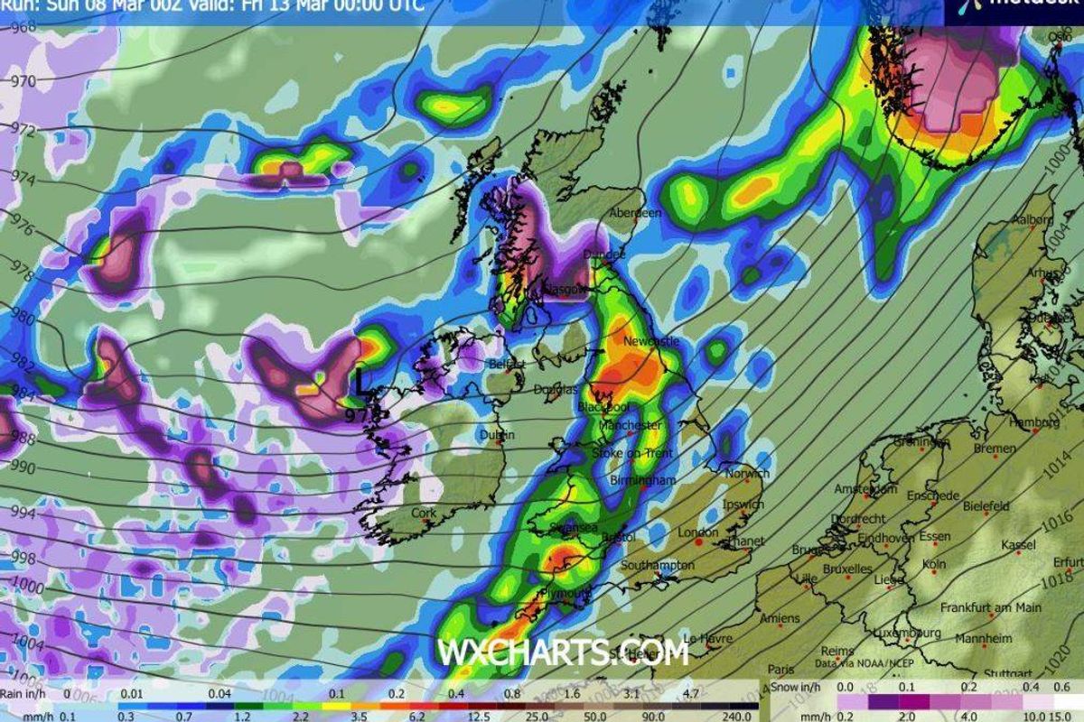
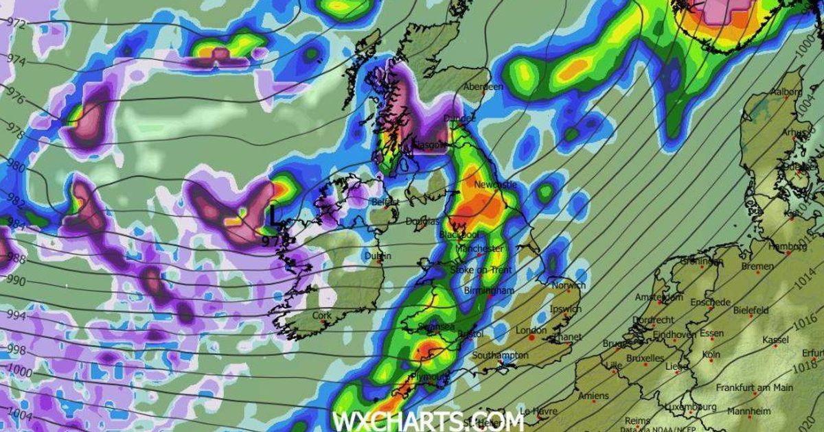
Weather models indicate blizzard like conditions next week(Image: WXCharts)
Ireland basked in extended periods of spring sunshine this weekend, but fresh weather maps indicate a dramatic change is approaching – with the possibility of snow arriving within days.
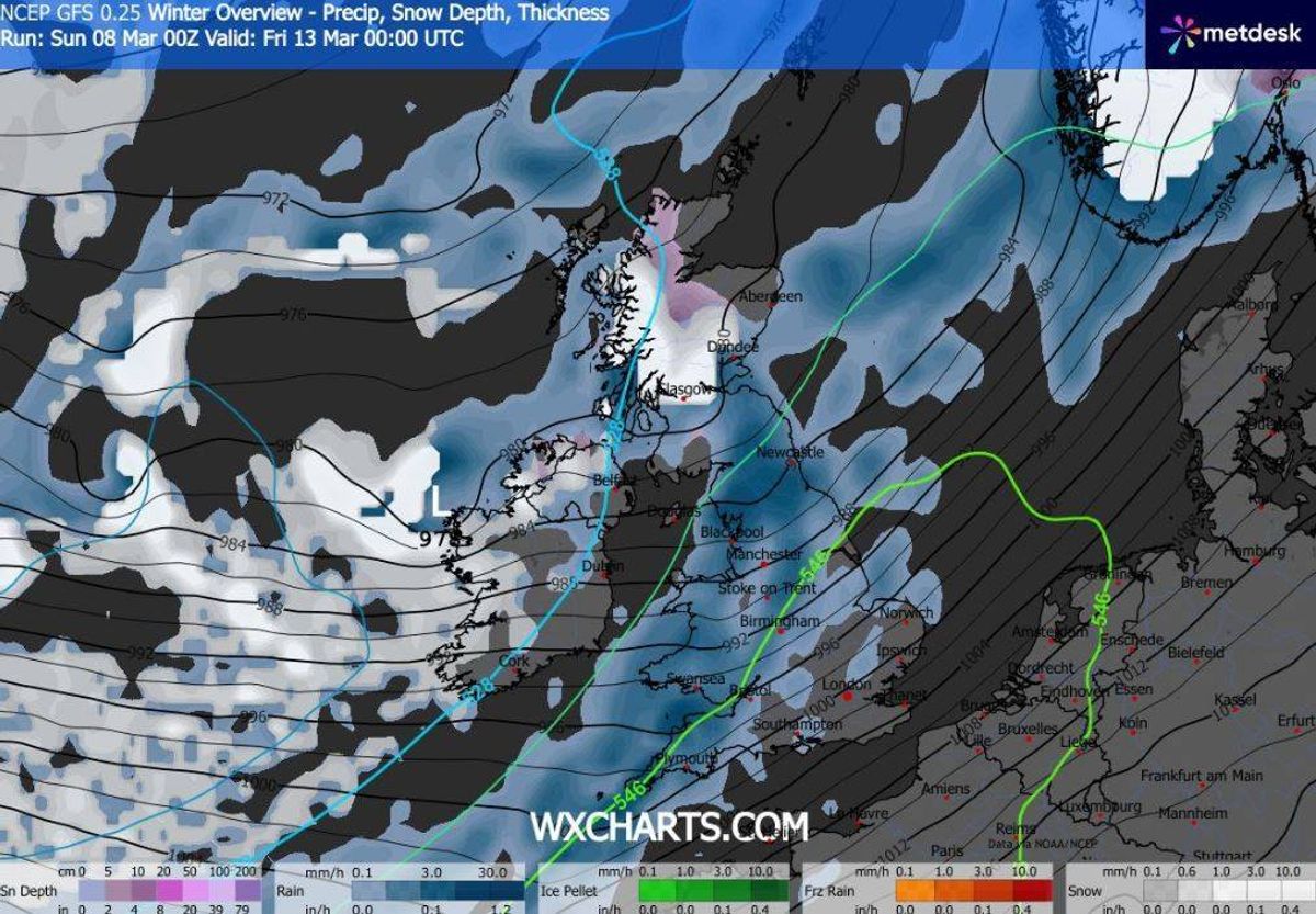
Based on current projections, snow is predicted to advance from the west on Thursday night, blanketing much of the nation by Friday. The most significant snowfall is anticipated across western and northern regions, where blizzard-like conditions may emerge throughout the day. Temperatures are expected to drop below freezing overnight Thursday and into Friday morning, marking an abrupt wintry turn.
Whilst long-range forecasts remain subject to revision, Met Eireann has acknowledged there is “uncertainty in the details” regarding Thursday’s conditions. Its present outlook for the day states: “Whilst there is uncertainty in the detail, current indications are for a windy day Thursday with widespread showers or more persistent spells of rain. The showers and rain will be heavy at times with a chance of hail and thunder. Highest temperatures of 45F to 50F , with strong and gusty southwesterly winds.”
READ MORE: Ireland weather blow as temperatures set to plunge with brutal storm loomingREAD MORE: Map shows Ireland bracing for stormy weather as wind and rain set to batter country
Weather specialist Alan O’Reilly from Carlow Weather has emphasized the potential for a striking forecast transformation within days. Posting the most recent model predictions on social media, he observed: “Latest airmass forecast shows cooler air likely to move in next week. Bad news for the heating bills given the price increases.”, reports the Irish Mirror.
Whilst predictions point to the potential for snow next week, conditions could shift and the timing and intensity of any winter showers remain uncertain.
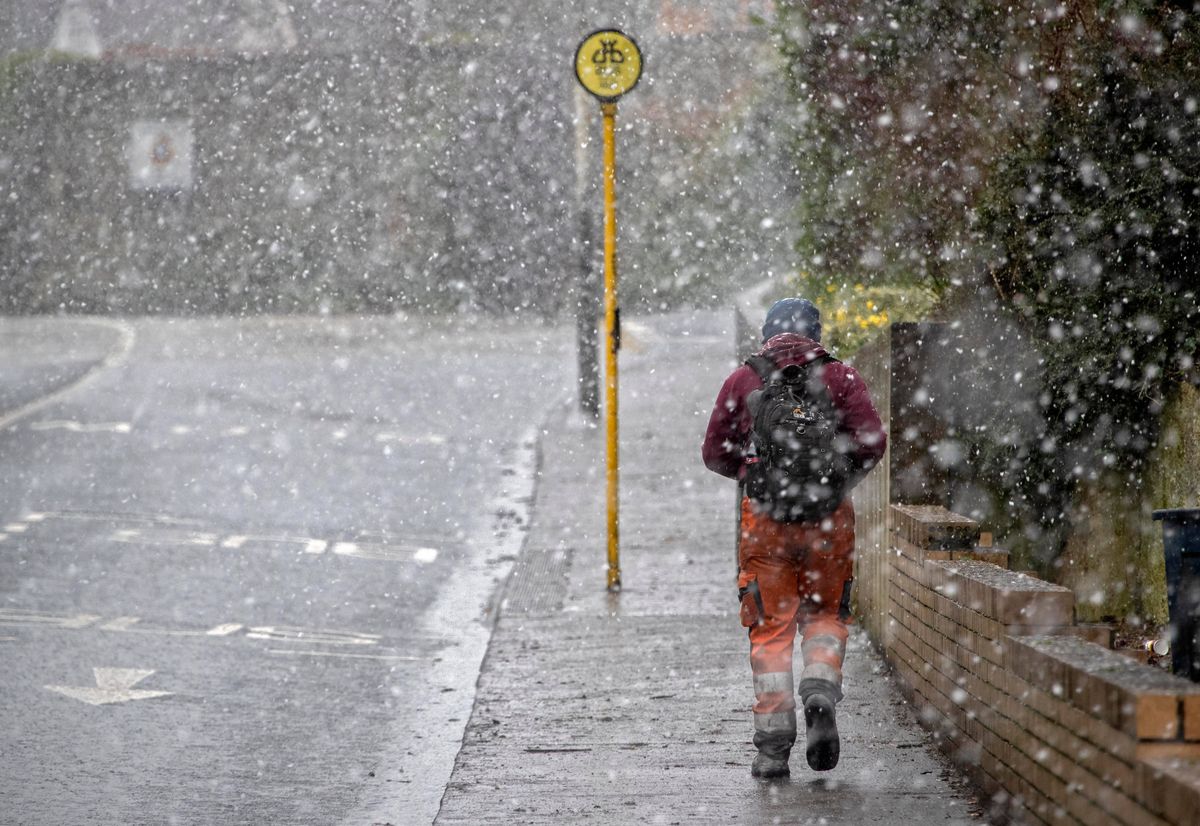
Walking in a snow shower in Lucan, Co Dublin(Image: Collins Agency, Dublin)
Some forecasts even hint at the possibility of another round of snow around St Patrick’s Day.
In the interim, Ireland should brace for a tempestuous beginning to next week, as Atlantic low-pressure systems dictate the weather. This will usher in unsettled, varied conditions – including periods of rain, strong winds, and hail.
Providing a day-by-day rundown of what to anticipate, Met Eireann stated: “A mix of cloud and bright spells Monday, with some patches of rain or drizzle throughout the day. Highest temperatures of 8C to 12C , with light, occasionally moderate, variable breezes.
Weather models indicate snow returning to Ireland on Friday(Image: WXCharts)
“A mostly cloudy Monday night, it will start off dry for most. However, outbreaks of rain and drizzle will spread eastwards across the country, becoming patchier as they do so. Lowest temperatures of 3C to 7C , with predominantly moderate southerly winds.
“A mostly cloudy day Tuesday with just limited bright spells and sporadic outbreaks of rain and drizzle. More persistent rain will encroach on the west later in the day. Becoming breezier throughout the day with moderate southerly winds shifting southwesterly and intensifying and becoming gusty. Highest temperatures of 50F to 13C.
“Wet and breezy for a time Tuesday night with rain from the west spreading eastwards across the country. As the rain clears eastwards, it will be followed by clearer conditions, but with some showers feeding in from the Atlantic. Lowest temperatures of 3C to 8C , with moderate to fresh southwest to west winds.
“A windy day Wednesday, it will start off mostly dry with sunny spells. However, scattered showers will develop through the day, becoming more isolated towards evening. Highest temperatures of 9C to 11C , with fresh to strong and gusty southwesterly winds.”
For the latest local news and features on Irish America, visit our homepage here.