

Some good news after this morning’s Status Yellow warning
16:27, 05 Jun 2026Updated 16:33, 05 Jun 2026

Barleycove Beach West Cork
With Cork looking miserable under a Status Yellow weather warning, it hasn’t been the start to the summer we’ve all been hoping for.
While it looks like wet, overcast weather is here to stay for the time being, there’s hope of a fresh heatwave on the horizon, with temperatures reaching up to 25°C.
Weather experts have signalled a dramatic change in conditions over the next ten days with the clouds – and occasional thunderstorms – dispersing in favour of clear, sunny days.
According to the latest weather charts, a high-pressure system is set to build near Ireland around Monday, June 15, bringing with it some proper summer sunshine.
High pressure typically brings settled, dry and warmer weather by pushing away the cooler, wetter low-pressure systems responsible for Ireland’s recent dampness.
Current projections suggest the high-pressure system could become established over Ireland for several days. Some forecasts show temperatures reaching 22C on Tuesday, June 16, rising to 24C on Wednesday, June 17, before potential widespread highs of 25C on Thursday, June 18.
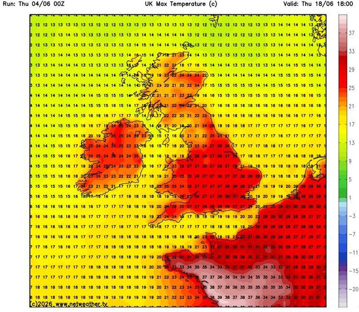
Weather maps currently show widespread highs of 25C on Thursday, June 18(Image: Netweather.tv)
While forecasts this far in advance can change significantly, Met Éireann’s latest long-range outlook appears to support this warmer outlook.
Looking ahead to next week, June 8 to June 14, the national forecaster said: “High pressure builds across the country this week, with higher than average temperatures across most of the country, with more than average temperatures along the west and south coasts. Rainfall amounts will be below average across the country.”
And for the following week, June 15 to June 21, it added: “During this week, there is no clear signal for a dominating pressure signal, but temperatures are expected to remain above average, with lower than average precipitation amounts continuing.”
Met Éireann noted that there is still “uncertainty in the forecast” beyond that point, with “little confidence in the forecast” towards the end of June and the beginning of July.
Despite the encouraging signs, the forecast temperatures would still fall short of Ireland’s official heatwave criteria. Heatwaves are often defined as five days of consecutive above-average temperatures, but Met Éireann previously told The Irish Mirror: “That is a working definition used by some other met offices, but the Met Éireann definition of a heatwave is five consecutive days of temperatures above 25 °C.”
Last month, Ireland recorded its hottest May day on record when Shannon Airport reached 30.6C on May 26. The previous May record was 28.4C, recorded in Ardfert, Co Kerry, on May 31, 1997.
However, despite those exceptionally warm conditions, the spell did not qualify as an official heatwave under Met Éireann’s definition.
In the meantime, the unsettled weather looks set to continue, with Met Éireann forecasting rain or showers every day for the remainder of this week.