
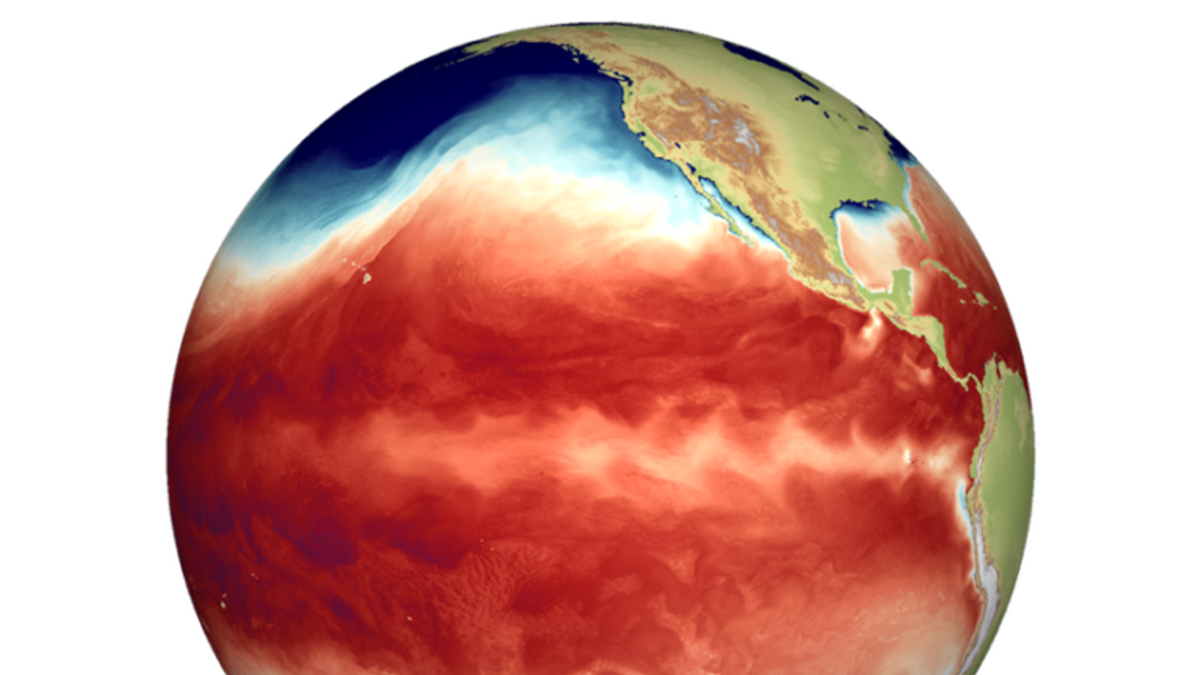
Met Eireann also predicts that the currently developing strong El Niño has the potential to lead to record high global mean temperatures in the second half of 2026 and in 2027, and to extreme weather events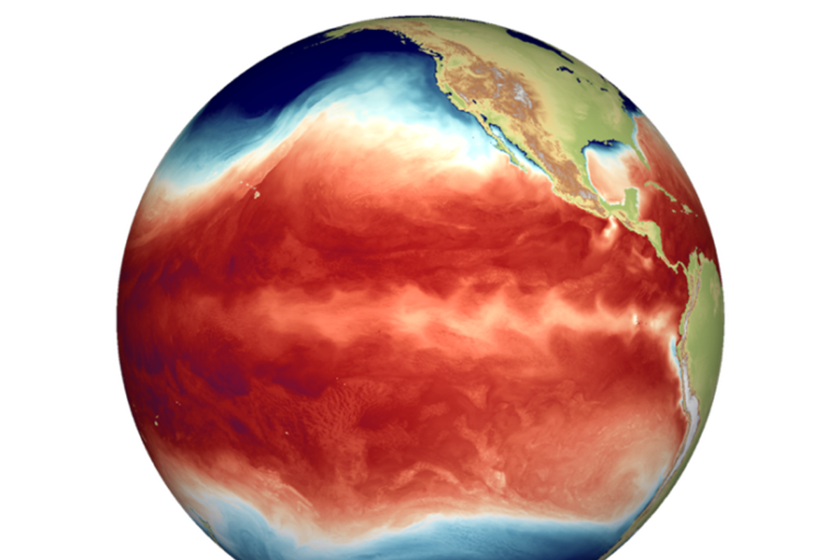
El Niño
A ‘historically strong’ El Niño weather event may see Irish temperatures rise and some disruption to regular weather patterns.
El Niño refers to warm surface waters in the Eastern tropical Pacific. It was first noted centuries ago by Peruvian fishermen who’s fish stocks were impacted. The El Niño phenomenon is the oscillation between warm Eastern tropical Pacific sea surface temperature conditions (El Niño) and cold Eastern tropical Pacific sea surface temperature conditions (La Niña), said Met Eireann.
This natural fluctuation between the two conditions influences weather and climate worldwide. However, it’s impacts on Ireland have predicted to be weak, but not insignificant.
“There has been much talk about the coming El Niño weather event this summer and through the next 12 months and the possible ramifications for our weather” reports Cathal Nolan of Ireland’s Weather Channel.
“While El Niño does have a major impact on global weather patterns typically the impacts are more subtle across Ireland, the UK and Europe as a whole. However, given the strength of the forthcoming event, perhaps reaching historically high levels, there is a greater chance of disruption to our own weather.”
“To emphasise this, the June update from the ECMWF in red lines, is compared with the May update and it’s very clear we can see a growing risk of a major El Niño. The latest trend would almost certainly see this coming El Niño breach into a Super El Niño (+2 degrees Celsius with the trend heading for +3).”
Met Eireann also predicts that the currently developing strong El Niño has the potential, together with the underlying global warming trend, to lead to record high global mean temperatures in the second half of 2026 and in 2027, and to extreme weather events” said Met Eireann.
“While El Niño has clear impacts on many regions worldwide through teleconnections (for example affecting monsoon systems), its influence on Ireland and Europe is comparatively weak, highly variable, and not robust in the present-day climate” said the national forecaster.
Here is Met Eireann’s forecast for the upcoming week:
Saturday
Outbreaks of rain and drizzle, heavy and persistent in places, will continue to clear eastwards but will linger in Ulster and north Leinster for much of the day. A clearance to scattered showers will spread from the west, bringing some afternoon and evening sunny spells, though further rain and drizzle will return to western coasts late in the evening. Highest temperatures will range from 12 to 16 degrees as winds become moderate to fresh westerly. Tonight will be quite cloudy with scattered rain and drizzle, though parts of the east and south will stay mostly dry with occasional clear spells and lowest temperatures of 8 to 12 degrees.
Sunday
It will be another cloudy day as outbreaks of rain move in from the west, becoming widespread, persistent, and occasionally heavy. Brighter conditions with sunshine and showers will follow later in the afternoon over the west and northwest before slowly extending eastwards, with highest temperatures reaching 13 to 18 degrees in moderate to fresh southwest winds. Sunday night will feature clear spells and occasionally heavy showers in the west and north, while eastern areas clear up early in the night with lowest temperatures of 7 to 10 degrees.
Monday
The week will start bright with a mix of sunshine and showers, some of which will be heavy. Cloud will increase from the west towards the evening, bringing further spells of rain and drizzle. Highest temperatures will be between 12 and 15 degrees in moderate west to southwest winds, which will turn fresh along western coasts.
Tuesday
Tuesday will bring a similar pattern of showers and sunny spells, with some heavy downpours and the possibility of isolated thunderstorms. Highest temperatures will range from 12 to 15 degrees, feeling mildest in the south, in moderate to fresh westerly winds.
Wednesday
Most areas will have a bright start to the day with just isolated showers. Cloud is expected to increase throughout the afternoon, bringing spells of rain for the evening and overnight period. Highest temperatures will be around 13 to 15 degrees in moderate westerly winds that will back southerly later and become fresh at times on western and southwestern coasts.
Thursday
The morning will get off to a wet start with heavy and persistent rain clearing eastward. Showers will follow behind for the afternoon, turning heavy at times, though occasional sunny spells will break through. Highest temperatures will reach 14 to 18 degrees in moderate to fresh and occasionally gusty southwest winds.
Next weekend
Showers will persist across the weekend, but they are forecast to become more isolated and ease through Saturday and Sunday, allowing more regular sunny spells to develop.
Want to see more of the stories you love from Dublin Live? Making us your preferred source on Google means you’ll get more of our exclusives, top stories and must-read content straight away. To add Dublin Live as a preferred source, simply click here.
Join our Dublin Live breaking news service on WhatsApp. Click this link to receive your daily dose of Dublin Live content.
We also treat our community members to special offers, promotions, and adverts from us and our partners. If you don’t like our community, you can check out any time you like. If you’re curious, you can read our Privacy Notice