
Sail north from the beach at Progreso, Mexico, and the seafloor appears unremarkable.
Survey charts show a flat bottom, shifting dunes, and long stretches of water that seem largely empty.

The local fishermen never quite believed that picture. They returned frequently to a handful of spots far offshore, hauling up catches that hinted at something solid rising from the seabed below.
Reefs beneath the sand
Curiosity about those patches drew in a team led by Ileana Ortegón-Aznar, a marine biologist and professor at the Autonomous University of Yucatán (UADY).
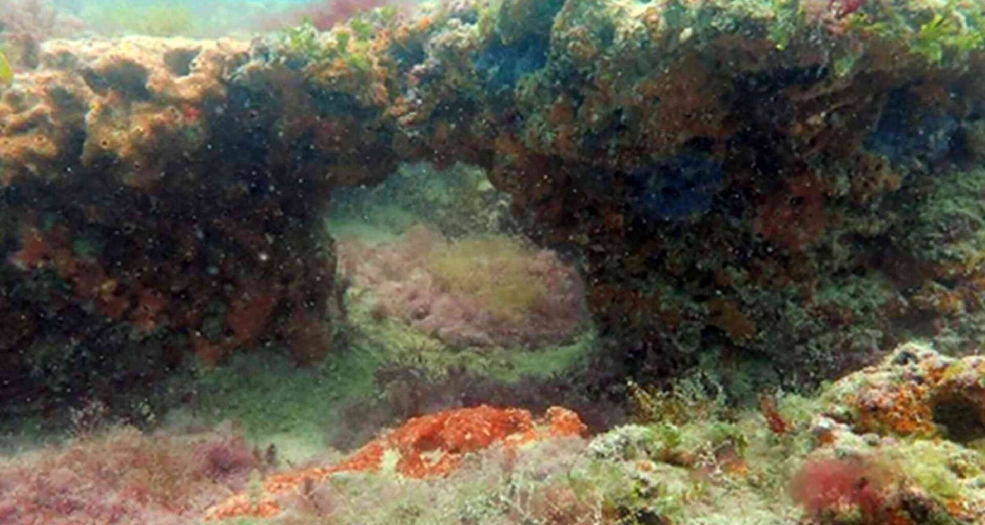
Using coordinates, they surveyed four sites. They found genuine rocky reefs, low ridges of hard rock rising four to seven feet off the seabed and pocked with caves.
No one had formally documented these structures on the Mexican Atlantic coast before.
Mexico’s coral reefs have drawn researchers for decades, especially the celebrated systems on the Caribbean side.
Rocky reefs cover even more seafloor, yet these had slipped past earlier surveys focused on sand and dunes.
Listening to the locals
The reefs did not turn up by accident. For generations, fishermen along the northern Yucatán coast had worked from these patches of water, passing down their mental maps of the seafloor.
Ortegón-Aznar’s team treated that knowledge as a starting point, not folklore.
The fishermen led them to four productive grounds along the peninsula’s Gulf-facing edge, roughly eight to 13 miles out in 30 to 50 feet of water.
Sonar mapping and underwater surveys turned those mental charts into measured data. The hunches built over years of hauling nets lined up closely with what the instruments recorded.
Mapping the ridges
To chart structures that had been unmapped, the team swept each site with sonar, pinging the bottom every second for depth profiles and rough 3D models.
Underwater surveys then photographed small plots of rock to log what grew there. Each reef looked different.
One near Dzilam rose as a single rocky mass honeycombed with caves. Another revealed a slab stretching close to a quarter mile.
A third, off Progreso, formed a maze of ridges and hollows across most of its area.
Across every site, the rock was strikingly complex, full of nooks and crannies that give marine life places to settle and hide.
Earlier research shows complex reefs shelter more species, and these scored high.
A fight for space
Once the team catalogued the surfaces, one group dominated. Large seaweeds, known as macroalgae, blanketed close to two-thirds of the rock.
They were far ahead of sponges, scattered coral, and a low gritty mat the researchers call sediment-laden algal turf.
The two leaders rarely shared the same rock. Thick mats of turf dominated some areas, while sprawling seaweed dominated others.
Where turf spread, the seaweed thinned, showing a pattern. Competition is a plausible explanation, though the survey recorded only the association, not its cause.
Sediment tipped the balance. Finer sand paired with more seaweed, coarser grains with more turf, and the mix shifted from reef to reef.
A separate study shows how seasonal swings in light and nutrients drive seaweed growth.
The Chicxulub crater
These reefs sit in geologically loaded ground. The northern Yucatán rests on a vast limestone platform marked by the Chicxulub crater.
The crater is a roughly 110-mile-wide scar left by the asteroid that ended the dinosaurs about 66 million years ago.
Buried under roughly two-thirds of a mile of younger sediment, the crater shows at the surface only as a ring of water-filled sinkholes threading across the landscape.
Ortegón-Aznar’s team is careful not to oversell the idea. They studied the reefs’ structure and living cover, not the rock’s origin.
They say that only dedicated geological work could test whether the formations trace back to the impact.
Reefs under pressure
Newly described does not mean protected. Threats include sediment runoff that can bury the rock, pollution, anchor damage, and heavy fishing on the same flagged grounds.
All of these dangers are currently present, and warming water adds a slower danger.
A broad analysis of reefs worldwide has tracked how rising sea temperatures trigger repeated, severe bleaching. Similar increases in algal turf have been observed at some Yucatán sites.
This hints that these communities could tip toward collapse. Rocky reefs sit almost entirely outside Mexico’s conservation plans, which were built around coral.
New maps and baseline numbers give managers evidence they lacked before. It may be enough to bring these habitats under protection before development or a warming Gulf alters them.
A coast redrawn
A stretch of seabed long written off as bare sand holds real rocky reefs, mapped for the first time, complete with caves, ridges, and dense seaweed.
The first confirmed evidence of these habitats was found on Mexico’s Atlantic side.
Researchers now have a starting line to track how the reefs fare, how they connect to the better-known coral systems offshore, and what their unusual geological setting might mean.
That changes the working picture of the entire northern Yucatán coast. It also vindicates the fishermen, whose generations of local knowledge led the team straight to the ecosystem.
The rock was never hidden from them. For generations, fishermen had worked these grounds and knew exactly where it lay. It had simply gone uncounted by science.
The study is published in PLOS ONE.
—–
Like what you read? Subscribe to our newsletter for engaging articles, exclusive content, and the latest updates.
Check us out on EarthSnap, a free app brought to you by Eric Ralls and Earth.com.
—–