
While wildfires happen at different times across the globe, they do all have one thing in common: they can be absolutely devastating.
One of the clearest ways to grasp the full impact these events have is to see them from space, and that’s exactly what Europe’s Copernicus program is built to do: deliver detailed and frequently updated images of Earth’s land and coasts that can be used to influence policies. To do this, the program uses Sentinel satellites, which zip around Earth, capturing various breathtaking, and heartbreaking, views from low Earth orbit.
What is it?
Sentinel-2 consists of a trio (or “constellation”) of Earth-observation satellites, each carrying a high-resolution multi-spectral camera that records reflected light in 13 spectral bands. Those bands include visible wavelengths (what we can see) but also near-infrared and short-wave infrared, which are especially helpful for measuring vegetation condition, soil and moisture difference and fire impacts.
You may like
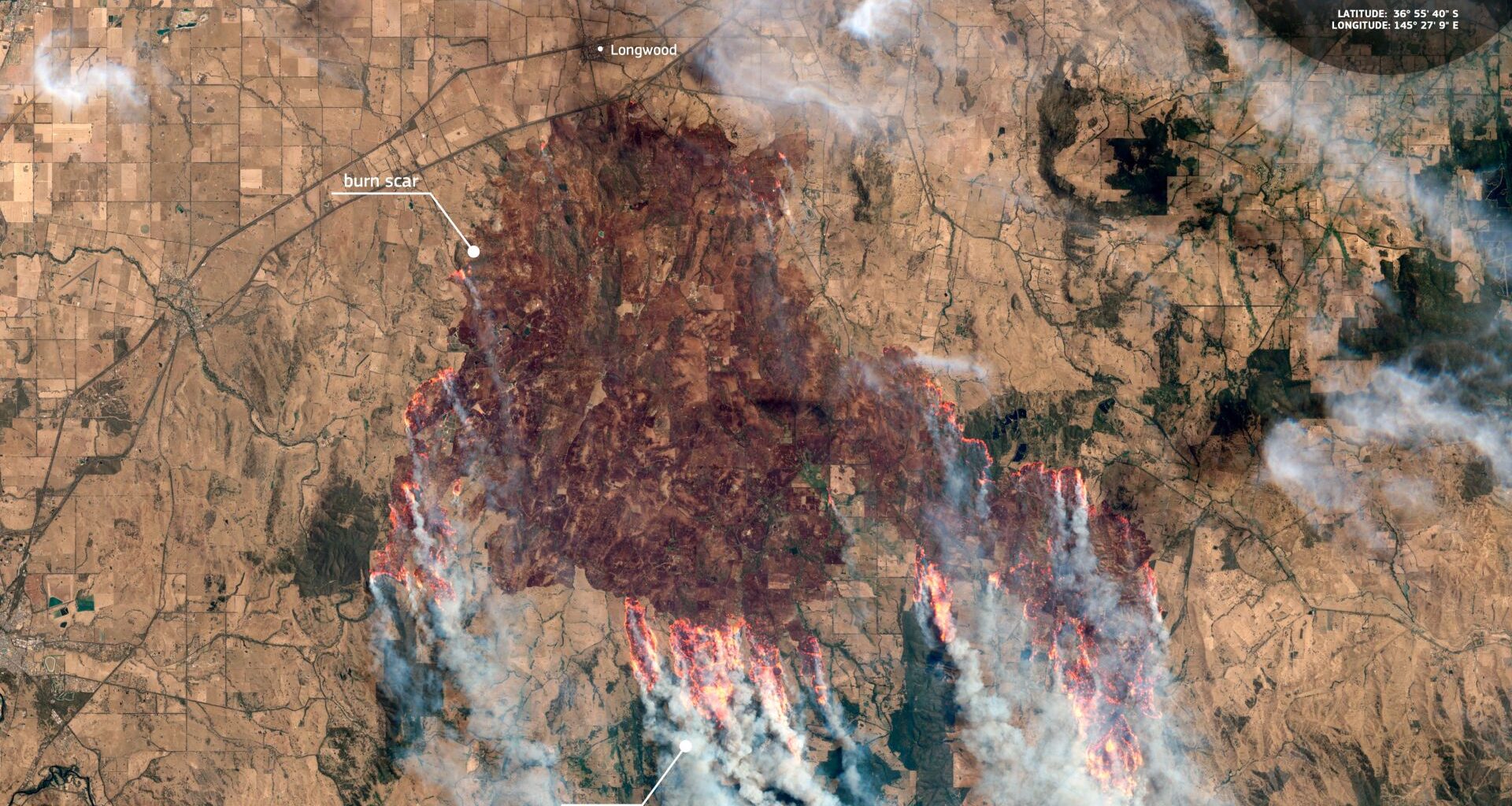
On Jan. 9, 2026, a Sentinel-2 satellite captured a devastating scene of the bushfires in Australia, seeing dark burn scars where the fire had already burned through the landscape. According to the Copernicus website, these uncontrolled fires have led to the closure of hundreds of schools and the evacuations of entire communities, resulting in thousands of people living without electricity.
Where is it?
This image was taken from low Earth orbit, showing an area south of Longwood in northern Victoria, Australia.
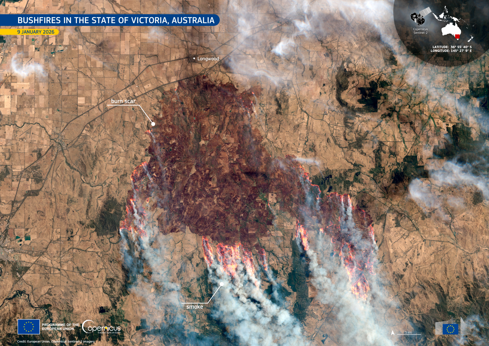
The uncontrolled bushfires have displaced thousands of people in the state of Victoria. (Image credit: European Union, Copernicus Sentinel-2 imagery)Why is it amazing?
Thanks to the Sentinel-2 imagery, analysts can delineate burned area boundaries, estimate how much land has been affected and update those estimates as new images arrive. The Copernicus program notes that Sentinel-2 plays a role in mapping burned areas and assessing damage to support emergency response and recovery planning.
With its near-infrared and short-wave infrared bands, Sentinel-2 can also help highlight changes in vegetation and charred ground, which may be harder to spot with ordinary cameras but can be key in creating standard fire-severity indicators and separating smoke from clouds, along with bare soil from burn scars.
The Earth-scanning satellites can further track the long-term effects of these fires. After the flames go out, the hard work is recovering the landscape: stabilizing soils, protecting waterways, restoring habitats and understanding how nature bounces back. Sentinel-2’s repeated scanning can help study the same area over longer periods of time to track regeneration and land-cover change.
Want to learn more?
You can learn more about wildfires and Earth-observing satellites.