
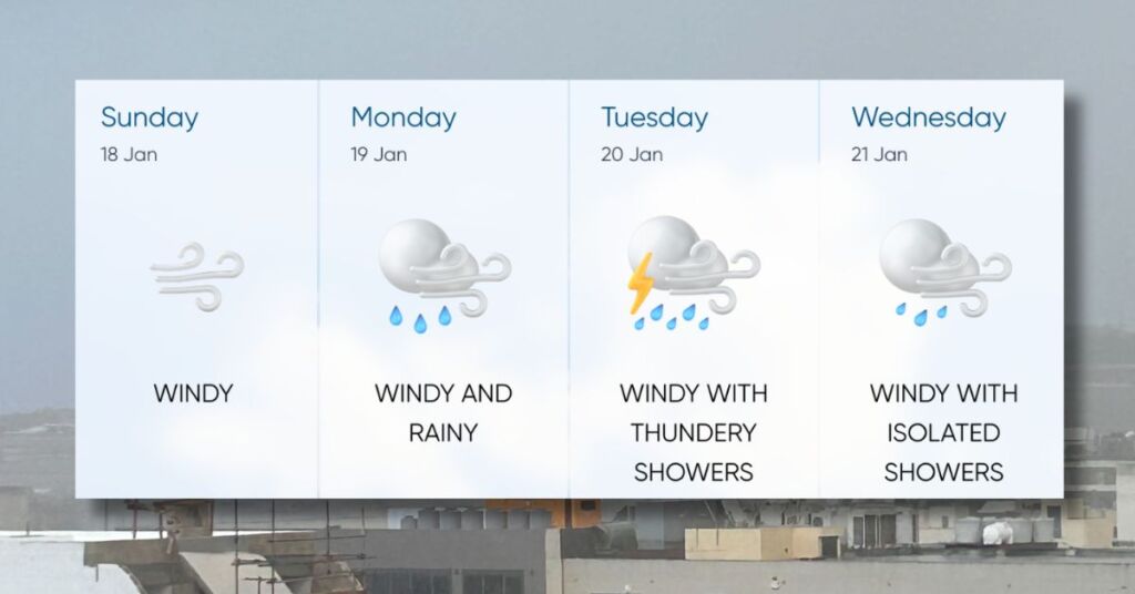
Malta is bracing for serious weather starting this afternoon as strong ESE winds pick up, with gale-force gusts expected from late Monday morning into Tuesday.
Peak gusts could reach a staggering 100 km/h (Force 10–11) overnight between Monday and Tuesday, bringing very rough seas.
Waves could hit up to 11 metres, putting exposed eastern and southeastern coastal areas like Marsascala, Marsaxlokk, and Xgħajra at risk of major damage.
On Tuesday, a cold front from Africa will sweep over the islands, bringing thundery rain showers, possibly heavy, with hail.
Key Advice: Stay indoors, secure loose items, avoid coastal areas, and be prepared for disrupted transport and rough seas.
Malta, it looks like stormy times ahead, literally.
Share with your household!