
As governments increasingly rely on high-quality geospatial intelligence to support policy-making, infrastructure planning and risk management, accurate elevation data has become a strategic resource. In Flanders, the northern region of Belgium, a major investment in that foundation is now underway. This year marks the start of a comprehensive renewal of the Digital Elevation Model of Flanders, a dataset that underpins a wide range of public-sector and scientific applications.
The new programme, known as Digital Elevation Model Flanders III (DHMV III), is being initiated by Digitaal Vlaanderen. The decision reflects both the ongoing transformation of the Flemish landscape and the growing demand within government for reliable, high-resolution geodata that can be used consistently across policy domains.
Responding to a changing landscape
Digital elevation data forms a critical basis for applications such as flood modelling, 3D city models, noise impact assessments, infrastructure design and archaeological research. Although two earlier versions of the Digital Elevation Model are still available, their relevance has diminished over time. The first dataset was produced in the early 2000s, while the second dates from the 2013–2015 period.
Since then, extensive infrastructure works, continued urban development and the implementation of climate adaptation measures have significantly altered the terrain. As a result, existing elevation data no longer fully reflects current conditions. With DHMV III, Digitaal Vlaanderen aims to once again provide an up-to-date, area-wide and high-quality digital representation of the Flemish surface, suitable for both policy preparation and operational use.
Data acquisition and processing
The acquisition of DHMV III data relies on a combination of aerial photography and airborne laser scanning, or Lidar. These complementary techniques allow for the collection of dense point clouds and centimetre-level elevation information. After acquisition, the measured points are classified so that terrain, buildings, vegetation and infrastructure elements can be accurately identified and processed into usable products.
Because Lidar acquisition is sensitive to weather conditions and vegetation cover, the flights are carefully planned during leaf-off periods, when trees no longer obstruct the view of the ground. For that reason, the data collection is spread across two winter seasons, with the first running from early January to mid-April 2026 and the second from November 2026 through mid-April 2027. Once the flights are completed, an intensive phase of processing and quality control will follow, carried out by Digitaal Vlaanderen’s geodata experts.
From acquisition to long-term value
The first flight season has already started. If the programme progresses according to schedule, the new Digital Elevation Model Flanders III products and services are expected to become available in 2028. These will include updated Digital Terrain Models, Digital Surface Models and renewed hillshade products, all designed to support a wide range of analytical and operational needs.
Although several years will pass before DHMV III is fully operational, the initiative represents a forward-looking investment in Flanders’ geospatial infrastructure. By renewing this foundational dataset, the region is strengthening its capacity for evidence-based decision-making and ensuring that future policies and projects are grounded in accurate, high-quality spatial information.
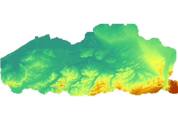
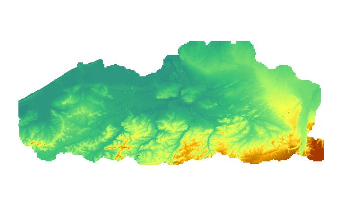
The digital elevation model of Flanders is a foundational reference dataset for spatial analysis, policy development and scientific research. (Image courtesy: Digitaal Vlaanderen)