
The Taiwan Space Agency (TASA) yesterday released the first images from its Formosat-8A satellite, featuring high-resolution views of Hsinchu Science Park (新竹科學園區), Tainan’s Anping District (安平), Kaohsiung’s Singda Harbor (興達港), Japan’s National Stadium in Tokyo and Barcelona airport.
Formosat-8A, named the “Chi Po-lin Satellite” after the late Taiwanese documentary filmmaker Chi Po-lin (齊柏林), was launched on Nov. 29 last year.
It is designed to capture images at a 1m resolution, which can be sharpened to 0.7m after processing, surpassing the capabilities of its predecessor, Formosat-5, the agency said.
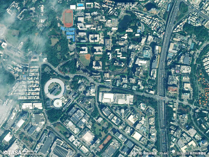
Photo courtesy of Taiwan Space Agency
It is the first of TASA’s eight-satellite Formosat-8 constellation to be sent into orbit and is intended to help Taiwan monitor natural disasters and security threats, it said.
The images featured detailed surface features, such as ocean waves and boat wakes, highlighting the satellite’s ability to capture urban and natural landscapes, TASA said.
Unlike Formosat-5, which can only capture blurred images of traffic flow, Formosat-8A can photograph airplanes and vehicles in detail, it said.
The next-generation satellite can also capture “red edge” images sensitive to vegetation, which can be used for monitoring forests, water resources and agricultural conditions, Formosat-8 project lead Cynthia Liu (劉小菁) said.
Achieving 1m resolution took eight years of testing and development, TASA Director-General Wu Jong-shinn (吳宗信) said, adding that Formosat-8A was made using 16 Taiwan-developed components.
Of the eight satellites in the Formosat-8 constellation, six would have 1m resolution capability and two would have 0.5m resolution, TASA said.
Once fully deployed in 2031, the constellation would provide global coverage and capture Taiwan three times a day, it said.
The second satellite, Formosat-8B, is scheduled to be launched aboard a Space Exploration Technologies Corp rocket by the end of this year.