
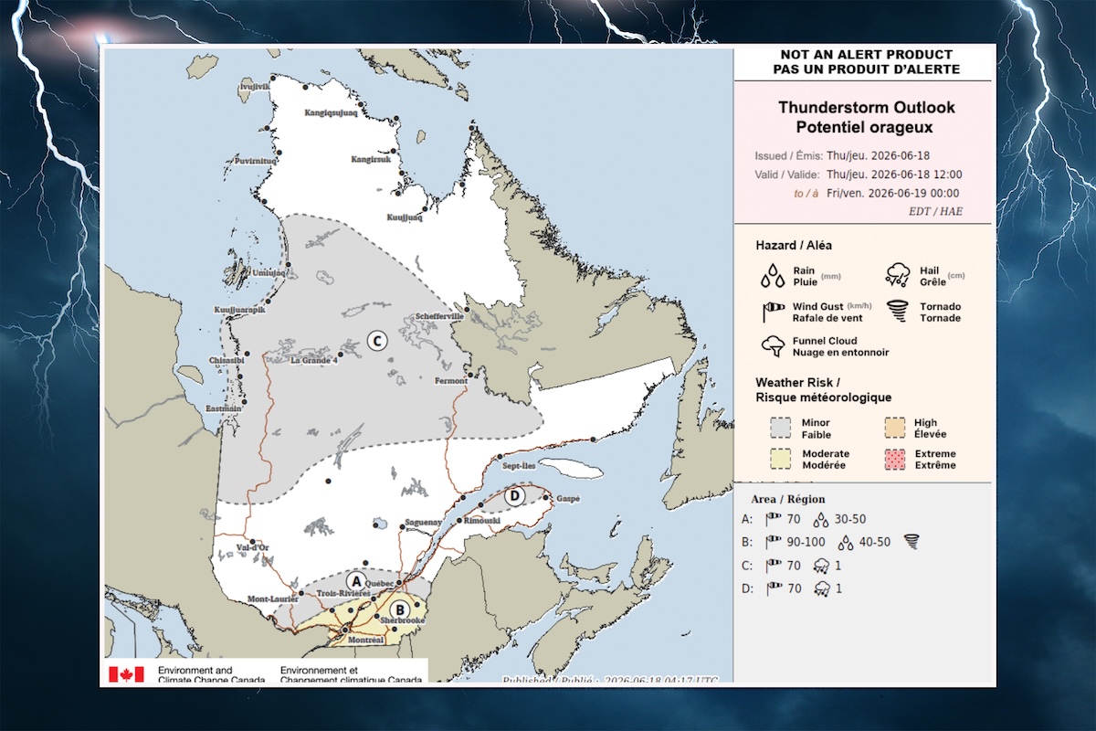
A thunderstorm outlook map has been added to Environment and Climate Change Canada’s daily weather page, giving Montrealers and our neighbours an early sense of whether the risk of damaging storms is minor, moderate, high or extreme.
The map can be accessed via a link on ECC’s daily weather forecast page.
Montreal’s thunderstorm outlook for Thursday is moderate. June’s pattern so far has been to vaguely threaten a storm all day, then suddenly unburden on a weary population.
A yellow thunderstorm watch was issued by ECC just before 10 a.m. Severe thunderstorms capable of producing strong wind gusts, large hail and heavy rain could hit in the afternoon or evening, and could lead to power outages.
Wind gusts will ramp up to 70 km/h by late afternoon.
“A slight risk of a tornado is also associated with these thunderstorms,” ECC says. Similar alerts were issued for much of southern Quebec.
The high for the day will be 20 C, with a humidex of 25 C and a UV index of 3, or moderate. Expect showers to end late in the evening, potentially after another storm. The low will be 15 C.
Friday? The risk of a thunderstorm late in the afternoon.